The Paul Smith's College Experience
My two weeks at Paul Smith's in July of 2024 was full of adventure. The Adirondack Park has so much to discover with every turn.
Introduction
This is me! Photo Credit: Emily Pulcini
Hello! My name is Keely, and I had the wonderful opportunity to be a part of the Paul Smith's College Adirondack Field Ecology course in the Summer of 2024. I graduated with an associate's degree in Arboriculture and Landscape Management from Paul Smith's in May of 2024, and it felt amazing to be back. I will now be going to Massachusetts to obtain a bachelor's degree in Natural Resource Conservation and Adirondack Field Ecology greatly helped me see all the opportunities there are in so many different fields! The two weeks were full of adventure and discovering new things. I learned something new in all modules and enjoyed all the professors I met along the way. From trapping small mammals to measuring trees to traveling up Whiteface Mountain we did it all! The Adirondack Park has so much diversity and beautiful landscapes to study, admire, and love.
This map shows all the places we did activities during our two week stay. Click on an icon to see what module was held there! Map created by Keely Zuber
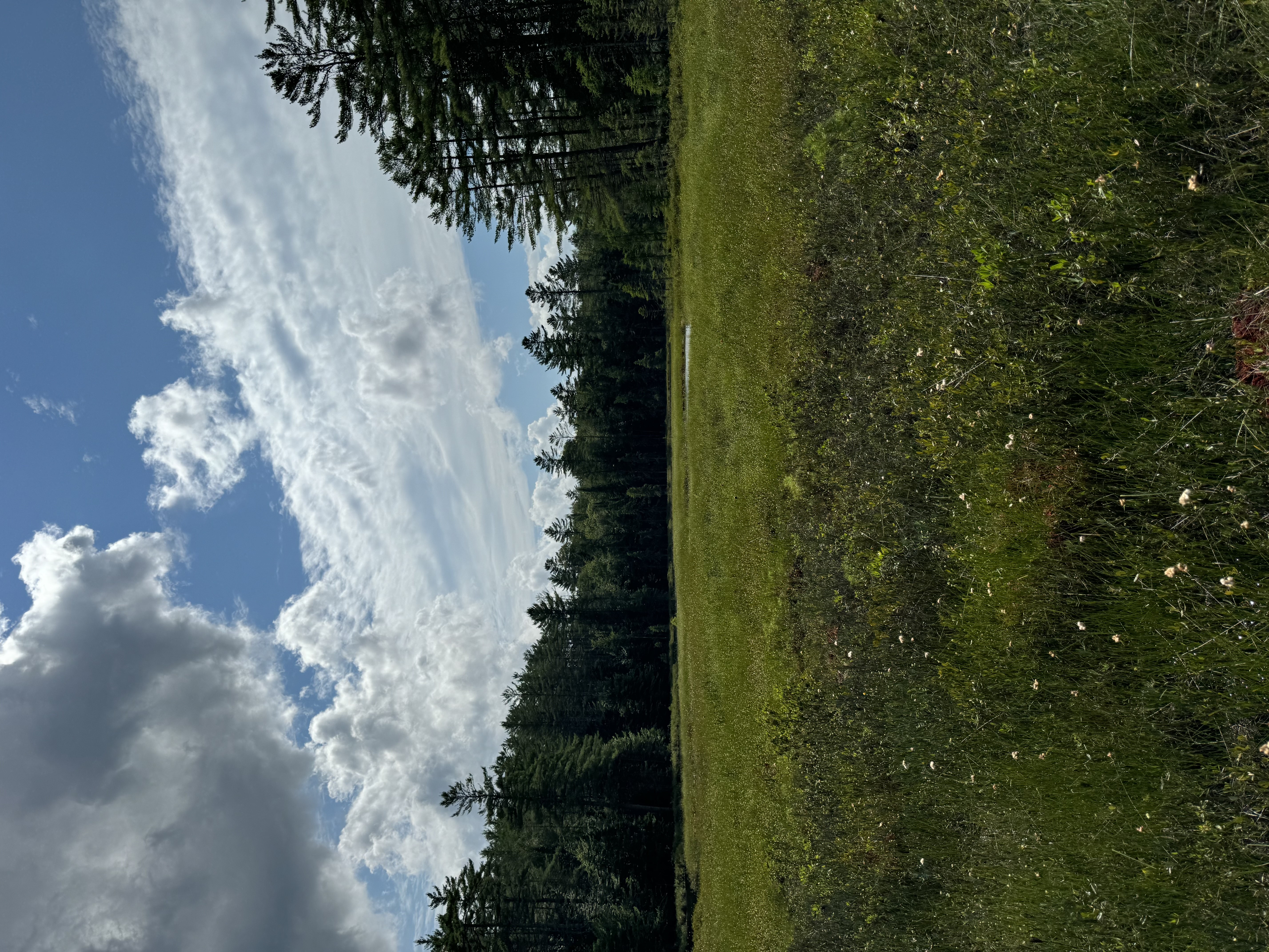
Watersheds
In the morning of 7/15, we travelled down Keese Mills Road to walk to Aldo Creek, Little Aldo Creek, and Smitty Creek with Dr. Mel Johnson, a professor at Paul Smith's College who teaches GIS (Geographic Information System) and ecology classes. Before entering the woods, we walked down the road to the depositional zone. The water was still, shallow, had lots of sand in it, and was surrounded by plants. We then began our walk to Smitty Creek. The forest had a soft floor and not much human interference other than a path to the creeks. After a quick demonstration my group set off to measure the creeks bankfull width, flood prone depth, and stream type of Aldo Creek using the Rosgen method. The creek was calm and surrounded by trees and had sand, pebbles, and cobble in the water. After that we traveled to the St. Regis Canoe area where there was once a mill and are currently dams. The water was deep and rushing quickly. After finding some animal bones and admiring the rushing water we made our way back to campus.
Left and Right Photos: Aldo Creek
Photo Credit: Keely Zuber
Botany
In the afternoon of 7/15, we travelled to Paul Smith's College VIC (Visitor Interpretive Center) where we met up with Steve Langdon, a field ecologist. After a brief discussion about botany, biodiversity, photosynthesis, and how plants have developed over millions of years we set off to the Boreal Life Trail to identify plants and learn some terminology. We learned about opposite and alternate bud arrangements and identified multiple tree species including tamarack, black spruce, eastern hemlock, pine, American beech, yellow birch, red maple, striped maple, and sugar maple, along with many ferns and plants in the bogs. Some plants found in the bogs are pitcher plants, roundleaf sundew, and cranberries. We also talked about peat land and how vital they are for our planet. Peat land sequesters carbon, meaning taking it out of the atmosphere, and stores it in the ground. While in the ground the carbon turns into oil which humans have dug up and use as fuel to power machines. This has caused excess carbon to be put in the atmosphere which is a contributing factor to climate change. We also stumbled upon Indian's pipe and rattlesnake plantain, which is only found in one specific spot on the Boreal Life Trail.
Left Image: Indian's pipe (Monotropa uniflora) Middle Image: View of boardwalk on the Boreal Life Trail at Paul Smith's College VIC Right Image: rattlesnake plaintain (Goodyera oblongifolia) Photo Credit: Keely Zuber
Soils and Geology
The morning of 7/16, we spent time with Dr. Matt Clemens, a professor at Paul Smith’s College who has a background in paleontology. Our classroom discussion focused on how rocks tell the history of the world, but the pages are scattered, what soil is, and the three different types of rock. Igneous rock is from lava that has cooled down, metamorphic is rock that has had significant change through high temperatures and pressure, and sedimentary is rock from sediments, meaning broken rocks. We went on to discuss soil and the soil horizons, O, A, F, B, C, and R, and set out to collect soil to do a sediment suspension test. The coarser material, such as sand, sank to the bottom while other materials, like silt, sat on top of the sand. We then went outside to practice the stratigraphic section using a Jacobs Staff, a PVC pipe that was marked every 10cm used to measure change in elevation, and a Bruton pocket transect which is used to measure the dip and strike of rock terrain. Dip is the vertical direction of incline (the slope), and strike is the horizontal direction of the rock. Both help with understanding a soils subsurface. After that we headed to Lower St. Regis Lake where we talked about different soils in the water and how sea levels are rising due to the melting of glaciers and higher air temperatures which is causing water to expand. We then made our way back to the classroom to discuss fossils.
Photo: Measuring strike and dip on the library hill
Photo Credit: Keely Zuber
Forest Ecology
Red Dot Trail down White Pine Road. Photo Credit: Keely Zuber
In the afternoon of 7/16, we travelled down white pine camp road to the Red Dot Trail to meet up with Dr. Justin Waskiewicz, a professor at Paul Smith’s who has a background in forestry and teaches forestry classes. We started our walk discussing forest composition, structure, and function. The forest was quiet, but cars could be heard from the nearby road. We analyzed components of the forest such as fungus on trees and different types of trees. We identified yellow birch, eastern white pine, balsam fir, and red maple, as well as discussed stratification which is different components happening in different locations in the forest. We then migrated to a different location which was a different stand of trees and was quite different from where we began. It was more open and did not have a lot of eastern white pine trees. In this stand we used many different types of tools to measure trees. We used a Biltmore stick to measure the diameter and height of trees, and a wedge prism to measure forest density. Next, we talked about basal area, which is the surface area of a tree and wood. Wood is 50% carbon, 5% hydrogen, 45% oxygen, and less than 1% for other elements. We then saw a fallen tree that was covered with seedlings and moss. Since decayed wood is very spongy and wet plants have a better chance of growing on the dead tree compared to the forest floor which is why it was covered in plant material. We then went to a new stand with hemlock trees and discussed their shade tolerance and ability to wait in the shade as well as humus, which is decomposed organic matter usually on the top of a soil profile. Our final activity we talked about red pine and how they can survive fire to pass on their genes and used and increment borer. An increment borer is a tool that a person hand drills into the tree to the pith (origin) of the plant. When removed a small cylinder comes out and the rings can be counted to determine the age of the tree without cutting it down. Determining the age of trees is called dendrochronology.
Left: A stump that is still alive found on the Red Dot Trail. Second to Left Photo: An increment core used to measure the age of trees Photo Credit: Keely Zuber
Learning about wetlands in the classroom Photo Credit: Keely Zuber
Wetland Ecology
In the afternoon of 7/17 we were with Dan Spada, a Paul Smith’s graduate who majored in Forest Ecology and worked for the Adirondack Park Agency. We began in the classroom discussing the history of conservation in the Adirondacks, such as the year the forest preserve and park were created, the creation of the Adirondack Park Agency, the controversial Private Land Use Plan, and the Freshwater Wetlands Act. The reason the Private Land Use Plan is controversial is because it allows the Adirondack Park Agency to control what residents do on their private property. We then went on to discuss the three factors of wetland delineation. The first factor is hydrophytic vegetation, meaning plants that grow in wetlands and have little to no oxygen in the soil. Next is hydric soils which is broken into two types of soil, histosoil and folist. Histosoil is soil made from decayed plant tissue, folist soils are located are in high elevations. The last factor is wetland hydrology, or when an area floods and how long the soil in that area is saturated. We then went outside to the wetland on campus which has a small boardwalk and identified many different types on wetland plants. These included wild raisin, cattails, yellow birch, mountain holly, tamarack, speckled alder, and black choke berry. We also identified sphagnum moss which can hold 25x its weight in water. For reference, cotton can only hold 5x its weight in water. The moss also acidifies wetlands and can do paludification, which is the process of dry land becoming a wetland. While on the boardwalk we also used a Dutch auger, a tool used to excavate soil and show the soil horizons. We also used a Munsell Soil Color Chart to identify the type of soil we were looking at. After that we travelled down Jones Pond Road to Teacher Bog which is a kettle bog, an area where the land dips and the glaciers melted into. The land completely relies on precipitation to remain wet. While there we got to walk on the bog and discuss what we saw compared to campus, as well as use the Dutch auger to drill into and analyze the local soil.
Middle Left Photo: Munsell Soil Color Chart. Middle Right Photo: Dutch auger used to excavate soil Bottom Photos: Standing on Teachers Bog Photo Credit: Keely Zuber
Herpetology
On the evening of 7/17, we travelled down Keese Mills Road to a trail that leads to a small kettle pond to try to see some salamanders and hear frog calls with Dr. Val Titus. Dr. Titus is a professor at Paul Smith’s College who teaches natural resource conservation management classes. The path took us through old silviculture plots with patches of ferns scattered throughout. The pond was very still and quiet. The soil near the pond was not very saturated. Unfortunately, we did not hear any frog calls or catch salamanders, but we did hear a red squirrel, loons, a barn owl, chicka dees, and woodthrush. The next day on 7/18, we met in the classroom to discuss why amphibians are important. A major reason is that if they are not present something is wrong with the land and/or water. We then discussed the types of amphibians and reptiles and what is found in the Adirondack Park. Some frog species include American toads, spring peepers, and gray treefrogs. Salamander species include spotted salamanders, and two lined salamanders. Snake species include rattlesnakes, ring necked snakes, and milksnakes. There are also snapping turtles and pained turtles in the Adirondacks as well as the five lined skink. Dr. Titus taught us briefly how to identify these creatures by looking at some physical features such as colors and patterns. We then talked about ways to sample amphibians such as for aquatic species using traps or seins, which are long nets with openings. For terrestrial animals drift fences, funnel traps, and game cameras are used. There are many other techniques such as mark and recapture, radio telemetry, genetics, and so many more. After being inside, we then headed back to the kettle pond on Keese Mills Road to find some salamanders. We were put into three groups that had four people in each group. One person used a tape measure to walk 100 meters (330 feet) out into the forest. Then the four group members would follow the tape and overturn fallen wood and clear some soil in spots for fifteen minutes in the hope of finding salamanders or other amphibians. Each group did this in three different spots. In my group’s first spot we did not find any salamanders, our second spot we found one four toed salamander under a log and two redback salamanders under a log, a group member saw another salamander but could not identify it. On our third spot we found a frog that could not be identified. We then came back together to discuss the importance of having no data and how it can help research efforts.
Photo: The kettle pond where we searched for salamanders
Photo Credit: Keely Zuber
Left Photo: Four toed salamander Right Photo: Redback salamander
Left Photo: Unidentifiable frog Right Photo: Redback salamander
Findings during the herpetology module Photo Credit: Keely Zuber
Small Mammals
Meadow vole caught in an open field. Photo Credit: Keely Zuber
Small mammal field guide. Photo Credit: Keely Zuber
On the evening of 7/18, we met up with Dr. Dan Bogen, a professor of environmental science at Siena College in Albany, in Freer to discuss small mammals. Dr. Bogen began by talking about how traps work and the proper way to set and adjust them. We then were able to make bait for the animals which was a peanut butter oat paste made into a small ball. We also made “blankets” for the traps out of poly fill since the temperatures would be dropping during the night, and he did not want any animals to be affected by the cold. There were two places' traps were located. The first location was an open field with tall grass and the other was in a forest with woody vegetation and downed trees. We got to pick two traps in both fields and ensured all traps were set and contained bait and poly fill. The next morning, we made our way out to the fields to see if anything was caught during the night. In the first location, I did not catch anything, but a meadow vole was caught. We then measured the weight, tail length and full body length on the small mammal and released it back into the wild. The next location, the wooded area on campus, I caught a deer mouse! In total three deer mice were caught. We also measured the weight, tail length and full body length, discussed why more small mammals were caught in the forest compared to the open field, and released the mice back into the woods. After that we collected all flagging and traps, made our way back to the classroom and washed the traps. After washing the traps and letting them air dry we started working on a practice packet. The first part involved estimating population abundance using the Lincoln Peterson Index. This index is the simplest population estimator and uses three factors. The first factor is that there is a closed population, meaning no birth or death is taking place, and the second factor is all animals are equally catchable. The final factor is marks are not gained, lost, or missed. Part two of the practice packet involved measuring community diversity using the Shannon Diversity Index. This practice involved using beans to represent species diversity and comparing the populations with a partner to see who had the most diversity. Dr. Bogen ended the class with a game called "High Density" that simulated small mammal foraging.
Events during the small mammal's module. Bottom Photos: Locations of where traps were set Photo Credit: Keely Zuber
Adirondack Raptors
Photo Credit: Kate Hemsley
The evening of 7/21, we got to spend time with Mark Manske and three of his owls, Winnie, Percy, and Morley. Mark is the owner of Adirondack Raptors, an organization that focuses on owl rescues, projects, and rehabilitation. The program began with Mark introducing his owls and explaining their species and features, and what makes them different compared to his other owls. He then went on to talk about their feathers, talons, eyes, and other characteristics. Some interesting facts are owls’ feathers are very soft which helps them stay quiet while they are hunting their prey. Not all owls are nocturnal or have very good night vision, and they do not have a very good scent sense! We also got the opportunity to hold Percy and pet him. The way you hold an owl is with a left-handed glove, hold your hand above your elbow, and pinch the knot that is around their “anklets”, and remain calm. Mark also mentioned the projects that he does throughout the year such as owl banding, project rescue snowy, the nestbox project, and more.
Left Photo: Winnie. Right Photo: Morley Photo Credit: Keely Zuber
Entomology
Dr. Janet Mihuc's moth collection. Photo Credit: Keely Zuber
Left Photo: Hayes Brook. Right Photos: Analyzing benthic macroinvertebrates Photo Credit: Keely Zuber
Ornithology
Ornithology Map Created by Keely Zuber
A Canada jay landing on my hand Photo Credit: Lauryn Menz
After the moth lighting at the VIC on the evening of 7/22 Brian McAllister took us for an owl prowl. Brian teaches botany, other environmental courses, and is an ornithologist (a person that studies birds). After teaching us the call of a barred owl, which sounds like “who cooks for you, who cooks for you all” we made our way to the Jenkins Mountain Trail. After being on the trail for only a few minutes there was a barred owl on the trail. Some of my classmates attempted the call and the owl responded with both territorial and normal calls. We also saw a saw whet owl and heard the bird’s chipping calls. During the day on 7/23 we started in the classroom discussing birds. We talked about what makes a bird a bird, such as having feathers, beaks, and being able to fly, the parts of a bird, and the three migration methods, which are trans-gulf migration, circum gulf migration, and island hopping. Brian also talked about bird banding, the benefits of it, and a bird’s voice box. In the environment birds are an indicator species which means if a problem is occurring in the environment looking at bird diversity and density could help find the problem and possibly find a solution. We then headed to Bloomingdale Bog which is a trail that has lots of bird diversity. After a crash course on how to use binoculars, we set off. We saw and/or heard a total of seventeen different birds including hermit thrush, great blue heron, common raven, downy woodpecker, and Canada jay. Brian brought cranberries and walnuts and told us to hold out our hands when we saw the Canada jays. The birds gathered around and kept swooping down the grab the food right out of our hands. After the amazing interaction with the Canda jays, we headed back to the vans and went to the VIC (Visitor Interpretive Center). While at the VIC Brian talked about the boreal chickadee and how it used to be on the Bloomingdale bog but no longer is and has moved to higher elevations such as Whiteface Mountain. We brainstormed on why this might be, and the two reasons could be because of rising temperatures and human interaction. Brian took us down Jenkins Mountain Trail again to do a bird count which is a tally of all birds seen and/or heard in a fixed location, in this case fifty meters, for ten minutes. After ten minutes my partners and I heard a sparrow, hermit thrush, and high pitch tweeting of a bird that we could not identify. After our point count, we visited the forest megaphone, heard the babbling of Barnum brook, and visited the butterfly house.
Second Photo: Bloomingdale bog. Third Photo: Paul Smith's VIC Jenkins Mountain Trail. Fourth Photo: A bee balm flower Last Photo: Me in the forest megaphone. Last Photo Credit: Julia Jannetty Remaining Photo Credit: Keely Zuber
Fishes and Their Environment
Aquatics
Lower St. Regis Lake. Photo Credit: Keely Zuber
In the morning of 7/25, we met up with Kayleen Snyder, a Paul Smith’s alumni who majored in environmental science. We started by canoeing on Lower St. Regis Lake and Spitfire Lake. The waves and wind were strong, but we managed to collect plankton samples, aquatic vegetation such as lily pads and flowers, and used a Secchi disk, which is a round black and white disk attached to a tape measure to see how transparent the water is. After collecting the samples, we headed into the classroom to discuss limnology (the study of inland waters, in this case lakes). Kayleen also discussed the sources that supply lakes such as precipitation, overland flow, and ground water as well as the properties of water. We learned that red light is the first to be absorbed by water and that blue light is reflected, which is why water looks blue! Kayleen talked about agal blooms and the detriments of them but also stated that not all blooms are toxic to the waters. We then talked about the stratification of lakes and dimitic, which is when a lake “turns over” and the water cycles. Some reasons a lake may not “turn over” is the lake is too cold, too warm, too shallow, or the density difference is too strong. To wrap up the lecture Kayleen discussed some creatures found in the water such as phytoplankton (which contributes a large percent to earth’s oxygen), zooplankton, green algae, diatoms, and protists and how lakes are being affected by climate change. We then grabbed microscopes and analyzed what we found in the water. I found phytoplankton/algae species which included volvox, asterionella, and aphanizomenon.
Beautiful findings and scenery from Lower St. Regis Lake. Last Photo: a volvox (green algae). Photo Credit: Keely Zuber
To Sum it All Up
Adirondack Field Ecology was a great experience! The Adirondack Park in the summer offers so many opportunities to learn about ecosystems and communities. It is always a joy to learn about the Adirondacks. Broadening my knowledge of the outdoors will greatly help me in my field and in life. The experiences I had during my stay I will never forget and have found a new love for owls, salamanders, and the passions people have shared with me.


