

Comparables
We looked at other trails and trail operators to build many of our recommendations.
Design
We found many innovative designs from successful greenways around the world to inform our recommendations. We recognize that not all of these designs may be applicable to the Essex-Hudson Greenway because local context is paramount. Yet, they can inspire more locally appropriate designs.
Public Art
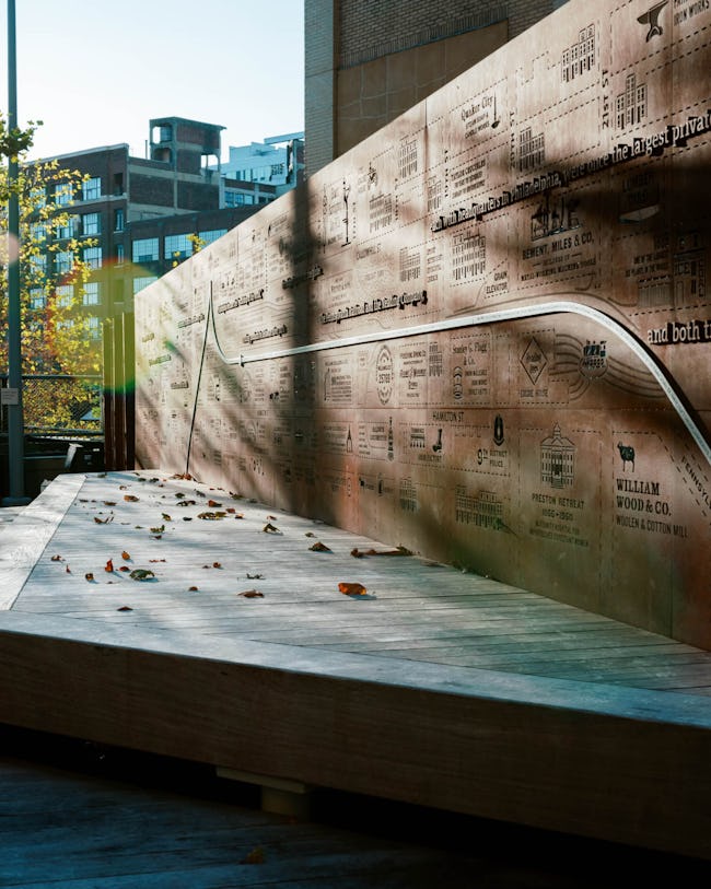
Many greenways include public art, some from local artists, and others from renowned workshops. Public art can take a lot of forms, including walls, sculptures, murals, monuments, soundscapes, land art, and electronic art. Some may even have an interactive component, and many entice users to visualize it from different angles to appreciate its beauty truly.
Public art can also be a form of programming: municipalities can organize competitions to encourage citizens to showcase their own work. Local artists can capture a municipality's history in unique and captivating ways.
The below photos and video capture just a small selection of the public art that beautifies many greenways and adds to their social value.
Sombras y Luz, by Bill and Mary Buchen, represents traditional designs inspired by the Mexican papel picado technique. Other designs include historical images and native flora in El Paso.

Looking Through the Windows, by Michael Kuschnir, is featured in the Indianapolis Cultural Trail and takes inspiration from the historic architecture in the area.

Talking Wall, by Bernard Williams, is also installed in the Indianapolis Cultural Trail and honors the African American culture and history in the city.

The Glick Peace Walk was commissioned by a group of artists and workshops and donated by Gene and Marilyn Glick to Indianapolis. The Walk is dedicated to accomplished people who have made peaceful contributions to society, such as Susan B. Anthony, Martin Luther King Jr., Jonas Salk, and Mark Twain.
Further afield in Jeju South Korea is the Jeju Art Park, home of 3D light sculptures and light tunnels.
Fort Worth installed a futuristic and playful art installation with an interactive component. Users sit in cylindrical pods and push a lever to spin a visual story around them. Stories are taken from traditional children's books.
Green Infrastructure
The Greenway passes through different environments, including suburbs, dense urban areas, and the Kearney marshes. Each segment requires careful planning to maximize biodiversity, minimize unwanted human-animal interactions, and bolster ecosystem services such as stormwater management.
Rutgers University and other counties in New Jersey have investigated the potential for green infrastructure as a flooding mitigation tool. Nearly half of the Greenway will face flooding, according to the Essex Hudson Greenway Framework Report. The following describes some examples of green infrastructure.
Wayfinding
Wayfinding is more than just signs. Wayfinding gives people the easiest route to the trail and allows trail users to find important services like train stations, nearby parks, landmarks, and shopping centers. It provides context for users and creates a sense of place. Signs can include QR codes for more information, such as interactive maps. Restoring the mile markers from the old Boonton Line can help wayfinding while paying homage to the trail's history. Wayfinding will also need to consider the predominant languages spoken in each municipality.
Wayfinding does not have to be purely visual. For the visually impaired, multisensory wayfinding can help orient a person. Examples include musical areas, food vendors, and fragrant plants such as Clethra (Summersweet).
Accessibility
The trail should do more than conform to ADA and other regulatory requirements. It should be welcoming to all, regardless of age or ability. Three principles are at the heart of universal design:
- Equitable use: any person can use the trail.
- Flexible use: the trail accommodates different abilities and preferences.
- Intuitive use: trail design is easy to navigate and not cumbersome.
Design features include adequate lighting, clear and clean paths, tactile pavement, auditory signals at crossings, shallow ramps, and multisensory wayfinding (as mentioned above). Several trails have developed design guides for accessibility, and some such as the Philadelphia Rail Park have engaged blind consultants to fully understand design aspects for the visually impaired. Others, such as the Circuit Trails in Philadelphia, have studied how to increase equitable access for underrepresented communities.
Interviews
The studio team interviewed ten trail organizations, networks, and county/state departments to generate planning, design, and programming recommendations for NJDEP. The interviewees and their comments are summarized in this map tour.

Schuylkill River Greenways
Joe Louis Greenway

Atlanta Beltline
Philadelphia Rail Park
Monmouth County Park System

Camden Greenway

NYS OPRHP

Delaware River Trail
Schuylkill River Greenways
February 27, 2023
The Schuylkill River Greenway runs from Philadelphia deep into the heart of Pennsylvania. It is a long-established greenway and waterway trail that will eventually span 120 miles. We received a lot of great insights based on their experience and some advice on how the EHG should be planned.
Funding: The Schuylkill River Greenway is a designated Heritage Trail and part of the National Park Service's National Recreation Trails. It is therefore eligible for NPS funding. Trail counters are also extremely useful for grant funding and what portions are used most often.
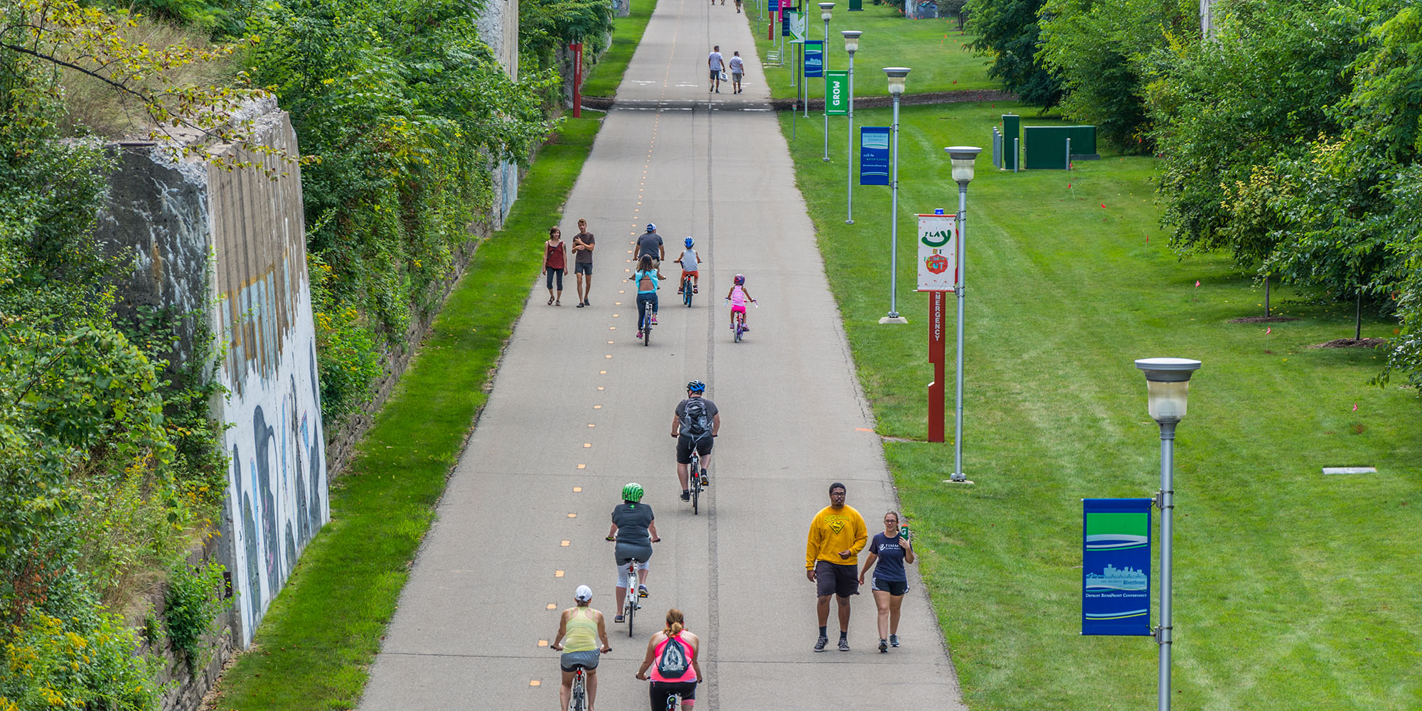
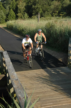
Usage: The Essex-Hudson Greenway is likely to get crowded immediately. Pave it now before having to do it later! Design standards will have to be high to accommodate many people. Some people may use the trail for commuting, going to school, running errands, or accessing public services.
Accessibility: Focus on the connections rather than the trail itself. Rail trails are by nature gentle slopes but getting people on/off will be the difficult part. Make signage and programming culturally /language appropriate.
Maintenance: There are 3 staff members who go and check the trail for fallen trees. Many volunteers help with cleaning and general maintenance. They do not remove snow in the winter.
Working with municipalities: We connect municipalities together and help them raise money. We organize steering committees so that there are political champions in each municipality.
Safety: There are studies that show that trails can reduce crime. There are design aspects that make the trails safer such as lighting, fencing, security cameras and patrols, but the best thing is to maximize usage.
Gentrification: Some towns along the trail such as Phoenixville experienced a growth in luxury apartments. The borough worked with a low income housing provider to build some affordable apartments. You need to work with municipalities and tell them that gentrification could happen.
Parking: Many trails do not have enough parking. Design a lot more than you think you need, but it does not have to be all at once. Just have some space set aside for expansion.
Joe Louis Greenway
March 3, 2023
The Joe Louis Greenway, planned in 2021, is planned 27.5-mile circuit in downtown Detroit. It was originally named the Inner Circle Greenway and then was renamed by Mayor Duggan in honor of the legendary Detroit boxer. The City released a detailed framework plan for the Greenway, split over two volumes ( Volume 1 , Volume 2 , Appendices ).
Funding: The Greenway received funding from different levels of government including the Michigan Natural Resource Trust Fund, Michigan Department of Transportation, Wayne County, and the City of Detroit.
Design: There is a separate path for walkers and cyclists/scooters.
Partners: LG works with the Detroit Riverfront Conservancy to set the goal to raise $350 million, of which $200 million will go toward development and operations for the JLG. The City Planning Department will oversee adjacent land use, General Services will manage construction, and the Department of Public Works will oversee maintenance.
Programming: The JLG is intended to be a community space and is not expected to generate revenue. Public art and programming are planned, including opportunities to showcase local history.
Safety and usership: There are few residents adjacent to the JGL. The greenway is expected to be open 24 hours with lighting to allow use by people working non-traditional shifts. The greenway will encourage use by all ages and especially schoolchildren.
Atlanta Beltline
March 10, 2023
The Atlanta Beltline is a massive urban redevelopment project encompassing several interconnected trails, parks, transit, and affordable housing along a 22-mile circuitous route within two miles of downtown Atlanta.
Implementation: The Beltline was approved in 2005 and is constructed in phases. Atlanta Beltline Inc oversees planning and execution while the Atlanta Beltline Partnership manages fundraising, awareness, and programming.
Funding: One innovation of the Beltline is its Tax Allocation District (TAD) which will expire in 2030 - the same year the Beltline is expected to be completed. The TAD has generated nearly $250 million since 2005. Other funding sources include the city, county, state, and federal grants; private investment and philanthropy; public-private partnerships; and a recently announced special service district, which increases taxes for commercial and multi-family properties.
Gentrification: The Beltline has a dedicated website and more resources to help people access affordable housing. The project goal is to build 5,600 units of affordable housing and to date has achieved 56 percent of that goal.
Maintenance: Design in the past was intended to reduce maintenance costs by using high end materials such as stainless-steel railings which do not rust and do not need painting, and retaining walls made from local granite, which is easier to clean graffiti. Lifecycle budgets and integrating the facilities and maintenance teams is the preferred plan to lower construction costs across the project.
Safety: Initially, cameras or lights were not installed. Reports of crimes and injuries have led to the installation of LED lights and high-definition cameras. Footage is recorded and stored for two weeks.
Philadelphia Rail Park
March 13, 2023
The Rail Park is a planned three-mile linear park in downtown Philadelphia. The first phase was completed in 2018, spanning a quarter mile. The park will connect 10 neighborhoods that have little access to open space and are surrounded by heavy traffic.
Planning: This project required high advocacy. The Rail Park partnered with the Philadelphia Parks and Recreation Department. The William Penn Foundation was a primary source of donations to the park. The Rail Park is integrated into Philadelphia's and the Delaware Valley Regional Planning Corporation's planning documents.
Public engagement: The pandemic made it hard to gain community input properly. A legacy of urban renewal has made some people skeptical of the park, so it was important to underscore that this is a community asset.
Design: The Rail Park hired a blind consultant to create a more universal design. The organization understands that additional work should be included to make the park accessible to other cultures, such as providing wayfinding in Mandarin and Cantonese because of the adjacency to Chinatown. They plan to include local plant material. A big takeaway from the interview is that there is a difference between being compliant and being welcoming.
Operations: The Parks and Recreation Department manage trash removal and maintenance though they do not have the equipment for graffiti removal or maintaining the wooden benches. The Rail Park organization manages the cycle of fundraising, programming, and maintaining usership.
Monmouth County Park System
March 14, 2023
Monmouth County has converted two former rail lines into multi-use trails: the Henry Hudson Trail (24 miles) and the Union Transportation Trail (9 miles). Monmouth County is much more rural than Essex or Hudson Counties, and many horse riders use their trails. Yet the staff at Monmouth County Parks System still gave us relevant advice.
Planning: Start small and incremental, and learn from your initial experience. Do the basic cleanup and paving. You will run out of money quickly if you do everything at once. Build the connections and support to work for something bigger - additional phases, or enhanced design/facilities.
Design: The path is a mix of asphalt and gravel. Most of the path is tree lined, with some distance between the edge of the path and trees to make it easier to manage vegetation and to prevent roots from going under the path. Amenities include fountains and bike repair stations. Larger facilities such as bathrooms are in linked parks, because the trail right-of-way is only 10 feet. It is best to clean natural ditches and swales, but do not alter their path. Creating new channels for rain flow may create unintentional diversions.
Operations: The County handles maintenance, aided by many volunteers who work thousands of hours cumulatively a year. The County does not remove snow and allows ATVs. The trail is open during daylight hours.
Institutional Organization: Whoever has the most resources should manage the Greenway. The counties can form a joint committee, meeting quarterly and having a dedicated staff member. Both Essex and Hudson countries have an Open Space Trust Fund, which they can use for budget allocation. NJDEP has a backlog of maintenance requests, and delegating maintenance to the municipalities could lead to variations in quality. A non-profit partnership could help with fundraising and recruiting volunteers.
Usage: Users of Monmouth County's two trails include seniors, school children, horse riders, cyclists, and others. The EHG trail has to be welcoming to all. There will likely be a lot of gig economy workers using the trail.
Camden Greenway
March 20, 2023
The Camden Community Partnership, formerly known as Cooper's Ferry Partnership, is a non-profit corporation that promotes the economic revitalization of Camden and manages the Camden Greenway.
History: The Greenway has a long planning history, beginning with the Camden Greenways Working Group in 1993. In 1998, the Camden Greenways Masterplan was incorporated into the City's Master Plan. A few years later, Camden City Council incorporated the Greenway plan as part of the City's zoning ordinance, creating two new conservation districts and a Stream and River Corridor Protection and Management Overlay Zone. The City Council adopted these zoning amendments after dozens of meetings and negotiations with residents and businesses.
Institutional organization: The Camden Community Partnership is a private non-profit. This structure helps connect public and private finance. They help grant with state and federal grant applications, and engage with foundations and philanthropic organizations. They liaise with the city and county to help coordination. The partnership is resident driven and experienced with community engagement. Finally, the partnership is part of the ‘Reimagining Civic Commons’ group, which is a national alliance of several cities and private partners that do peer knowledge exchange of best practices for park maintenance. They have volunteers and youth ambassadors that helps with maintenance.
Community Engagement: Some residents, like at the Philadelphia Rail Park, where skeptical about whether this was the best use of public dollars. It is important to have spaces where people can ask these kinds of questions, and explain where the funding comes from and what it is dedicated for (especially grant funding). The Partnership helped create a space for the Little League, which bolstered community support.
Design: The first trail took several years. There is a trail standard for subsequent phases. Current work is on consolidating gaps. Even though only half of Camden residents own a vehicle, the city is car-oriented, and giving up parking for the on-road portion of the trail was controversial.
Funding: The Camden Greenway is a brand. This helps with getting funds. They have multiple public and private sources, and they help the City and County apply for grants. Grant applications will be a constant process, especially for phased projects. It needs to be timed well with the project timeline (preliminary design, final design, RFP, construction). User statistics and surveys are a big requirement from donors. They suggest two possible mechanisms - (1) a business improvement district or TAD (like the Atlanta Beltline) to generate tax revenue for maintenance, or (2) a conservancy which is volunteer-run and funded by philanthropy, possibly with support from the New Jersey Neighborhood Revitalization Tax Credit.
Programming: The Camden Greenway is a community-oriented asset, and therefore there are lots of events. There are amphitheaters, exercise classes, movie nights, and jazz nights. They make sure that the weekend is full of events. Funding has been hard to obtain for public art.
NYS OPRHP
March 21, 2023
The New York State Office of Parks, Recreation, and Historic Preservation plans more than 2,000 miles of greenway trails, including the 750 mile Empire State Trail connecting New York City, Buffalo, Albany, and the Canadian border. The OPRHP also conducts community and stakeholder engagement, high level planning, and identifies gaps in the greenway.
Funding: The OPRHP is the dedicated agency to receive federal dollars, especially Department of Transportation grants such as TAP and CMAQ. Its operations are funded through state appropriations. It cannot approach the private sector (for-profit or not-for-profit), but private organizations can approach the OPRHP. Most grants go towards capital budgeting and design, but few for maintenance. The disconnect between capital budgeting and maintenance budgeting is mentioned in their Master Plan.
Planning: The statewide greenway trail plan came from legislative mandate, following lots of advocacy. It is a high-level planning document that identifies gaps in the trail and recommendations for future planning, such as interagency coordination. For example, the interview highlighted the need for more formal cooperation with NYDOT especially with regard to on-road portions of trails.
Operations: Most trails are owned and managed by municipalities, counties, and non-profits rather than NYS OPRHP. Exceptions include the Harlem River Rail Trail and Genesee Riverway Trail, though the OPRHP has maintenance agreements with respective municipalities for these trails. Higher capacity towns and counties generally take on more responsibility, though the OPRHP provides grants to less resource jurisdictions for equipment purchase, staff recruitment, and programming.
Design: There is no specific design template for the entire state. If the trail is owned by a non-profit, then the OPRHP recommends some aspects. If it part of the Empire State Trail, then OPRHP has a design guide, but there is no enforcement. If there are wayfinding to transportation facilities or roads, then it has to follow AASHTO/NYSDOT rules.
Community Engagement: OPRHP defers to the trail organizations for public facing events. They work with organizations to help prioritize parts of the trail, but the organization handles outreach. There were cases when OPRHP brought on a consultant for public engagement for a trail near Vermont where there was public opposition.
Delaware River Trail
March 24, 2023
The Delaware River Waterfront Corporation, historically known as the Penn's Landing Corporation, is a private non-profit that manages and plans the 3-mile Delaware River Trail.
Design: For most of the trail, there are separated bike and pedestrian paths. The city is planning to cap a section of I-95 and build a park on the cap with the trail running through it. Even though it is a short trail, there are different designs for different neighborhoods. For example, there is a warehouse that is converted to an artists' studio at Cherry Street. So they planned for more traffic and congregation there. Near a wetland there has been more work done on environmental conservation (river bank stabilization). Throughout they have stopping spaces to relax or socialize. Most crossings are at grade with Columbus Boulevard, so all crossings are high-visibility with warning stripes for the visually impaired. There are lots of planters and trenching to manage stormwater.
Public engagement: There were many focus meetings and outreach events. The residents of Pier 3 were worried that the trail would create a lot of noise and reduce parking spots. DRWC will soon launch an etiquette campaign to inform users of proper trail behavior. The trail FAQs address the issue of parking, and mention that layby lanes are rarely full.
Partners: The trail runs through the property of a casino. The casino helped with funding. Natural Lands provided some land at below market price.
Funding: Just like with SRG, DRWC highly recommends trail counters for grant writing. Just over half of users are pedestrians though a substantial percentage of users are cyclists. Hourly data indicate that commuters use the trail. The William Penn Foundation also gave a lot of money. The City of Philadelphia funds daily operations and provided $20 million for trail development. The Waterfront Corporation also receives grants from the Pennsylvania DOT, DCNR, and DCED.
Programming: DRWC is including public art as part of its Waterfront Arts program. The Corporation is working with the City of Philadelphia Public Art Office to develop a public art program. The capped park over I-95 will eventually include an amphitheater.
We also met with greenway networks that are not fixed in one location.
High Line Network
March 7, 2023
The High Line Network is a group of nearly 50 greenways in the United States. They provide technical support to planners and organizations for infrastructure reuse. Their aim is to encourage peer-to-peer learning among different parks to understand what operations have worked and what has not.
Green Gentrification and Equitable Development: It is important to understand the context within which these parks are developed. Many have had histories of either disinvestment or investment that destroyed communities. It is also important to acknowledge that concerns about green gentrification are not an excuse not to invest in public spaces. Many in these communities want more access to public parks. Also important that speculation can happen well before construction - especially if heavily publicized. Several cities have policies for value capture such as Tax Allocation Districts, Tax Increment Reinvestment Zones, and Payment in Lieu of Taxes. The 11th Street Bridge has implemented a four-pronged approach to equitable development:
- Workforce development - training in construction
- Affordable housing and capacity building for housing organizations such as community land trust and homebuyers organizations.
- Small and medium business support
- Cultural equity.
Community Engagement: Smart small. Build these relationships. Build local leadership. Listen. Acknowledge concerns. Make space for concern raising. Have a full-time member working on community engagement rather than outsource it to a consultant. The network has its own Community First Toolkit .
Funding: Grant writing requires a lot of time. It is best to have a dedicated staff member. Get community support and organizational support to encourage local politicians to allocate funding. Non-profit and private partnerships tend to be more flexible than public funding. Monetizing through vendors is typically low return.
East Coast Greenway
March 10, 2023
The East Coast Greenway is a network of active and planned trails that will span 3000 miles from Maine to Florida. The East Coast Greenway Alliance works with volunteers, organizations, and different levels of government to create a multi-use trail that links cities and towns all across the East Coast.
Parking: Park must accommodate disabled users. Consider having a loading and unloading zone for elderly people who go on day trips.
Design: Crushed stone provides an authentic trail feel but can get damaged easily, especially after storms. Paved surfaces last longer but can be hard for runners or joggers.
Maintenance: Maintenance can be government-led, e.g., by a municipality or state DOT. There can also be a public-private management alliance, or a non-profit trail preservation organization.


