History of Washougal Parks
City of Washougal
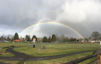
Bill Hamllik Park
4285 Addy Street
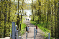
Captain William Clark Park at Cottonwood Beach
South Index Street and 32nd Street
Community Garden
2036 Main Street
Dick Beaver Park
1200 “A” Street
Elizabeth Park
811 - 14th Street
George J Schmid Memorial Ball Field
4855 Evergreen Way
Hartwood Park
Trailheads @ Campen Creek Park: 1820-42nd Ct. Hartwood Park, 2251-49th Street Eldridge Park, 2211-49th Street
Hathaway Park
799 – 25th Street
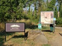
Kerr Park
4600 Gifford Place
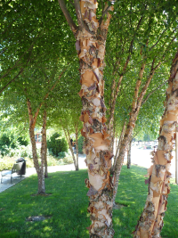
Main Street Pocket Park
Main Street and Washougal River Road
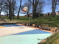
Oak Tree Park
350 West “Y” Street
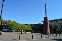
Reflection Plaza
1703 Main Street
River Bend Park
1099 4th Street
Sandy Swimming Hole
550 North Shepherd Road
Schmid Family Park
1407 32nd Street
SR-14 Pedestrian Tunnel
Pendleton Way and State Route-14
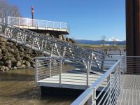
Steamboat Landing
100 S 15th Street
Bill Hamllik Park
4285 Addy Street
Amenities
One softball field, bleachers, playground, bike skills course, walking path, barbecues, benches, tables, a covered picnic shelter, restrooms, and off-street parking.
Recreation Opportunities
Originally named after phase one and two of Bethea Park Estates subdivisions, the footprint for “Bethea” Park was forming as early as 1979. In June of 1986, Washougal City Council surprised former council member, Bill Hamllik, with his own namesake park. Landscape Designer Dave Pettyjohn and Mayor Bill Bright broke ground in 1987 on two baseball fields; however, frequent errant pop flies into neighboring residences ultimately resulted in the dismantling of the west field. A playground, gazebo, and asphalt paths were added to the park in the mid-1990s. In 2012, the City installed new bleachers for spectators. The City of Washougal plans to improve access to the park from the surrounding streets, add a half basketball court, and plant more trees. Watch for these improvements coming soon!
Captain William Clark Park at Cottonwood Beach
South Index Street and 32nd Street
Amenities
Picnic shelters, barbecues, picnic tables, benches, paths, restrooms, sandy beach, open grassy spaces, historical features, off-street parking, and a year-round caretaker.
Recreation Opportunities
Captain William Clark Park provides a long sandy beach where sunbathers congregate, swimmers play, and small motorboats anchor off shore. The park is designed with ample picnic opportunities; however, access may prove challenging since the shelters and tables are far from parking and further separated by a steep levee. The park offers a pleasant path for outdoor enthusiasts to walk, jog, bike, or ride horses. Take a moment to read the historical points along the trail. No lifeguard on duty.
History of Captain William Clark Park
Also known as B.A. Beach and Cottonwood Beach by locals, Clark Park has a rich history. In 1792, Lieutenant William R. Broughton, the first foreign explorer, ascended the Columbia River from the Pacific Ocean on a journey to find the headwaters of the Columbia River. He landed at a point near this park, claimed the Washougal area for England, named Mt. Hood, but went no further upriver. In 1806, Captains William Clark and Meriwether Lewis descended the Columbia River in their famous transcontinental exploration, camping for six days to gather supplies at this now namesake park. To find the full story on these historical events, visit Clark County’s site: https://cchmuseum.org/research-library/ . Over the years, residents used this park for drag racing, partying and other rowdy activities. The 2005 total park makeover by five partnering government jurisdictions reshaped the park into a family friendly environment. Since this is a regional park, not a city park, contact Clark County for special use permits or shelter reservations. The Washougal Public Works Department would happily assist with contact information or additional historical resources.
Community Garden
2036 Main Street
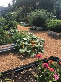
The Washougal Parks & Recreation Community Garden Program consists of our new Downtown Community Garden, located at 2036 Main Street. Our program promotes community building, sustainable practices, and ecologically responsible gardening. We are growing! Join us and help fuel this movement towards a healthier Washougal. Gardeners in the program have the opportunity to grow flowers, fruits, and vegetables in privately leased plots and also cooperate with one another to manage the larger community garden site. Gardening is one of the most popular recreational activities in America, providing an opportunity for recreation, exercise, therapy, and often access to a wider variety of nutritious and healthy food than might otherwise be available. The City of Washougal recognizes community gardening as an activity that contributes to the health and well-being of the wider community as well. Gardening together provides an opportunity for education, environmental awareness, social interaction among diverse people, inter-generational and cross-cultural connections, and a connection to the environment and the practice of sustainability.
Dick Beaver Park
1200 “A” Street
Amenities
Small playground, gazebo, benches, and art.
Recreation Opportunities
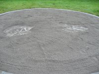
Dick Beaver Park offers a different playground than typically found in the Camas/Washougal area. The sandbox provides the opportunity to excavate dinosaur bones buried in sand. A John Muir climbing tree gives more ambitious children a challenge.
History of Dick Beaver Park
The City of Washougal acquired a parcel of land from the State of Washington in 1973. The State declared this property as surplus after the 1960s SR-14 extension project continued the highway from now Washougal River Road to Evergreen Highway in the 1960s. In June 1986, the Washougal City Council surprised long-serving citizen and former council member, Richard Beaver, by honoring him with a namesake park surrounding the Silver Star Search & Research station that he assisted in building.
Elizabeth Park
811 - 14th Street
Amenities
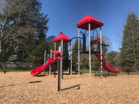
Playground, half court basketball, asphalt walking path, barbecues, and permanent picnic tables.
Recreation Opportunities
Set in the heart of a residential neighborhood, Elizabeth Park offers a laid-back atmosphere for family picnics. Parents can easily watch children play.
History of Elizabeth Park
Elizabeth Park possesses an interesting and mysterious background. Information found at the Two River’s Heritage Museum reveals that an unknown man sold this property to the City of Washougal for $10 on the condition the park receive his grandmother’s name. The man was reported to be an escaped fugitive from the FBI. After completing the sale of the property at City Hall, he exited the building into an agent's handcuffs. The man’s identity remains a mystery, and the name on the property deed leads to a string of aliases. To this day, Elizabeth's identity remains a mystery.
George J Schmid Memorial Ball Field
4855 Evergreen Way
Amenities
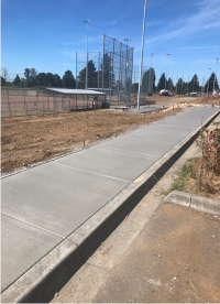
Three baseball fields, bleachers, restrooms, concession stands, and off-street parking.
Recreation Opportunities
This site provides softball, baseball, and open grassy areas for passive recreation. The site sits adjacent to Mable Kerr Park, popular for its trails and wildlife.
History of George J. Schmid Memorial Ball Fields
A part of the Kerr family orchards, this property played a role in the regional prune industry in pre-1950s. After the decline in the orchards, many properties like this grew wild for decades. The Washougal School District purchased this land in 2001 for expansion of school services. In 2004, the School District built Administrative Offices and a maintenance shop on the site. In 2006, the City of Washougal and the Washougal School District partnered to build three baseball fields.
Hartwood Park
Trailheads @ Campen Creek Park: 1820-42nd Ct. Hartwood Park, 2251-49th Street Eldridge Park, 2211-49th Street
Amenities
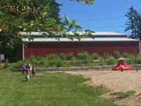
Disc golf, Cedar View Trail, benches, picnic tables, farm themed playground, parking, and a community orchard.
Recreation Opportunities
This park provides views of distant Oregon hills and vistas of surrounding Washougal. This system of parks provides diverse ecosystems, from forest to field, ponds, and streams. The site is a popular haven for deer and other wildlife.
History of Hartwood Park
At over 40 acres, Hartwood Park is the City of Washougal's largest park. Eldridge Park was the first acquisition with a 1998 grant from the Clark County Conservation Futures Program. The property was sold by the Kerr family as a tribute to Dr. Horace L. Eldridge.
The Cedar View Trail was constructed by volunteers, Eagle Scouts, City staff, and the Clark County Parks Foundation. It has become a popular recreational trail for area residents. A 2013 Parks Foundation grant provided farm-themed play structures in Hartwood Park. A 2014 Washington Wildlife and Recreation Program Local Park grant also added a barn style play structure, picnic tables, parking improvements, and ADA accessibility.
Hathaway Park
799 – 25th Street
Amenities
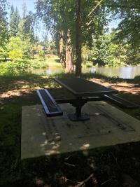
Softball field, asphalt paths, three playgrounds, barbecues benches, tables, picnic gazebo, two restrooms, pavilion with power and water, six pickleball courts, three off-street parking lots, swimming beach, and a boat launch at the Washougal River.
Recreation Opportunities
At over 15 acres, the park has a variety of recreational opportunities, from pickleball to swimming. But remember, no lifeguard is on duty, so be sure to swim within your limits. The Main Pavilion in Upper West Hathaway remains the favorite location for picnics and events.
History of Hathaway Park
Hathaway Park began with a land donation by A.O. Hathaway in approximately 1910. Multiple sales transactions and grants provided by the Recreation and Conservation Office over the next 100 years shaped this into one of Washougal’s most highly visited and treasured parks. In 1949, volunteers graded the “lower” park into rodeo grounds. The very first Washougal Rodeo, held on July 30th, 1950 was forever captured by aerial photography. In 1953, the arena and bucking chutes were replaced by a back stop and infield, now known as Bates Field. With most of the facilities dating to the 1900s, the Washougal Public Works Department makes ongoing improvements to aging assets and preserve the features that Washougal residents love.
Kerr Park
4600 Gifford Place
Amenities
Gravel trail, wooden bridge over Campen Creek, benches, and information kiosks at trailheads.
Recreation Opportunities
Kerr Park provides trails through woodlands and along Campen Creek. The park offers opportunities to observe wildlife and enjoy a melody by songbirds. Great Blue Herons visit the small wetland on the “island” across the bridge. These shy creatures tend to vacate the property immediately upon seeing humans. Frequently, deer browse for food or nestle in the grass. Campen Creek is known as spawning grounds for Coho Salmon. Winter Steelhead and Fall Chum may also traverse this creek. Views of the neighboring Orchard Hills Golf Course peak between trees. Errant golf balls may fall into the park; exercise caution.
History of Kerr Park
As a part of the Kerr family orchards, this property played a role in the regional prune industry in pre-1950s. After a decline in the prune orchards, many properties like this were left to revert to natural landscapes and grew wild for decades. Because the Kerr family wanted this land protected from development, the Columbia Land Trust purchased this property in 1997 on behalf of the City of Washougal. In 2007, the Parks Department began a site restoration campaign. The Parks Foundation of Clark County provided grant funds in both 2008 and 2011 for trails and native plants. Service groups, students, and residents planted trees and built all the trails and bird boxes, resulting in a popular site to escape for a short hike. The City officially acquired the deed to this property in 2011.
Main Street Pocket Park
Main Street and Washougal River Road
Main Street Park is a small pocket park in downtown Washougal.
Oak Tree Park
350 West “Y” Street
Amenities
Asphalt trail, benches, half court basketball, picnic tables, playground, street parking, and views.
Recreation Opportunities
This site provides amazing views of the Columbia River, Oregon, Mt. Hood, and Washougal below. The flat grassy setting surrounded by mature Oregon White Oak trees offers a serene and scenic location for family picnics. The playground is designed for 2-5 year old children.
History of Oak Tree Park
This Southern face of Woodburn Hill was once used for hayfields and pastureland. Outcrops of Oregon White Oak trees dotted the rocky hillside, but this one-acre savanna of Oaks grew in the middle of a future subdivision. The Lookout Ridge development surrounded this grove of Oak trees and naturally became the ideal site for a neighborhood park. The developer had admirable plans to utilize utility easements for trail connectivity; however, only part of these plans materialized. The City of Washougal took over maintenance of Oak Tree Park in 2009.
Reflection Plaza
1703 Main Street
Amenities
Benches, drinking fountains, electrical outlets, Wifi, and paved open space.
Recreation Opportunities
Reflection Plaza acts as the hub of Washougal with easy access to downtown merchants, Washougal’s public buildings, a history museum, and recreation opportunities beyond the SR-14 Pedestrian tunnel. Reflection Plaza provides a trendy venue for public events and offers individuals a charming niche to enjoy the amenities of downtown.
History of Reflection Plaza
In 1880, Fritz Braun disassembled and moved his Park Hotel from Parkersville to this site, now known as Reflection Plaza. Washougal’s first town pump, dug in the center of the intersection of Main and Pendleton, gave explosive growth to the new community in 1882. Life flourished around this water source. When the first pump collapsed, residents dug a second pump in the same location. Historical records skip a beat about the Reflection Plaza site, leaping forward to more modern times, long after automobiles replaced horses. In 1991, Washougal purchased and demolished the Texaco gas station and neighboring apartments for a town square. Reflection Plaza had a gazebo, popular water fountain, and a wooden platform "stage." With the 2005 revitalization of downtown Washougal, the Park experienced a modern redesign and a name change. The new Reflection Plaza’s tower stands symbolically to mark the location of Washougal’s first town water pump. Today, Reflection Plaza serves as Washougal’s venue for hosting community events.
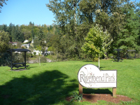
River Bend Park
1099 4th Street
Amenities
Hooded benches and tables, barbecues, and views of Washougal River.
Recreation Opportunities
Riverbend Park is a 0.22 acre site most suitable for small picnics. Although traditionally used as a path to the Washougal River, Riverbend Park actually does not have significant riverfront property. Neighboring residential properties extend down to the river, meaning the beaches in this area are privately owned. Because of this, the City of Washougal encourages visitors to stay on top.
History of Riverbend
Riverside Estates subdivision developed in 1994 from a portion of the David C. Parker Donation Land Claim. Of the five residential lots created along the Washougal River, Lot 1 was identified as a potential neighborhood park. The City of Washougal acquired and developed the lot with funds from a Community Development Block Grant. The park offers picnic tables and benches for enjoyment of Washougal River views.
Sandy Swimming Hole
550 North Shepherd Road
Amenities
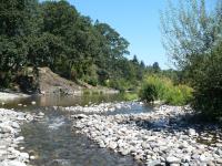
Gravel beach, observation deck, benches, picnic tables, off-street parking, and restrooms.
Recreation Opportunities
For decades, “Sandy” has welcomed Camas and Washougal swimmers and sunbathers during summer months. Sandy also provides a gentle beach for kayaks and other non-motorized watercraft. Park visitors not wanting to get wet may remain at the observation deck, where picnic tables and benches are easily accessed from the parking lot. No lifeguard is on duty.
History of Sandy Swimming Hole
Generation of families have cooled themselves in the waters of the Sandy Swimming Hole. Remnants of Sandy’s early restrooms and outbuildings still nestle in the beach gravel. In the early 1990’s, the Cities of Camas and Washougal applied to the Recreation and Conservation Office to enhance Sandy with an Aquatic Lands Enhancement Account grant, funded by the Washington State Department of Natural Resources. The grant improved access, parking, and added new restrooms. Sandy remains the community hot spot during warm weather; at times, visitors exceed Sandy’s capacity and congest surrounding streets. Observe “No Parking” signs along Shepherd Road to avoid citation or tow.
Schmid Family Park
1407 32nd Street
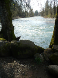
The City of Washougal purchased 18 acres of land for use as a community park as identified in the City’s Parks Comprehensive Plan. The property is located west of 32nd Street, about a half mile north of Evergreen Blvd. It is located east of the Washougal River and is centrally located within the city.
SR-14 Pedestrian Tunnel
Pendleton Way and State Route-14
Amenities
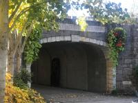
Lit corridor, drinking fountain, basalt benches, and a permanent petroglyph art exhibit. Parking is generously provided by Pendleton Woolen Mills. The site is monitored by 24-hour surveillance.
Recreation Opportunities
Provides a connection between downtown Washougal and amenities on the south side of SR-14. Visitors can walk or bike from the tunnel to Steamboat Landing Park, Captain William Clark Park, and the Steigerwald National Wildlife Refuge. The U.S. Corps of Engineers levee trail extends 3.4 miles from the tunnel, providing an easy recreation opportunity. These resources offer amazing views of the Columbia River, the mouth of the Columbia River Gorge National Scenic Area, Mt. Hood, and wildlife.
History of the SR-14 Pedestrian Tunnel
Early residents settled the banks of the Columbia River for the food and water it offered and the ease of access by boat. With advancements in transportation, Washougal residents relied less and less upon the river for resources. Seeking the protection of a flood-controlling levee, Washougal forfeited the benefits offered by an immediate connection to the river. The U.S Corps of Engineers levee construction (1960's) and the extension of State Route 14 (early 1970's) severed the direct relationship between Washougal and its original source of life. Washougal visionaries sought to rejoin Washougal residents with the majestic river by building the SR-14 Pedestrian Tunnel. This link adds an essential element to the Downtown Washougal Revitalization Plan, dedicated to building a pedestrian and bike friendly city environment. To recognize and honor the earliest residents of this area, the city worked with a select team of Washougal High School students to create petroglyph images on slabs of basalt. After researching ancient native tribes from this region, the student’s designs were hand etched in stone by local rock craftsmen. The petroglyphs are permanently displayed in the tunnel.
Steamboat Landing
100 S 15th Street
The Lower Columbia River Estuary Partnership is one of the largest organized stewardship programs in the Portland/Vancouver area with 450 members. LCREP is the lead agency in the development of the kayak Water Trail for the lower stretch of the Columbia River between the Bonneville Dam and the Pacific Ocean. On the Washington side of the river, Steamboat Landing Park (river mile 123) is the only free dock that is not in a busy marina setting. Motorboat launches and marinas force kayakers to share space with larger vessels. There are several sandy and rock beaches on the water trail. Steamboat landing dock allows fisherman, kayakers, site seers to utilize this beautiful dock.