Investigating 38 years of water quality in the GTMNERR
Nitrogen and Phosphorus Change in the Guana Tolomato Matanzas National Estuarine Research Reserve from 1984 to 2022
Land Use Change and Nutrients
- Coastal habitats are heavily affected by land use change and nutrient influx.
- Land development, such as urbanization and agriculture, result in higher nutrient levels.
- Septic systems (Herren et al. 2021) and agricultural waste, such as fertilizer and manure (De Rossi et al. 2023) can increase nutrient levels in waterways.
- Stormwater runoff, and wastewater runoff (septic systems and sewers) can also be a source of nutrient influx to wetlands (Cocoa City Department, 2024).
- Studies have shown that increased impervious surfaces and increased precipitation events result in higher nutrient runoff (Gold et al. 2019, MacDonnell et al. 2017).
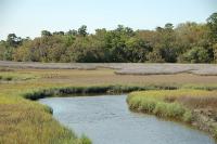
Coastal Wetlands and Nutrients
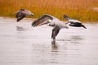
- Coastal wetlands, such as salt marshes and mangroves, provide clean water, flood protection, recreational opportunities, fishery habitats and more (NOAA 2024).
- They are also great sinks for excess nitrogen (N) and phosphorus (P) from anthropogenic development (Dangremond et al. 2019).
- An increase in urbanization can also subsequently result in a decrease in coastal mangroves.
- From 1990 to 2014, there was a 12,000 acre decrease in coastal wetland habitat in Northeast Florida (Dix et al. 2021).
Methods
Data Collection and Quality
We used data that was collected by the Guana Tolomato Matanzas National Estuarine Research Reserve (GTMNERR) via the System-Wide Monitoring Program (SWMP) and St. John’s River Water Management District (SJRWMD). These data range from 1986 to 2022 and were collected from 13 different SJRWMD water quality stations and 4 SWMP stations. Nitrogen parameters included ammonium (NH 4 + ), combined nitrate (NO 3 - ) and nitrite (NO 2 - ), total Kjeldahl nitrogen (TKN), and total nitrogen (TN). Phosphorus parameters included orthophosphate (PO 4 -3 ) and total phosphorus (TP). We compiled the water quality records and annotated with metadata. Figures include both SJRWMD stations and SWMP stations, while interpolations include only SJRWMD stations. This StoryMap and data will be published for public use.
Interpolation
For interpolation, we categorized the SJRWMD dataset into three time periods: 1984-2000, 2001-2010, and 2011-2022 and conducted an inverse distance weighted interpolation for both total N and total P data to investigate spatially projected nutrient trends over the course of data collection (~38 years).
Land Use Change Map
Land cover change data was downloaded and imported from the National Land Cover Dataset (NLCD) for 2011 and 2021 into ArcGIS Pro. We measured the change from woody wetlands (category 90) to open development, low intensity development, medium intensity development and high intensity development (21, 22, 23, 24)
Study Sites
This study utilized data from St. John's River Water Management District (SJRWMD) and the National Estuarine Research Reserve's System-Wide Monitoring Program (SWMP).
Click pins below or scroll to navigate to SJRWMD an SWMP collection sites.
Smith Creek
Tolomato River

Guana River

Stokes Creek

Guana and Tolomato River Confluence

San Sebastian River

Moultrie Creek
Moses Creek

Matanzas River North
Matanzas River
Pellicer Creek at Faver Dykes St Pk

Confluence at Pellicer Creek

Pellicer Creek

Fort Matanzas SWMP Station

San Sebastian SWMP Station

Pine Island SWMP Station

Pellicer Creek SWMP Station
Smith Creek
The Smith Creek water quality station is located inland, off of the Tolomato River. It's near the Nocatee Preserve and Guana River Wildlife Management Area. Salinity is > 20 ppm at this station.
Tolomato River
The Tolomato River branches off from the St. John's River and later joins the Guana River. The water quality station is located inland, next to Deep Creek State Forest and the Aquatic Preserve Guana River Marsh. Salinity is > 20 ppm at this station.
Guana River
The Guana River runs parallel to the Tolomato River and the coast. This water quality station is located by the coast, next to the Guana River Dam. Nutrient loads are affected by the Dam's usage. Salinity is > 20 ppm at this station.
Stokes Creek
Stokes Creek is another inland water body that stems from the Tolomato River. The water quality station is located near suburban development. Salinity is > 20 ppm at this station.
Guana and Tolomato River Confluence
The Guana Tolomato River Confluence is where the Guana and Tolomato River meet and the Guana River joins the Tolomato River. The water quality station is near where there is suburban development. Salinity is > 20 ppm at this station.
San Sebastian River
The San Sebastion River water quality station is located inland, near US Highway 1, outside of the heart of St. Augustine. It's surrounded by suburban and urban development. Salinity is > 20 ppm at this station.
Moultrie Creek
Moultrie Creek stems off of the Matanzas River. The station is located inland, below South St. Augustine and St. Augustine Shores. It's surrounded by suburban and urban development. Salinity is > 20 ppm at this station.
Moses Creek
Moses Creek is another inland water body that stems from the Matanzas River. The water quality station is located by US Highway 1 and the Moses Creek Conservation Area. Salinity is < 20 ppm at this station.
Matanzas River North
The Matanzas River North water quality station is located next to Crescent Beach. It's parallel to the coast and is surrounded by suburban development and the Crescent Beach Bascule Drawbridge. Salinity is > 20 ppm at this station.
Matanzas River
The Matanzas River water quality station is located by the Matanzas State Forest and the Fort Matanzas National Monument. It's located parallel to the coast. Salinity is > 20 ppm at this station.
Pellicer Creek at Faver Dykes St Pk
The Pellicer Creek water quality station at Faver Dykes is located in the Pellicer Creek Aquatic Preserve. It's near the Faver-Dykes State Park and is surrounded by several trails and boat launches. Salinity is > 20 ppm at this station.
Confluence at Pellicer Creek
The Confluence at Pellicer Creek is where the Matanzas River and the Pellicer Creek meet. This water quality station is located by Marineland and the Guana Tolomato Matanzas Research Reserve Office, by the coast. Salinity is > 20 ppm at this station.
Pellicer Creek
The Pellicer Creek water quality station is located inland, near highway 1. It is surrounded by suburban development and anthropogenic stressors, such as a local junkyard and trucking company. Salinity is > 20 ppm at this station.
Fort Matanzas SWMP Station
Fort Matanzas SWMP station is a part of the NERRs System-Wide Monitoring Program, which has been ongoing in the GTMNERR since 2002. Fort Matanzas SWMP Station has a salinity >20ppt.
San Sebastian SWMP Station
The San Sebastian SWMP station is a part of the NERRs System-Wide Monitoring Program, and is located in adjacent to the 312 bridge. San Sebastian SWMP Station has a salinity >20ppt.
Pine Island SWMP Station
The Pine Island SWMP station is a part of the NERRs System-Wide Monitoring Program, and is in the Northern portion of the GTMNERR. Pine Island SWMP Station has a salinity <20ppt.
Pellicer Creek SWMP Station
The Pellicer Creek SWMP station is a part of the NERRs System-Wide Monitoring Program, and is located within the Pellicer Creek Conservation Area. Pellicer Creek SWMP Station has a salinity >20ppt.
Nitrogen Results
Figure 1: Annual average total NH 4 + , NO x and total nitrogen levels from 1984 to 2022 at SJRWMD sites (circles) and SWMP sites (triangles), categorized by salinity type. Each point represents an annual mean for a site. NO x calculated as NO 2 - +NO 3 - , and TN calculated as Total Kjeldahl Nitrogen + NO x .
Interpreting water quality trends in nitrogen over time:
Average nitrogen levels were categorized according to the salinity of the water body. Total Nitrogen concentrations were usually higher in freshwater than saltwater water quality stations. This difference is likely because freshwater water quality stations are more heavily impacted by anthropogenic changes such as impervious surfaces and agricultural development. Additionally, tidal influences can mask changes in water quality. The distance from the inlet and salinity levels have a large effect on water quality because saltwater stations are influenced by tidal flushing more often than freshwater stations (Chaya et al. 2023). Contaminants can be transported from the river water to the ocean water via ebb tides, and ocean water to river water via flood tides (Aslan et al. 2018).
The two inorganic nitrogen parameters, NH 4 + and NOx (NO 3 - + NO 2 - ) indicate different influences. Ammonium (NH 4 + ) typically comes from runoff from human waste, wastewater treatment plants, forest fires, agricultural land and commercial fertilizers. NO 3 - is sourced from automobiles, power plants, manufacturing (such as cement, glass and petroleum refineries), lightening and forest fires. We see in Figure 1 that NH 4 + levels were generally higher in water compared to NO 3 - . While the majority of the recorded data was below the 1.54 mg/L Florida Department of Environmental Protection threshold for total nitrogen, there are different state thresholds for different waterbodies (Table 1). The total N values generally exceeded the estuary specific thresholds.
Estuary | Total Nitrogen |
|---|---|
Tolomato | 0.65 mg/L |
North Matanzas | 0.55 mg/L |
South Matanzas | 0.53 mg/L |
Pellicer Creek | 1.10 mg/L |
Table 1: Total Nitrogen Threshold Guidelines for different estuaries in Northern Florida
In St. John’s County (SJC), 30% of homeowners have septic tanks (Florida Department of Health in St Johns, 2024). In Florida, 80% of septic tanks are located by bodies of water (Chaya et al. 2023). Septic tanks are likely sources of NH 4 + , as they slowly release nutrients into the groundwater overtime. From 1990 to 2010, the population of SJC increased from 83,000 to 190,000. This vast population growth leads to higher usage of the septic tanks.
With large storm events, especially in Florida, these nutrients can naturally be dispersed. From 1990 to 2010, the population of SJC increased from 83,000 to 190,000. This vast population growth leads to higher usage of the septic tanks. With stronger and more frequent hurricanes as a result of climate change, it is evident why NH 4 + could have increased, especially with the four hurricanes that occured in 2004. Another potential explanation to the higher levels of NH 4 + is the controlled burning that has been occurring in the GTMNERR.
Figure 2: Seasonal average total NH 4 , NO x and total nitrogen levels from 1984 to 2022 at SJRWMD sites (circles) and SWMP sites (triangles), categorized by salinity type. NO x calculated as NO 2 - +NO 3 - , and TN calculated as Total Kjeldahl Nitrogen + NO x . Each point represents a monthly mean for a site. Error bars represent standard error.
Interpreting seasonal trends in nitrogen:
Nitrogen levels were more affected by seasonality and one time events, rather than by year to year variability. During the wet season in Florida (June 1 to November 30), there is more runoff from storm events that transports these nutrients into the waterways (Zhang et al. 2009). Additionally, during hurricanes there is an influx of nutrients because of very high runoff. For instance, in 2004 there were 4 hurricanes in 6 weeks in Florida weeks (Hurricane Charley, Hurricane Ivan, Hurricane Jeanne, and Hurricane Frances) and nitrogen levels spiked on average across these 13 sites. Freshwater flow is the main driver that transports nutrients into coastal waterways (Zhang et al. 2009).
Map 1: Interpolated Distance Weighted Interpolation for nitrogen values in 1984 to 2000 (toggle to right) and Interpolation Distance Weighted Interpolation for N values in 2011 to 2022 (toggle to left). Black circles indicate SJRWMD sites from which data was collected. Click the legend icon on the bottom left corner of the map to view the legend.
Interpreting nitrogen interpolation:
We see that the nitrogen projected levels decreased in the northern part of the reserve from 1984-2000 to 2011-2022, but increased in the southern part. The lowest levels of nitrogen projected by the interpolation were by the coast and the higher levels were generally inland.
The Pellicer Creek and the Guana River water quality stations generally had higher levels of projected nitrogen. The Pellicer Creek station likely had high N values because of it's proximity to waste disposal, trucking companies, and suburban development, and large highways, such as Highway 1. The Guana River station also had higher N levels, likely because of it's proximity to the Guana River Dam. Dams typically starve downstream ecosystems from nutrients by trapping them in upstream reservoirs, but when the reservoirs fill, the nutrients are released and result in an influx of nutrients (Palinkas et al., 2019).
Phosphorus Results
Figure 3: Annual average total PO 4 and total phosphorus levels from 1984 to 2022 at SJRWMD sites (circles) and SWMP sites (triangles), categorized by salinity type. Each point represents an annual mean for a site.
Interpreting water quality trends in phosphorus:
Similar to the nitrogen results, phosphorus values were more affected by seasonality and one-time events, such as hurricanes, rather than long-term trends. Freshwater stations had higher inorganic P levels than saltwater stations, similar to the N results. Overall, we noticed a downward trend of PO 4 -3 annual averages across the study period (Figure 3). Phosphorus in water levels have been decreasing all throughout Florida since the Clean Water Act (CWA) was passed in 1972 (Clean Water Act, 1972). The act set parameters, that P could not exceed 0.10 mg/L and anything above that is harmful. In Florida, the general guideline is 0.12 mg/L, however specific estuaries have specific guidelines (Table 2). In the 1990s, Florida began to implement various legislation to ensure that P levels continued to decrease. We see this gradual decrease in Figure 3 in both freshwater and saltwater.
Estuary | Total Phosphorus |
|---|---|
Tolomato | 0.105 mg/L |
North Matanzas | 0.110 mg/L |
South Matanzas | 0.111 mg/L |
Pellicer Creek | 0.123 mg/L |
Table 2: Total Phosphorus Threshold Guidelines for different estuaries in Northern Florida
Figure 4: Seasonal average total PO 4 and total phorsphorus levels from 1984 to 2022 at SJRWMD sites (circles) and SWMP sites (triangles), categorized by salinity type. Each point represents a monthly mean for a site. Error bars represent standard error.
Interpreting seasonal trends for phosphorus:
Similar to what we found for nitrogen, rainfall patterns seem to drive seasonality in phosphorus levels. The summer months, when rainfall is highest, exhibited the highest total P and PO 4 levels. This pattern was especially pronounced for PO 4 levels in freshwater. More brackish and saline bodies of water showed less variation in PO 4 over the seasons.Phosphorus levels were more affected by seasonality and one time events, rather than by year to year variability. During the wet season in Florida (June 1 to November 30), there is more runoff from storm events that transports these nutrients into the waterways (Zhang et al. 2009). Additionally, during hurricanes there is an influx of nutrients because of very high runoff. For instance, in 2004 there were 4 hurricanes in 6 weeks in Florida weeks (Hurricane Charley, Hurricane Ivan, Hurricane Jeanne, and Hurricane Frances) and phosphorus levels spiked on average across these 13 sites. Freshwater flow is the main driver that transports nutrients into coastal waterways (Zhang et al. 2009).
Interpretation of results for phosphate:
A potential explanation for this pattern are efforts from the CWA are deemed effective. Phosphate is often sourced from wastewater treatment plants, runoff from fertilized lawns, cropland, failing septic systems, runoff from animal manure, drained wetlands, and commercial cleaning. PO 4 3- peaked between 2010 and 2015 in freshwater stations. Phosphate comes from wastewater treatment plants, runoff from fertilizer lawns, failing septic systems and drained wetlands. A potential explanation to this is that the population of St. John’s County increased, which could have resulted in higher usage of septic tanks and more nutrients. However, in 2016, there was a wastewater treatment was installed in St. Augustine, which could have resulted in the decrease in phosphate after 2015 (Martin, 2016).
Map 2: Inverse Distance Weighted interpolation for TP values in 1984 to 2000 (toggle to left) and Interpolated Distance Weighted Interpolation for P values in 2011 to 2022 (toggle to right). Black circles indicate SJRWMD sites from which data was collected. Click the legend icon on the bottom left corner of the map to see the legend.
Interpreting phosphorus interpolation:
From 1984-2000 to 2011-2022, we see a large difference of projected P water values. In the 1984-2000 map, the projected P were between 0.101 to 0.50 mg/L of P in water and then in the 2011-2022 map, the projected values were mainly between 0.05 to 0.06 mg/L of P in water. This is likely a result of the Clean Water Act.
In both time periods of the interpolation by the coast, higher projected values of P were projected for the inland regions of the south of the reserve near the Pellicer Creek station and for coastal areas of the northern part near the Guana River, Tolomato River, Smith Creek and Stokes Creek Stations. Stations in the southern region, such as the Pellicer Creek Confluence, the Matanzas River, and the Matanzas River North, by the coast have lower levels of projected P. Inland locations in the center of the reserve also have mid-levels of projected P, such as the Moultrie Creek, and the San Sebastian River.
Land Use Change
Map 3: Land Use Change in St. John's County from 2011 to 2021 from woody wetlands to different types of development
Land Use Change Results Explained:
In this map, we see that both woody wetland habitats and developed land cover increased from 2011 to 2021 and that the highest transformed land was from woody wetland to developed area was developed, open development and the lowest change was from woody wetland to developed, high intensity development.
Type of Development | Acres |
|---|---|
Open Development | 672 |
Low Intensity | 640 |
Medium Intensity | 551 |
High Intensity | 68 |
Table 3: The change in acres from woody wetlands coverage to developed areas (open development, low intensity development, medium intensity development, and high intensity development) from 2011 to 2021 in St. John’s County, Florida
Open development indicates a mixture of constructed materials and vegetated areas such as lawns. Impervious surface accounts for 20 percent or less of these areas. Developed, low intensity indicates 20 to 49 percent of impervious surface areas. These areas contain mainly single-family housing units, indicating that most of the land use change was a result of more suburban development being built. These land use changes are likely a result of the population increase in St. John's County, since the population from 2010 to 2020 went from 190,000 to 273,000.
Implications
- Water quality is more influenced by seasonality and one-time events such as storms (Zhang et al. 2009).
- The distance from freshwater inlets and salinity levels have a larger effect on water quality in coastal wetlands compared to urbanization, as tidal influences can mask changes in water quality (Chaya et al. 2023).
- Location within the reserve can also impact water quality, as vulnerability to sea level rise and other stressors is generally highest in the northern- and southernmost reaches compared to the central portion of the reserve (Verutes et al. 2024).
- Phosphorus levels decreased from 1984 to 2022 potentially as a result of the Clean Water Act (Zacharias et al. 2019).
Suggestions
- Environmental management, strategies and goals specifically created for specific locations can improve the P and N level conditions there (Zacharias et al. 2022).
- Conversion from septic tanks to sewers with proper Wastewater Treatment Plant management (Strokal et al. 2021).
- Protection of salt marshes and mangroves can improve their ability to serve as sinks for excess N and P (Dangremond et al. 2019).
Acknowledgements
We would like to thank Dr. Samantha Chapman, Dr. Adam Langley, Dr. Jen Santoro, Dr. Nikki Dix, the Changley Lab, the GTMNERR and friends and family for their support throughout this process. The Friends of the GTMNERR provided funding for this research.


