Community Voices on Water
Stories of social and cultural connections to water, and concerns for the future of this shared resource.

Agua Fría Village
Located five miles southwest of the Santa Fe Plaza, the area's human occupation dates back 10,000 years; farmed by Native Americans in the region until a drought in 1250 A.D., then again between 1300 until 1400 when the settlement was finally abandoned.

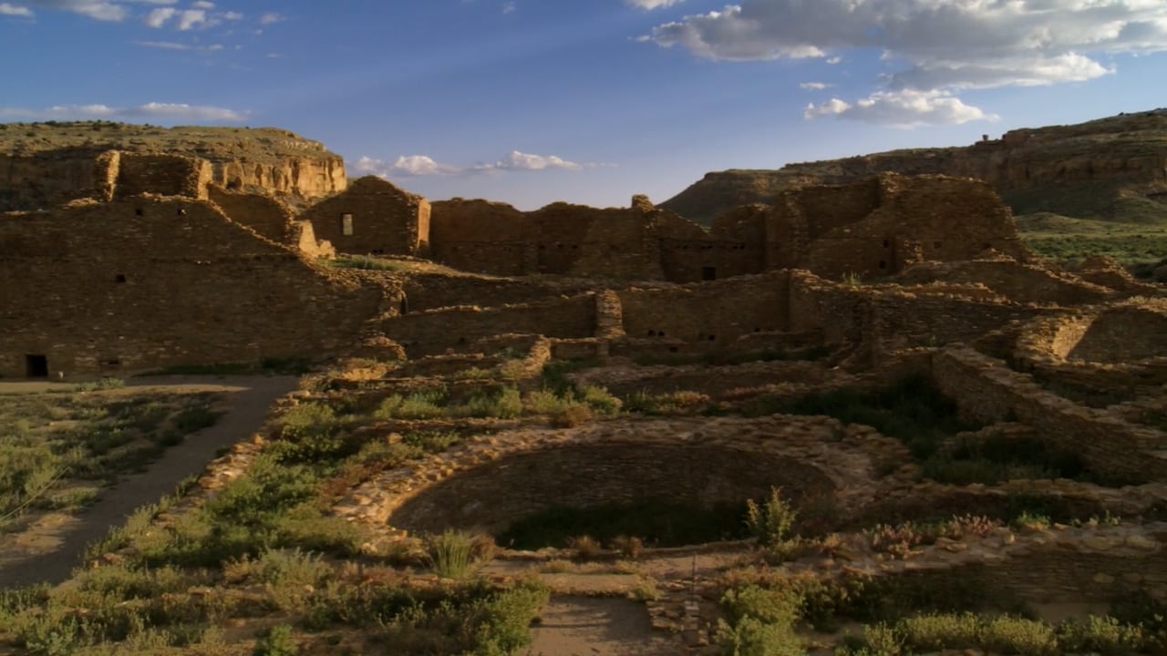
Pueblo Voices: Water
Historical perspectives of Pueblo Indians are shaped by their deep cultural heritage and kept alive through oral tradition. Archaeologists' understanding of Pueblo history derives primarily from the application of the scientific method. In a series of videos, Pueblo people and archaeologists discuss aspects of Pueblo history and culture from their different—but often complementary—perspectives.

History of Pueblo Agriculture
Water is the most important ingredient for successful agriculture in this arid climate. The Ancestral Pueblo people developed a number of farming techniques that conserve water. Pumice (a light, frothy rock that is full of gas) is a major component of the local volcanic tuff. Pumice can act as a sponge, absorbing water and releasing it slowly over time. It was used as mulch to preserve moisture in the soil.

Traditional Pueblo Foods
On December 9, 2016, the television program, New Mexico in Focus, aired a program about the traditional foods of pueblo communities in New Mexico. Correspondent Megan Kamerick sat down with chef Lois Ellen Frank and Roxanne Swentzell, co-editor of “The Pueblo Food Experience Cookbook” to discuss food traditions and why some Native Americans are returning to the diets of their ancestors.
However Wide the Sky: Power of Place
This documentary is about the history and spirituality of the Indigenous People of the American Southwest who are deeply rooted in the Land. Since the beginning of time, they have been stewards and protectors of their homelands, past and present. These places intimately connect the People and their beliefs to the natural world. No place is ever abandoned, the landscape is forever living. This is their story, of the Land and who they are.

Cochiti Dam
Cochiti Dam is one of the 10 largest earthen dams in the United States. It contains more than 65 million cubic feet of earth and rock, stretches more than five miles across, and rises about 250 feet above the Rio Grande.

Meaning and Traditions of Water
"A history of New Mexico vs. Aamodt and the meaning and traditions of water in New Mexico," by Michael Miller

Archival Photo circa 1935
"Indian Maiden", posed view at Santa Fe River, Santa Fe, New Mexico - Palace of the Governors Photo Archives, T. Harmon Parkhurst Collection - CONTENTdm Title (unm.edu)

The Pueblos' Last Stand
By John Collier, 1884 -1968

Pueblo of Tesuque
Tesuque River vicinity

Zuni Rainbow Dance
Kallestewa Dance Group dances on the Santa Fe Plaza Indigenous People's Day, 2021

La Cieneguilla
A historical marker along the road entering La Cieneguilla reads, “This community is one of the earliest Spanish and Grants in the United States. Originally, the site was a Keres Village, until surrounding land was granted to Francisco Anaya de Almazan by the Spanish government prior to 1680. The grant was resettled following the reconquest of New Mexico in 1693 and has been continuously occupied since then. Nearby is the Spanish period Capilla de San Antonio.”

Acequias—The Way of the Water
By Estevan Arellano

Acequia Madre
Acequia Madre is a communal irrigation ditch that currently supports agricultural practices. The Acequia Madre receives water from the Santa Fe River above the intersection of Alameda Street and the river near the Los Cerros Reservoir. The acequia runs in a westerly direction through the city for over 2 miles, first following Acequia Madre Street and then East Manhattan. Most of the acequia is stone-lined and ranges from 4' to 5' wide. The Acequia Madre is not used regularly, but it does carry water when the river is at a high level.

Acequia de la Muralla
Constructed over 400 years ago, the Acequia Madre, or Mother Ditch, transports precious water to Santa Fe from the Sangre de Cristo Mountains. The Spanish brought ditch technology and regulation procedures of Arabic origin to New Mexico from Spain, where they used acequias to irrigate similarly arid terrain. Shortly after settlers arrived in Santa Fe, they dug the Acequia Madre, and its companion the Acequia de la Muralla, on the northern wall of the old presidio along today’s Hillside Avenue, to supply water for domestic use and crop irrigation to residents. Both the Acequia Madre and the Acequia de la Muralla continue to run, though at a reduced rate. Homeowners along the acequias must understand that caring for their section of acequia affects the flow of water to neighboring properties and to the community. Historically, communities built acequias along with other communal structures such as churches, emphasizing the significance of shared experience and collaboration.

Acequia del Caño
A Community Ditch Association

New Mexico Acequia Commission
The New Mexico Acequia Commission was created in 1987 to advise the governor, the New Mexico Interstate Stream Commission, and the U.S. Army Corps of Engineers on what criteria should be used to determine priorities for rehabilitating acequias under a new federal funding program. The Acequia Commission was established by statute by the 1993 Legislature as an eleven-member commission serving four-year terms.

Generation Justice
KUNM Radio featured "Water is Life"

La Capilla de San Ysidro Labrador
La Capilla de San Ysidro Labrador is a small private chapel built in 1928 by Lorenzo López, using rocks gathered from his property and mud from the nearby acequia to construct the walls. Built on a rock outcropping above Cerro Gordo Road, it honors San Isidro Labrador, the eleventh-century patron saint of farmers. For nearly a century, it has played a role in the San Isidro feast day celebrated on May 15. The López Chapel reflects the tradition of small family shrines that appeared throughout New Mexico during Spanish colonization and beyond and is a unique handcrafted folk-art construction.

Acequia Communities Adjust Centuries-Old Water Traditions Under COVID-19
May 29, 2020 – With social distancing orders in place to slow the spread of the novel coronavirus in New Mexico, acequia communities modified springtime traditions—like convening to clean acequias and blessing the waters passing onto fields, gardens, and orchards—that have endured for centuries. In mid-May, instead of gathering for blessings, tossing flower petals into the waters, and singing alabanzas, people had to watch online those ceremonies to honor San Isidro, the patron saint of farmers and workers. (New Mexicans will also see his name spelled San Ysidro) “On May fifteenth, it’s customary and traditional to ask for a blessing from San Isidro, to bless our crops and our acequias, our fields, in hope of a good harvest,” says Paula Garcia, executive director of the New Mexico Acequia Association. “The story of San Isidro goes that he was such a faithful servant of God, and he would attend mass even if he had a lot of work to do on his garden.” That saint is a role model for the faithful, she says.

"Roadrunner, the Chosen Prophet"
In 2019, New Mexico poet, farmer and water-rights activist Olivia Romo joined the 35th National Cowboy Poetry Gathering in Elko where she shared a tale of a magical journey in the desert with "Roadrunner, the Chosen Prophet." Romo was the New Mexico State Slam Poetry Champion in 2011 and was featured in "Work Songs of the Cowboy Poets" article in The New York Times, a piece written about the Gathering.

Blessed Holy Water as a Sacramental
Published May 6, 2021

The Water Drum
Navajo Technical College New Media student Clinton Desiderio produced, "The Water Drum," for the 2012 American Indian Higher Education Consortium film festival. It received second place in the judging category but took home the People's Choice Award.

Holy Water
Joe Tohonnie Jr. Apache songs, album "Medicine Road," released on November 23, 2017

Santa Fe Land Grant
By J. J. Bowden

Barrio de Analco
The oldest house in Santa Fe is located on East De Vargas Street. Tree rings from the vigas in the ceilings suggest that they were cut sometime between 1646-1767, however the exact age of the building remains unknown. Legend says that the Tlaxacalan Indians traveling with Don Juan Oñate built the oldest house and San Miguel church next door, by 1610.

History of Adobe Brick Making in New Mexico
Adobe is an ancient and labor-intensive building material, but it has become more popular in recent years in New Mexico because it’s an environmentally friendly way to construct a home or commercial building, according to the Earthbuilders’ Guild, an organization that promotes and aims to preserve earthen construction.

Donaciano Vigil House
In 1832 this house with its farmlands and orchard was the residence of minor city official Juan Cristóbal Vigil, his wife María Antonia Andrea Martínez, and his large family, among whom was a soldier son, Donaciano. It then apparently included the buildings on either side of the front portion, as Juan Cristóbal in his will dated May 31 of that year and María Antonia in her testament of May 26, 1834, described it as "composed of four parts." After the death of his mother, Donaciano bought out the other heirs and added still another section, probably on the south. Today, the buildings facing Alto Street have different owners, but the main part of the house, with its charming inner placita, is the private residence of the person responsible for its restoration" The doors and windows used in the restoration came from the original Loretto Academy in Santa Fe and are Territorial in style.

Bishop Lamy's Garden
The garden was walled with adobes by his first French architects, who had crafted its main entrance out of native granite. There was a sparkling fountain, and a sundial stood on a pedestal of polished Santa Fe marble. Aisles of trees, plants, and arbors led to it from all quarters of the enclosure. Formal walks reached from one end of the garden to the other, with little bypaths turning aside among the flower beds and leading to benches cunningly placed in the shade . . .At the south end of the garden on its highest ground was a spring which fed a pond covering half an acre. From the pond flowed little graded waterways to all parts of the garden. In the pond were two small islands on one of which stood a miniature chalet with a thatched roof. Little bridges led to the islands. Flowers edged the shores, and water lilies floated on the still surface, and trout lived in the pond and came to take crumbs which the archbishop threw to them. Now and then he would send a mess of trout over to St Michael's College to be cooked for the scholars. . . .Sweeping the long shady vista and its bright colors of fruit and flower with a gesture, he would say that the purpose of it all was to demonstrate what could be done to bring the graces and comforts of the earth to a land largely barren, rocky, and dry. -- Paul Horgan, Lamy of Santa Fe

Ciderpress on the Santa Fe River
In 1895 William L. Jones divided the property [of the CiderPress] and sold the west portion to Bertha L. Cartwright. Documents pertaining to the house in general are filed with the East Portion. The Roque Tudesqui house is in the best preserved and oldest section of the Barrio de Analco. The barrio dates from the early 17th century. The Tudesqui building was a substantial five-room house by 1850.

Historic Santa Fe Foundation
Offices & garden at El Zaguán Historic Santa Fe Foundation's mission is to preserve, protect, and promote the historic properties and diverse cultural heritage of the Santa Fe area, and to educate the public about Santa Fe's history and the importance of preservation.

History of Chocolate in New Mexico
Chocolate in New Mexico: A Brief History By Nicolasa Chávez

Leonora Curtin Wetland Preserve
The Leonora Curtin Wetland Preserve is a 35-acre nature preserve located in La Cienega, south of Santa Fe. This rare natural cienega, or marsh, hosts a bountiful diversity of plants and wildlife. Along with the riparian/wetland zone of the cienega, the preserve also contains transitional and dry uplands plant zones.

A Hydrogeologic Investigation of Groundwater-Fed Springs and Wetlands at La Cienega, Santa Fe County, New Mexico
By: Peggy S. Johnson, Daniel J. Koning, and Stacy S. Timmons

Archival Photo 1925
Group in wagon crossing river, New Mexico - Palace of the Governors Photo Archives, T. Harmon Parkhurst Collection - CONTENTdm Title (unm.edu)

Border Land, Border Water: A Conversation with C. J. Alvarez
By: Sarah Soliz, December 20, 2019

Yootó
The Diné referred to the Santa Fe River as “Yootó” meaning “a string of water beads,” which describes shallow pools of standing water along the river’s course.

Snail Girl Brings Water
By Geri Keams and illustrated by Richard Ziehler-Martin

Archival Photo 1979
Crew works to clear Santa Fe River, Santa Fe, New Mexico - Palace of the Governors Photo Archives Collection - CONTENTdm Title (unm.edu)

La Llorona
Hispano-American folklore

Archival Photo 1985
Children playing in the Santa Fe River, Santa Fe, New Mexico - Palace of the Governors Photo Archives Collection - CONTENTdm Title (unm.edu)

Santa Fe River
The Santa Fe River is 46 miles long with its headwaters in the Sangre de Cristo mountain range. Historically, its flows were perennial and are now classified as intermittent, with two perennial reaches with cold water temperatures that does not harbor much aquatic life. The Santa Fe River watershed is approximately 285 square miles and all the surface water within the area flows to, and is a part of, the river system.

Communities along the Santa Fe River
Hilario Romero, Historian

Baca Street Well Contamination
The Acequia Madre flows on the west side of a walking and biking trail shaded by old-growth Elm trees, with many trail connections to streets within the Sierra Vista Street neighborhood. Hikers and cyclists utilizing the Acequia Trail Easement that connects the Baca area to the North Railyard pass by a fenced area dotted with yellow piping of nearly three dozen monitoring wells, unaware of the contamination beneath. At 60 feet below the surface of the property, a petroleum plume floats above the water table. It's one of five known chemical plumes that contaminate groundwater within the city limits, caused by landfills, leaky gas tanks and dry-cleaning chemical spills before state groundwater regulations were established in the 1980s.

Santa Fe River flash mob event
The Santa Fe EARTH event, put on by 350.org and the Santa Fe Art Institute, which showed how the Santa Fe River could look if there was water running through it. With global warming decreasing snow melt and raising temperatures, Santa Fe's water supplies will need to be managed sustainably.

Santa Fe River Community Cleanup Days!
Join the Santa Fe Watershed Association for River Community Cleanup Days! Bring your friends and family out to your favorite spot along the River or an arroyo and spend some time cleaning it up. Meet fellow watershed lovers, and help make our community a little happier, healthier, and more beautiful.

San Juan-Chama Return Flow Project
Santa Fe will also receive $6 million from the federal government to move forward on planning and construction through a grant from the Water Reclamation and Reuse Program. With the county’s $2 million, that leaves a gap of as much as $22 million.

Sources and controls of arsenic in the Santa Fe embayment, Santa Fe County
By: Karen Torres

Are there environmental costs to producing artificial snow?
Chemical concerns Naturally, there are concerns over the chemical impact of the ingredients in snowmaking products on the environment. In the case of one particular product called Snomax, which contains proteins from a bacteria, certain fungicidal proteins in the bacteria reportedly retain their activity. The potential effects on the environment and on human health of distributing these proteins through artificial snow are not yet well understood. But scientists appear to be more concerned about how artificial snow might affect the natural water cycle in the regions where it is produced.

Amigos Bravos
New Mexico is full of iconic rivers but under a new federal rule, rivers, streams, lakes, and wetlands are at risk like never before.

Toxins that remain unregulated
In August 2017, the Environmental Working Group, a Washington, D.C.-based nonprofit, found millions of Americans are drinking water that might be unsafe for consumption. The group compiled data from each state and the Environmental Protection Agency to assess more than 250 contaminants in 50,000 public drinking-water systems across the nation. The nonprofit analyzed the data, largely using health guidelines set by the state of California — a more rigorous measure than standards set by the EPA, which regulates just over 90 contaminants.

Microbial contamination
UNM student master's thesis, 2018

Concerned Citizens for Nuclear Safety
In May 2022, the New Mexico Water Quality Control Commission met to deliberate and make final decisions about the state’s Surface Water Quality Standards. In a Clean Water Act administrative process that occurs approximately every three years called the Triennial Review, conservation groups, including Amigos Bravos, Communities for Clean Water (CCW) and Gila Resources Information Project (GRIP), made proposals to the Commission to strengthen water quality standards and include important definitions that address the impacts of climate change on New Mexico’s waters. As temperatures increase across the Southwest the need to further protect New Mexico’s waters is paramount.

Stormwater in the Santa Fe Watershed
The City of Santa Fe is not only a treasured community of rich culture, history and natural beauty, it is also a watershed which provides the City with drinking water, open space, and community cohesion.

Rain Gardens
Photo: Mori Hensley Rain gardens on East Alameda are designed to slow stormwater and allow it to infiltrate into the soil, purifying and replenishing water supplies.

Santa Fe Water Conservation
Join the growing number of Santa Fe restaurants that are dedicated to reducing their water footprint by becoming a Certified Waterwise by the City of Santa Fe.

KOB 4 News Investigates: The future of water
El agua es vida. Water is life. Broadcast: August 7, 2019

YUCCA Earth Care youth
Youth perspectives on climate change and water issues
Agua Fría Village
Located five miles southwest of the Santa Fe Plaza, the area's human occupation dates back 10,000 years; farmed by Native Americans in the region until a drought in 1250 A.D., then again between 1300 until 1400 when the settlement was finally abandoned.
The Village of Agua Fria-Quemado When the Spanish first arrived, Khaʼpʼoe Ówîngeh, also known as the Pueblo of Santa Clara, referred to the area by a Tewa name, P’o’Karige, meaning “cold water place”. The cold springs along Agua Fria served as a central hub for area settlement. Tewa and Tano Indians named the village Ca-Tee-Ka meaning "cold water," which is likely a reference to the cold temperatures of high elevation mountain springs such as the Santa Fe River which flowed through the area via acequias and converged with the Rio Grande.
Later Spanish colonists named the village, “Agua Fria,” which means “cold water”. In 1693, a land grant was given to Captain (Maestro del Campo) Roque Madrid, for his service in the “Reconquest” of New Mexico in 1692, led by General Diego de Vargas. The boundaries of Madrid’s land grant extends from Ojito Fresco to Pueblo Quemado. For two generations, Captain Madrid’s family farmed the area since 1640. Other soldiers were also given land grants to farm the Agua Fría area...
Pueblo Voices: Water
Historical perspectives of Pueblo Indians are shaped by their deep cultural heritage and kept alive through oral tradition. Archaeologists' understanding of Pueblo history derives primarily from the application of the scientific method. In a series of videos, Pueblo people and archaeologists discuss aspects of Pueblo history and culture from their different—but often complementary—perspectives.
Published by Crow Canyon Archaeological Center on January 22, 2015
History of Pueblo Agriculture
Water is the most important ingredient for successful agriculture in this arid climate. The Ancestral Pueblo people developed a number of farming techniques that conserve water. Pumice (a light, frothy rock that is full of gas) is a major component of the local volcanic tuff. Pumice can act as a sponge, absorbing water and releasing it slowly over time. It was used as mulch to preserve moisture in the soil.
Other water-preserving practices included terracing, check dams that slowed water moving across slopes, and waffle or grid gardens. Waffle gardens are constructed by forming small depressions surrounded by a low earthen wall. Seeds are planted within the cavity. The selection of plants was also a good one. Corn is sun-tolerant and grows tall. Beans and squash are less tolerant but grown shorter and can be shaded by the corn plants which also provide support for growing.
Corn, beans, and squash were the most important crops. The Ancestral Pueblo people depended on agriculture to sustain them in their more sedentary lifestyle. Corn, beans, and squash were the most important crop items.
The Railyard Park is Santa Fe's largest cultivated and landscaped park in Santa Fe. The park's gardens are designed to conserve water and are maintained by local Santa Fe volunteers. Explore the Railyard Park and find an orchard, the historic Acequia Madre, a Native Bee House, a Heritage Waffle Garden, a temporary public art piece, or, if you look hard enough, you might even find the park's time capsule. During the warm season, the park hosts FREE family-friendly programs and events!
Visit www.railyardpark.org for current schedules.
Traditional Pueblo Foods
On December 9, 2016, the television program, New Mexico in Focus, aired a program about the traditional foods of pueblo communities in New Mexico. Correspondent Megan Kamerick sat down with chef Lois Ellen Frank and Roxanne Swentzell, co-editor of “The Pueblo Food Experience Cookbook” to discuss food traditions and why some Native Americans are returning to the diets of their ancestors.
Click this link to learn more: Home | floweringtree (floweringtreepermaculture.org)
However Wide the Sky: Power of Place
This documentary is about the history and spirituality of the Indigenous People of the American Southwest who are deeply rooted in the Land. Since the beginning of time, they have been stewards and protectors of their homelands, past and present. These places intimately connect the People and their beliefs to the natural world. No place is ever abandoned, the landscape is forever living. This is their story, of the Land and who they are.
"Sacred places are the truest definitions of the earth; they stand for the earth immediately and forever…If you would know the earth for what it really is, learn it through its sacred places." —Scott Momaday, Kiowa
Cochiti Dam
Cochiti Dam is one of the 10 largest earthen dams in the United States. It contains more than 65 million cubic feet of earth and rock, stretches more than five miles across, and rises about 250 feet above the Rio Grande.
Congress authorized construction of the dam as part of the Flood Control Act of 1960, and over opposition from many tribal members, the U.S. Army Corps of Engineers built Cochiti Reservoir between 1965 and 1975. The lake inundated sacred lands as well as fields the tribe had tended for centuries.
“As issues of resistance were met with the threat of condemnation, the elders conceded to the construction of Cochiti Lake but pleaded that if it was going to happen that a single request be adhered to. The one request was that, if no other areas could be protected, the only place that we wanted protected was an area very important to many pueblo people, one of the most revered places of worship.” —Regis Pecos
Meaning and Traditions of Water
"A history of New Mexico vs. Aamodt and the meaning and traditions of water in New Mexico," by Michael Miller
The issue is water. In New Mexico and throughout the West, it is precious, often scarce, and rapidly becoming the key to economic and financial success for many communities.
To many Nuevo Mexicanos, water is much more. It is the center of a unique way of life founded on centuries of tradition, dependence on sustainable agriculture, with a physical and spiritual attachment to the land. For hundreds of residents of the Pojoaque Valley, north of Santa Fe, water represents a landmark court case, a seemingly endless legal battle, and possibly a long-awaited settlement that has lasted over 43 years...
To read the full historical essay, click this link: Meaning and Traditions of Water – New Mexico History
The Pueblos' Last Stand
By John Collier, 1884 -1968
Between 1776 and 1887, the United States appropriated over 1.5 billion acres of land from Native peoples. In 1921 New Mexico senator Holm Bursum introduced a bill into Congress that would have allowed non-Native people to claim further Pueblo Indian lands if they could prove ten years of residency. The Indigenous governors of the nineteen pueblos worked with John Collier, Indian rights advocate and FDR’s commissioner of Indian affairs, to send representatives to Congress who would voice their opposition to this legislation.
In Santa Fe, women including Elizabeth and Martha White, the sisters who bequeathed their estate to SAR in 1972, also fought against the Bursum Bill. In the process, they aimed “to improve access to political and legal power and to promote economic self-sufficiency as well as respect and tolerance for Indian cultural difference,” writes Molly Mullin in Culture in the Marketplace. The movement by the White sisters and others in their social circle did “Santa Fe a great service by advertising the unique historic, science and ethnological attractions of this region,” opined in the Santa Fe NewMexican newspaper on April 30, 1923. Mullin adds, “They legitimated their ambition [and deep interest in anthropology and Pueblo art] by associating it with benevolence and collective progress.” And together with the Pueblo governors, they defeated the Bursum Bill in 1923.
To read the six-page article in Sunset Magazine, February 1923 issue, criticizing the Bursum Bill and the United States governments' policies concerning the Pueblo Indians' land and water rights, and the eradication of Pueblo Indian culture, click this link: Pueblos' Last Stand - Western Waters Digital Library
Pueblo of Tesuque
Tesuque River vicinity
Historic American Buildings Survey, C., Borchers, P. E., Burns, J. A., Grulke, B., Lamsam, J. J., Lawrence, J. C. & Alderson, C. R., New Mexico State Highway Department & Borchers, P. E., photographer (1933).
Pueblo of Tesuque, Central Portion, Tesuque River vicinity, Tesuque, Santa Fe County, NM [Aerial Photograph].
Retrieved from the Library of Congress: https://www.loc.gov/item/nm0100/
Zuni Rainbow Dance
Kallestewa Dance Group dances on the Santa Fe Plaza Indigenous People's Day, 2021
La Cieneguilla
A historical marker along the road entering La Cieneguilla reads, “This community is one of the earliest Spanish and Grants in the United States. Originally, the site was a Keres Village, until surrounding land was granted to Francisco Anaya de Almazan by the Spanish government prior to 1680. The grant was resettled following the reconquest of New Mexico in 1693 and has been continuously occupied since then. Nearby is the Spanish period Capilla de San Antonio.”
Human occupation of the La Cienega area dates back thousands of years, until it was abandoned by the Keres Indians in the early 1600s. The “Sanchez site,” located within the area, is a group of Spanish settlements inhabited the area in 1630, until the Pueblo Revolt of 1680. Francisco Anaya de Almazan was the original Spanish land grantee of a tract of land in La Cienega.
In 1693, Don Diego de Vargas estimated the Almazan land grant to be over three thousand acres. Population growth in the area did not occur until Almazan sold the grant in 1743. The area had been a frequent stopping point on the Camino Real de Tierra Adentro. In 1795, twenty-five families were provided with land along the Rio Grande at Cieneguilla. During the 19th century the area was used for farming and ranching, then affordable housing became available within the city of Santa Fe and those that commuted for employment relocated...
“One of the best preserved acequia systems in New Mexico. An irrigation feature dating to Spanish colonial settlement in the seventeenth century, acequias were constructed to divert water for use in irrigating agricultural fields and pastures. Acequias shaped the surrounding landscape, contributing not only to the physical layout of the villages but to community life and regional identity. La Cienega Acequia remains in operation along relatively unchanged alignments and contains several traditional water control devices such as dams, checks, and flumes. It remains essential to the local agricultural economy and landscape.” —Library of Congress
To read the full historical essay, click this link: Pueblo-La-Cieneguilla.pdf (santafelibrary.org)
Acequias—The Way of the Water
By Estevan Arellano
In terms of water, Ibn Bassal, writing in 1075, identified four sources of water: 1) water from rivers that is then channeled into a network of acequias, 2) water from norias, anora in Arabic, or wells, 3) spring water and 4) rainfall. And the “water way” described by Ibn Luyun in his 1348 book is nothing more than an acequia, which is Arabic word for “water canal,” and there is nothing more coveted in a property than to have the acequia run close to the house.
It has a soothing effect and it provides for a very tranquil sleep. Here in northern New Mexico such a “water way” is also used to delineate property boundaries, and such acequias are known as linderos or cequiecitas menores, (to differentiate from the acequia madres or mother ditch). From them run the brazos, and from them the ramos, and eventually all the water comes together at the desagüe (outlet) in order to move the water to the next parciante (water rights owner) or to the river.
The acequia system resembles the human body and how the blood moves through the veins, arteries and capillaries. A desagüe is also an emergency outlet at the onset of the acequia, near the presa, used to clean the acequia of unwanted silt or to let the water into the river when the arroyos run or during the spring runoff; or if there is a break in the acequia and the water needs to be diverted back to the river...
To read the full historical essay, click this link: Acequias-The Way of the Water – New Mexico History
Acequia Madre
Acequia Madre is a communal irrigation ditch that currently supports agricultural practices. The Acequia Madre receives water from the Santa Fe River above the intersection of Alameda Street and the river near the Los Cerros Reservoir. The acequia runs in a westerly direction through the city for over 2 miles, first following Acequia Madre Street and then East Manhattan. Most of the acequia is stone-lined and ranges from 4' to 5' wide. The Acequia Madre is not used regularly, but it does carry water when the river is at a high level.
New Mexico’s history of communal irrigation and flood-control agricultural practices dates back to ancestral Pueblo people of the Four Corners region circa 800 A.D. By the time that Spanish explorers arrived in the 1540’s, both the Pueblo and Navajo people had developed irrigation practices. Historical records show that Acequia Madre was in use at the time of the Pueblo Revolt in 1680 and was likely created during Spanish occupation of Santa Fe, as early as 1610.
Spain, like New Mexico, has an arid climate and a long history of centralized, community-based irrigation practices. Water laws written by the Spanish recognized the primacy of communal rights to water resources, and the need to supply surrounding Pueblo communities with water for irrigation purposes as part of their allocation system.
Early settler communities were built adjacent to rivers with irrigation ditches in place often before houses were built. Homes were clustered together in small town settlements that were surrounded by cultivated fields and pasture land. The survival of these early settlements depended on the careful allocation of water resources by way of a system that operated with mandatory community responsibility for the maintenance of canals and ditches. This community-based network of irrigation ditches, or acequias, remained part of the culture of New Mexico until the arrival of the U.S. government in 1848...
To read the full historical essay click this link: Acequia-Madre.pdf (santafelibrary.org)
A Sangria is a lateral ditch of the Acequia Madre. This one waters the field belonging to Leandro (Lalo) Quintana: Photo 1995 El Cerrito y la Acequia Madre - New Mexico Waters - CONTENTdm Title (unm.edu)
Acequia de la Muralla
Constructed over 400 years ago, the Acequia Madre, or Mother Ditch, transports precious water to Santa Fe from the Sangre de Cristo Mountains. The Spanish brought ditch technology and regulation procedures of Arabic origin to New Mexico from Spain, where they used acequias to irrigate similarly arid terrain. Shortly after settlers arrived in Santa Fe, they dug the Acequia Madre, and its companion the Acequia de la Muralla, on the northern wall of the old presidio along today’s Hillside Avenue, to supply water for domestic use and crop irrigation to residents. Both the Acequia Madre and the Acequia de la Muralla continue to run, though at a reduced rate. Homeowners along the acequias must understand that caring for their section of acequia affects the flow of water to neighboring properties and to the community. Historically, communities built acequias along with other communal structures such as churches, emphasizing the significance of shared experience and collaboration.
Source: Old Santa Fe Today, 5th edition by Audra Bellmore
Click this link for more information: Acequia de la Muralla — Historic Santa Fe Foundation
Acequia del Caño
A Community Ditch Association
Acequia del Caño is located in Santa Fe County and diverts northerly from the Rio Pojoaque in Nambe.
New Mexico Acequia Commission
The New Mexico Acequia Commission was created in 1987 to advise the governor, the New Mexico Interstate Stream Commission, and the U.S. Army Corps of Engineers on what criteria should be used to determine priorities for rehabilitating acequias under a new federal funding program. The Acequia Commission was established by statute by the 1993 Legislature as an eleven-member commission serving four-year terms.
The Acequia Commission was also charged with the duties of serving as a facilitator for communication between local acequia organizations and the state and federal governments, and for reviewing plans or legislation that affect acequias and presenting their findings to the governor and the New Mexico Interstate Stream Commission.
Generation Justice
KUNM Radio featured "Water is Life"
The Southwest experienced one of the worst droughts in its history. In fact, California recently implemented water restrictions for its residents. What can New Mexico do to avoid this? And how can we ensure that our unique systems and relationships to water thrive and flourish? We discuss the drought, conservation, and the future of water in New Mexico.
New Mexico Acequia Commission, Chairman Ralph Vigil, along with representatives from Western Governors Association, Secretary Tom Blaine (State Engineer), Secretary Ryan Flynn (Environment Department) and Nuestro Rio Regional Water Caucus member Michelle Martinez (Council woman City of Espanola) were featured on the radio show.
Hosts: Edgar Cruz & Maya Quinones Producer: Christina Rodriguez Engineer: Kamaria Umi
La Capilla de San Ysidro Labrador
La Capilla de San Ysidro Labrador is a small private chapel built in 1928 by Lorenzo López, using rocks gathered from his property and mud from the nearby acequia to construct the walls. Built on a rock outcropping above Cerro Gordo Road, it honors San Isidro Labrador, the eleventh-century patron saint of farmers. For nearly a century, it has played a role in the San Isidro feast day celebrated on May 15. The López Chapel reflects the tradition of small family shrines that appeared throughout New Mexico during Spanish colonization and beyond and is a unique handcrafted folk-art construction.
To listen to an audio recording from 1956 of the song, "San Ysidro Labrador," performed by Julian Zamra in Tome, NM, click this link: San Ysidro Labrador - UNM CSWR John Donald Robb Field Recordings - CONTENTdm Title
Acequia Communities Adjust Centuries-Old Water Traditions Under COVID-19
May 29, 2020 – With social distancing orders in place to slow the spread of the novel coronavirus in New Mexico, acequia communities modified springtime traditions—like convening to clean acequias and blessing the waters passing onto fields, gardens, and orchards—that have endured for centuries. In mid-May, instead of gathering for blessings, tossing flower petals into the waters, and singing alabanzas, people had to watch online those ceremonies to honor San Isidro, the patron saint of farmers and workers. (New Mexicans will also see his name spelled San Ysidro) “On May fifteenth, it’s customary and traditional to ask for a blessing from San Isidro, to bless our crops and our acequias, our fields, in hope of a good harvest,” says Paula Garcia, executive director of the New Mexico Acequia Association. “The story of San Isidro goes that he was such a faithful servant of God, and he would attend mass even if he had a lot of work to do on his garden.” That saint is a role model for the faithful, she says.
"Roadrunner, the Chosen Prophet"
In 2019, New Mexico poet, farmer and water-rights activist Olivia Romo joined the 35th National Cowboy Poetry Gathering in Elko where she shared a tale of a magical journey in the desert with "Roadrunner, the Chosen Prophet." Romo was the New Mexico State Slam Poetry Champion in 2011 and was featured in "Work Songs of the Cowboy Poets" article in The New York Times, a piece written about the Gathering.
Watch a Moving Rural Verse Poem-Film by Olivia Romo: " Bendición del agua" — Western Folklife Center
Blessed Holy Water as a Sacramental
Published May 6, 2021
A member of the clergy explains the religious pratice of Holy water as a blessed sacrament by the Catholic Church.
The Water Drum
Navajo Technical College New Media student Clinton Desiderio produced, "The Water Drum," for the 2012 American Indian Higher Education Consortium film festival. It received second place in the judging category but took home the People's Choice Award.
Holy Water
Joe Tohonnie Jr. Apache songs, album "Medicine Road," released on November 23, 2017
Santa Fe Land Grant
By J. J. Bowden
Following the conquest of New Mexico in the summer of 1598, Governor Juan de Oñate established his headquarters at the Pueblo of San Gabriel, which the Tewa Indians voluntarily gave to the Conquistadors. San Gabriel was located on the west bank of the Rio Grande not far from junction with the Chama River. However. Oñate was not satisfied and was continuously looking for a more suitable location for his capitol. During his reconnaissance expedition into the Arkansas River Valley in the Spring of 1605, Oñate was compelled to cross the Santa Fe River at a point near the present city of Santa Fe. The locale greatly impressed Oñate.
Its adequate water supply, fertile soil abundance of timber, mild climatic conditions and strategic position for dealing with both the hostile mountain and plains Indians prompted Oñate to select it as the site for the permanent capitol of New Mexico. Since Oñate's expedition was not financially successful, there was some question as to whether or not the colony would be abandoned and permission to move it to the new site was not granted by the Spanish officials until some time after the arrival of Governor Pedro de Peralta in 1609...
To read the full historical essay, click this link : Santa Fe Grant – New Mexico History
Barrio de Analco
The oldest house in Santa Fe is located on East De Vargas Street. Tree rings from the vigas in the ceilings suggest that they were cut sometime between 1646-1767, however the exact age of the building remains unknown. Legend says that the Tlaxacalan Indians traveling with Don Juan Oñate built the oldest house and San Miguel church next door, by 1610.
A metal plaque from the Historic Santa Fe Foundation, embedded into the wall at the corner of East DeVargas Street and Old Santa Fe Trial, marks the Barrio de Analco district that was established in the 1600s. The name’s origins are thought to come from Mexico, where there are “barrios de analco” in the cities of Puebla, Durango, and Jalisco, Mexico. The Nahuatl word “analco” means “the other side of the water”.
In Santa Fe, the north side of the Santa Fe River housed the Spanish colonists and royal officials, and the south side was occupied by servants, soldiers, laborers and teachers; many Tlaxcalan Indian descendants from Mexico that came with the Franciscan missionaries and Spaniards...
To read the full historical essay, click this link: San-Miguel-Chapel_Barrio-of-Analco.pdf (santafelibrary.org)
History of Adobe Brick Making in New Mexico
Adobe is an ancient and labor-intensive building material, but it has become more popular in recent years in New Mexico because it’s an environmentally friendly way to construct a home or commercial building, according to the Earthbuilders’ Guild, an organization that promotes and aims to preserve earthen construction.
Jake Barrow, a program director for Cornerstones Community Partnerships, a historical conservation nonprofit that also works to keep the tradition alive, said adobe has been used as a building material around the world for over 1,000 years.
The use of adobe in the Southwest dates to the 17th century, when it was introduced by the Spanish, he said. The bricks are stacked into walls for a home or church and then slathered with more adobe to create a smooth mud-plaster finish.
“In New Mexico, before the 20th century, most of the villages were all built out of adobe,” Barrow said.
Cornerstones invited its volunteers, members of the Earthbuilders’ Guild and community people to gather Saturday at the San Miguel Chapel in downtown Santa Fe, one of the nation’s oldest churches, to learn the craft and help recreate history by building bricks together. Making adobe brick traditionally has been a community-wide ordeal.
“In the old days, in May, people would get together and make bricks, much like we are today,” Barrow said.
Donaciano Vigil House
In 1832 this house with its farmlands and orchard was the residence of minor city official Juan Cristóbal Vigil, his wife María Antonia Andrea Martínez, and his large family, among whom was a soldier son, Donaciano. It then apparently included the buildings on either side of the front portion, as Juan Cristóbal in his will dated May 31 of that year and María Antonia in her testament of May 26, 1834, described it as "composed of four parts." After the death of his mother, Donaciano bought out the other heirs and added still another section, probably on the south. Today, the buildings facing Alto Street have different owners, but the main part of the house, with its charming inner placita, is the private residence of the person responsible for its restoration" The doors and windows used in the restoration came from the original Loretto Academy in Santa Fe and are Territorial in style.
The house is of special historic value, in addition to its charm and antiquity, as the former residence of Donaciano Vigil, one of the most important military and political figures of his day. While Santa Fe was under Mexican rule, 1821 to 1846, he served first in the presidial company of Santa Fe and then commanded the company of San Miguel del Vado. He was also military secretary to Governor Manuel Armijo. After US occupation in 1846, General Kearny appointed him secretary of the territory, and in January 1847 he became acting civil governor of New Mexico following the assassination of Governor Charles Bent. From 1848 to 1850 he continued as secretary of the territory and register of land titles.
In 1851 Donaciano led the opposition to the secular use of La Castrense by the U.S. Government. As a member of the Santa Fe grand jury, he refused to take his place in the courtroom of the U.S. court of the first judicial district that had been located by Judge Grafton Baker within the church. His stand against violation of a consecrated structure where his own father was buried resulted in the removal of the court to the Palace of the Governors. Some reports of the incident state that Judge Baker threatened to arrest Vigil but changed his mind when the townspeople and army personnel rallied to Vigil's support.
When this house served as the home of Donaciano Vigil and his wife, Doña Refugia Sánchez, its lands extended along the Rio de Santa Fe and still contained the orchard mentioned in his parents' wills. At that time, it was the scene of much civil and political activity, but in 1855 the Vigils retired to their ranch on the Pecos River, and in 1856 sold the property to Vicente García. They are buried in Rosario Cemetary. In May 1969 the house was placed on the State Register of Cultural Properties and subsequently on the National Register of Historic Places.
Bishop Lamy's Garden
The garden was walled with adobes by his first French architects, who had crafted its main entrance out of native granite. There was a sparkling fountain, and a sundial stood on a pedestal of polished Santa Fe marble. Aisles of trees, plants, and arbors led to it from all quarters of the enclosure. Formal walks reached from one end of the garden to the other, with little bypaths turning aside among the flower beds and leading to benches cunningly placed in the shade . . .At the south end of the garden on its highest ground was a spring which fed a pond covering half an acre. From the pond flowed little graded waterways to all parts of the garden. In the pond were two small islands on one of which stood a miniature chalet with a thatched roof. Little bridges led to the islands. Flowers edged the shores, and water lilies floated on the still surface, and trout lived in the pond and came to take crumbs which the archbishop threw to them. Now and then he would send a mess of trout over to St Michael's College to be cooked for the scholars. . . .Sweeping the long shady vista and its bright colors of fruit and flower with a gesture, he would say that the purpose of it all was to demonstrate what could be done to bring the graces and comforts of the earth to a land largely barren, rocky, and dry. -- Paul Horgan, Lamy of Santa Fe
Source: The Santa Fe Review by George Johnson
Ciderpress on the Santa Fe River
In 1895 William L. Jones divided the property [of the CiderPress] and sold the west portion to Bertha L. Cartwright. Documents pertaining to the house in general are filed with the East Portion. The Roque Tudesqui house is in the best preserved and oldest section of the Barrio de Analco. The barrio dates from the early 17th century. The Tudesqui building was a substantial five-room house by 1850.
The historic plaque on the building read: “The CiderPress was an antique store for many years, but it is now a private residence. The brick section was built by the Cartwright Family and was the first garage built in Santa Fe. The adobe section was built in the early 1940’s by Juanito Lujan, a Taos Indian, for his own use. He was the gardener and good friend of Jimmy Caldwell, whose family still owns it. The property, which extends to East DeVargas Street, was purchased by Mr. Caldwell in 1939, and is known as the Western portion of the Roque Tudesqui House."
Historic Santa Fe Foundation
Offices & garden at El Zaguán Historic Santa Fe Foundation's mission is to preserve, protect, and promote the historic properties and diverse cultural heritage of the Santa Fe area, and to educate the public about Santa Fe's history and the importance of preservation.
In the mid-1850s, the era when James L. Johnson owned El Zaguán orchards and fields extended from the Santa Fe River all along the acequia madre. There are still several old fruit trees on the property, some of which date back to the Johnson Era. The foundation feels that it's important to make use of the fruit, in the interest of preserving tradition and in support of the restoration of Santa Fe's once fertile agricultural belt.
History of Chocolate in New Mexico
Chocolate in New Mexico: A Brief History By Nicolasa Chávez
When thinking of New Mexican cuisine, one often recalls delectable images of chile, tortillas, tamales, and enchiladas, but one often does not reference chocolate… even though historically it had been a staple in the New Mexican diet during the Spanish colonial and Mexican periods. The name itself, chocolate, is directly descended from the Spanish spelling and pronunciation of earlier pre-Colombian terminologies, most notably the Aztec “Xocolatl.”. When referencing the chocolate of this time period it is not the contemporary candy bars or truffles we think of today but is instead a thick frothy drink.
The Mayan “chacau haa” or “chocol haa” and the Aztec “cacahuatl” referred to the drink made from the cacao bean. The beans, harvested from pods that grow on the trunk of a tree, were dried and ground into a paste and shaped into bars or wedges for long-term storage and travel. During the colonial period, the beverage most resembled a hot melted chocolate mousse, so thick that one might have needed a spoon. A blend of Old and New World spices and additives such as red chile, cinnamon, almonds, honey or sugar, and sometimes rosewater or orange blossom flavored this delicious concoction. New Mexican drinking chocolate thus represented hundreds of years of cultural mixing and hybridization that took place throughout the colonial Americas...
To read the full historical essay, click this link: Chocolate in New Mexico – New Mexico History
Leonora Curtin Wetland Preserve
The Leonora Curtin Wetland Preserve is a 35-acre nature preserve located in La Cienega, south of Santa Fe. This rare natural cienega, or marsh, hosts a bountiful diversity of plants and wildlife. Along with the riparian/wetland zone of the cienega, the preserve also contains transitional and dry uplands plant zones.
The wetlands are named for Leonora Scott Muse Curtin, an avid naturalist and self-studied ethnobotanist, who first came to Santa Fe in 1889. Mrs. Curtin developed a great interest in the local flora and devoted much of her time to collecting information about the about the varieties and uses of local herbs and plants by Spanish American and Native American cultures. Her years of research culminated in two books, By The Prophet of the Earth and Healing Herbs of the Upper Rio Grande.
In 1932, Mrs. Curtin and her daughter purchased the historic El Rancho de las Golondrinas in La Cienega. El Rancho de las Golondrinas now functions as a living history museum of New Mexico’s Spanish colonial heritage; and the Leonora Curtin Wetland Preserve is located on this historic property.
A Hydrogeologic Investigation of Groundwater-Fed Springs and Wetlands at La Cienega, Santa Fe County, New Mexico
By: Peggy S. Johnson, Daniel J. Koning, and Stacy S. Timmons
Executive Summary Cienega’s springs and wetlands are important hydrologic, ecologic and cultural resources, and provide many beneficial water-related functions. The wetlands discharge groundwater from regional and local aquifers that provide the sole water source for the southern Santa Fe region. We investigate the wetland system by examining the hydrologic interactions manifested in the wetland water balance.
This investigation addresses all aspects of the wetland system, including: 1. The links between geology, groundwater flow, and wetland location, 2. Groundwater conditions surrounding the wetlands, 3. Chemical, isotopic and age indicators of water sources for the wetlands, 4. The effects of climate variability on streamflow and groundwater levels, 5. Wetland evapotranspiration, and 6. Groundwater depletion and water-level declines.
The various data are integrated into a physical, conceptual model of wetland hydrogeology, which can support and enhance wetland conservation plans. To be successful in their objectives, hydrologic models and wetland management plans must incorporate the hydrogeologic features that create and maintain the wetlands...
To read the full report, click this link: New Mexico Bureau of Geology and Mineral Resources - March 2015 Report
Border Land, Border Water: A Conversation with C. J. Alvarez
By: Sarah Soliz , December 20, 2019
Sarah sat down with C. J. Alvarez —SAR’s 2019–2020 Mellon fellow and an assistant professor in the Department of Mexican American and Latino/a Studies at the University of Texas, Austin—to discuss his new book, Border Land, Border Water: A History of Construction on the US-Mexico Divide (UT Press, 2019). While in residence at SAR, he worked on a history of the Chihuahuan Desert that considers this area as an ecosystem rather than a political territory along a border. The conversation featured what he learned about the environmental history of the border region and the connections to Santa Fe.
Yootó
The Diné referred to the Santa Fe River as “Yootó” meaning “a string of water beads,” which describes shallow pools of standing water along the river’s course.
Source: Hazen-Hammond, Susan. 1988. A Short History of Santa Fe. San Francisco: Lexikos.
Snail Girl Brings Water
By Geri Keams and illustrated by Richard Ziehler-Martin
On Indigenous Peoples' Day, October 10, 2020, Ms. Gisa read aloud the book, Snail Girl Brings Water, which is a retelling of the traditional Navajo folktale of how water came to the earth.
La Llorona
Hispano-American folklore
The folklore of Spanish America is full of exciting accounts of a wandering, shrieking, tormented spirit called La Llorona, the "Wailing Woman." Her eerie spine-chilling cry was said to be an omen of death. This is the first serious account of the frightening tale that has fascinated people for generations.
Ray John de Aragon, an expert on Spanish folklore, traditions and myths, traveled throughout the villages and byways of New Mexico searching out the roots of this very popular Spanish phantom. What he found was that every person he listened to had a different version. They sometimes placed her in their own towns as having been a local girl who had lived, loved, and then died a tragic death. She then arose, according to hearsay, and now she searches throughout the countryside for the children she lost in a watery grave. Some villagers even took him to a nearby river or arroyo to show him where La Llorona and her children drowned, but they always cautioned, "Don't come here late at night because she will appear to you crying, and she will follow you as you try to get away."
The author then took the threads of the stories he heard and has woven them in a full-length study of this famous ghost. Noted folklorist Pedro Ribera Ortega called this book in a review, "The tragic mythic love/ghost story laid out to scare even the bravest of readers."
Santa Fe River
The Santa Fe River is 46 miles long with its headwaters in the Sangre de Cristo mountain range. Historically, its flows were perennial and are now classified as intermittent, with two perennial reaches with cold water temperatures that does not harbor much aquatic life. The Santa Fe River watershed is approximately 285 square miles and all the surface water within the area flows to, and is a part of, the river system.
Santa Fe’s Historic Plaza was the site of ancient settlements that spread for half a mile to the south and west; this was the Tewa village of “Ogha Po’oge” or “White Shell Water Place,” which refers to its sacred water. Historically, Pueblo villages irrigated fields with flow from the Santa Fe River.
After the Spanish seizure of the village of Ogha Po’oge in 1610, water for agricultural use intensified. During the 18th and 19th centuries, more than 30 acequias that fed from the Santa Fe River, were in use irrigating an estimated 2,000 acres of farmland. Acequias operate under the premise that water is a shared commodity; communal management with laws and penalties for misconduct governs it...
To read the full historical essay, click this link: Santa-Fe-River.pdf (santafelibrary.org)
Communities along the Santa Fe River
Hilario Romero, Historian
Presentation about the communities, cultures, and histories along the Santa Fe River at Teatro Paraguas on March 13, 2022.
Baca Street Well Contamination
The Acequia Madre flows on the west side of a walking and biking trail shaded by old-growth Elm trees, with many trail connections to streets within the Sierra Vista Street neighborhood. Hikers and cyclists utilizing the Acequia Trail Easement that connects the Baca area to the North Railyard pass by a fenced area dotted with yellow piping of nearly three dozen monitoring wells, unaware of the contamination beneath. At 60 feet below the surface of the property, a petroleum plume floats above the water table. It's one of five known chemical plumes that contaminate groundwater within the city limits, caused by landfills, leaky gas tanks and dry-cleaning chemical spills before state groundwater regulations were established in the 1980s.
Since 1996, the New Mexico Environment Department and Public Service Company of New Mexico have been remediating the site after well testing revealed contaminants. Fuel spilled at the PNM generating station during the 1950s and the company excavated and disposed of many tons of contaminated soil shortly after. During the 1980s and '90s Baca residents began to report benzene and gasoline compounds appearing in the city well adjacent to the property. Santa Fe Well #1, formerly the Baca Street Well, was one of eight wells that supplied the city's drinking water supply, historically producing 350,000 to 400,000 gallons per day prior to the Buckman Direct Diversion project...
Click on the following Storymap link to learn more: Baca Street Well (arcgis.com)
Santa Fe River flash mob event
The Santa Fe EARTH event, put on by 350.org and the Santa Fe Art Institute, which showed how the Santa Fe River could look if there was water running through it. With global warming decreasing snow melt and raising temperatures, Santa Fe's water supplies will need to be managed sustainably.
Learn more about the Santa Fe River flash mob event and why was it historically significant. Since the 2010 Flash Flood event, what has changed?
In April of 2007, the Santa Fe River was named America's Most Endangered River by American Rivers, a conservation based advocacy group in Washington, D.C. "The Santa Fe River spends most of the year as a dry, weed-choked ditch", American Rivers officials stated.
Santa Fe River Community Cleanup Days!
Join the Santa Fe Watershed Association for River Community Cleanup Days! Bring your friends and family out to your favorite spot along the River or an arroyo and spend some time cleaning it up. Meet fellow watershed lovers, and help make our community a little happier, healthier, and more beautiful.
Love Your River Day has been happening every February since 2006! This is the biggest cleanup event of the year, where Frenchy’s Field Barn is set up with donuts and coffee to entice volunteers. The annual event happens on the Saturday closest to Valentine’s Day and is a great way to express your love and appreciation for our wonderful Santa Fe River and its tributary arroyos.
San Juan-Chama Return Flow Project
Santa Fe will also receive $6 million from the federal government to move forward on planning and construction through a grant from the Water Reclamation and Reuse Program. With the county’s $2 million, that leaves a gap of as much as $22 million.
The pipeline would carry water from the city treatment plant on Airport Road about 17 miles to be directly discharged into the Rio Grande. Today, that water flows into the Santa Fe River channel after it’s treated at the reclamation facility. Getting what’s known as “return flow credits” for sending it straight to the Rio Grande means the BDD would be permitted to draw more water upstream.
Efforts to improve the resiliency of the city’s water supply in the face of climate change, a primary motivation for pursuing the return flow project, can be traced back to at least 2015, when the city projected water supply and demand to develop adaptive strategies to prepare for climatic, human and other changes...
The Bureau of Reclamation (Reclamation) Albuquerque Area Office, is preparing an Environmental Assessment on the City of Santa Fe’s (City) and Santa Fe County’s (County) proposed San Juan-Chama Return Flow Project (Project). Learn more: San Juan Chama Return Flow Project — www.virtualpublicmeeting.com
The Santa Fe River Traditional Communities Collaborative began as a group responding to a proposed Santa Fe River restoration proposal, has evolved into a knowledgeable, thoughtful and respected group of individuals all of whom share concerns about the Santa Fe River Watershed, the health of its riparian environment and the rich cultural traditions of its agricultural history. The Collaborative is a true collaboration comprising of a wide range of individuals, organizations and government entities including area ranchers and farmers, the Presidents of the La Bajada Village Association, the Agua Fria Village Association and the La Cienega Valley Association, the Executive Director of the Santa Fe Watershed Association, the Director of the Water-Culture Institute and representatives from the New Mexico Acequia Association, the Santa Fe–Pojoaque Soil and Water Conservation District, the Pueblo de Cochiti and the Rivers Run Through Us: SFRTCC – The Santa Fe Watershed Association
FLANIGAN, KEVIN G., and AMY I. HAAS. “The Impact of Full Beneficial Use of San Juan-Chama Project Water by the City of Albuquerque on New Mexico’s Rio Grande Compact Obligations.” Natural Resources Journal, vol. 48, no. 2, 2008, pp. 371–405. JSTOR, http://www.jstor.org/stable/24889560. Accessed 27 Aug. 2022.
Sources and controls of arsenic in the Santa Fe embayment, Santa Fe County
By: Karen Torres
A Professional Project report submitted in partial fulfillment of the requirements for the degree of Master of Water Resources, Water Resources Program, University of New Mexico.
Arsenic is a naturally occurring chemical element closely linked to geologic units and structural elements within aquifers of the Southern Espanola Basin in Santa Fe County, New Mexico. Public water systems are required by the US Environmental Protection Agency (EPA) to reduce arsenic levels below the Maximum Contaminant Level of 10 μg/L but this mandate does not cover private domestic wells.
The New Mexico Environment Department (NMED) is aware of this issue and regularly conducts water fairs which allow homeowners to have a chemical analysis performed of their well water at no cost. A water fair conducted in 2009 collected over 300 samples of domestic well water which were analyzed for major anions/ cations, heavy metals and trace elements. These data are used in this study to perform a geospatial analysis of 200 domestic wells to investigate the arsenic occurrence in the Santa Fe Embayment of the Southern Española Basin.
The goal is to determine if conditions exist in which arsenic levels may exceed the EPA maximum contaminant level of 10 ppb. To benefit from recent geologic mapping and geochemical characterization, the Santa Fe Embayment of the Espanola Basin was chosen as the project area. This allows incorporation of existing surface and groundwater chemistry and isotopic data into this study. Wells are plotted on geologic and aquifer maps for a regional view of structure, stratigraphy and aquifer type. Four zones of elevated arsenic, named Northwest, Southwest, South and Mountain Front respectively with unique Stratigraphic and structural features were identified...
Are there environmental costs to producing artificial snow?
Chemical concerns Naturally, there are concerns over the chemical impact of the ingredients in snowmaking products on the environment. In the case of one particular product called Snomax, which contains proteins from a bacteria, certain fungicidal proteins in the bacteria reportedly retain their activity. The potential effects on the environment and on human health of distributing these proteins through artificial snow are not yet well understood. But scientists appear to be more concerned about how artificial snow might affect the natural water cycle in the regions where it is produced.
Ecological concerns A laundry list of potential effects of artificial snow fall into the category of physical changes to the environment. To start, artificial snow tends to melt much more slowly than natural snow. This delay can change the normal levels of the water table (see above figure). The water table is the boundary between water-saturated ground and dry ground. Below the water table, the ground is flooded and full of water. In addition, artificial snow can create ice layers on plants and damage them. These effects on the water table and plants have the potential to alter the biodiversity of a local ecosystem...
Amigos Bravos
New Mexico is full of iconic rivers but under a new federal rule, rivers, streams, lakes, and wetlands are at risk like never before.
To learn more, click this link: 2020 Dirty Water Rule : Amigos Bravos
Toxins that remain unregulated
In August 2017, the Environmental Working Group, a Washington, D.C.-based nonprofit, found millions of Americans are drinking water that might be unsafe for consumption. The group compiled data from each state and the Environmental Protection Agency to assess more than 250 contaminants in 50,000 public drinking-water systems across the nation. The nonprofit analyzed the data, largely using health guidelines set by the state of California — a more rigorous measure than standards set by the EPA, which regulates just over 90 contaminants.
The analysis showed that 1.7 million people in New Mexico, out of a population of nearly 2.1 million, have concentrations of uranium in their drinking water that exceed the guidelines, set at about 0.64 parts per billion, compared to the less stringent EPA and New Mexico standard of 30 parts per billion. Uranium increasingly has shown up in drinking water systems throughout the Southwest.
In Santa Fe County, the Agua Fría Water Association, serving 650 people, has had federal lead and copper violations dating back to 2005. Canada de Los Alamos, a mutual domestic water system serving 70 residents, has exceeded state and federal limits for uranium and coliform bacteria, requiring residents to boil their water. The Chupadero Mutual Domestic Water Consumers Association, supplying water to 160 people near Tesuque, has had illegal levels of nitrate and fluoride, while the Greater Glorieta Regional Mutual Domestic, with 120 customers, has had issues with E. coli and radium.
Santa Fe’s water system, which serves 78,000 residents, is in compliance with state and federal standards, but the Environmental Working Group found that city water contains eight cancer-causing contaminants at levels above California’s health guidelines, including radiological pollutants and hexavalent chromium.
Chloroform in city water, at 25.2 parts per billion, is double the national average and more than four times higher than the state average. That chemical, a byproduct of chlorine used to disinfect water, can increase the risk of bladder and colon cancers, kidney and liver disease, and nervous system disorders, such as depression, according to the Centers for Disease Control and the EPA...
Read the full article: Small New Mexico communities struggle to deliver clean water | AP News
Microbial contamination
UNM student master's thesis, 2018
Microbial contamination affects many water bodies in the United States and pathogens associated with contamination pose a threat to human health. While the nation’s lakes, streams and rivers have been monitored for decades, many still do not meet the requirements of the 1972 Clean Water Act. Due to the number of pathogens that occur in water bodies, it is not feasible to directly monitor all of them.
Instead of testing for a plethora of pathogens, it is standard practice for water divisions to monitor fecal indicator bacteria (FIB) as a proxy to determine water quality. The City of Santa Fe Water Division monitors FIB in the Santa Fe River but cannot determine the source of contamination when tests come back positive.
In this thesis, microbial source tracking is used on water samples from five different locations along the river to provide insight into the quality of the Santa Fe River water and determine the sources of contamination. Water from each site was tested for human, dog, bird, beaver and/or ruminant genetic markers. FIB were detected at all sites at either low, medium or high concentrations. The information from this thesis aids the Santa Fe Water Division in complying with the United States Environmental Protection Agency stormwater discharge permit requirements by informing their best management practices.
Concerned Citizens for Nuclear Safety
In May 2022, the New Mexico Water Quality Control Commission met to deliberate and make final decisions about the state’s Surface Water Quality Standards. In a Clean Water Act administrative process that occurs approximately every three years called the Triennial Review, conservation groups, including Amigos Bravos, Communities for Clean Water (CCW) and Gila Resources Information Project (GRIP), made proposals to the Commission to strengthen water quality standards and include important definitions that address the impacts of climate change on New Mexico’s waters. As temperatures increase across the Southwest the need to further protect New Mexico’s waters is paramount.
Sources: https://www.env.nm.gov/opf/water-quality-control-commission/ and https://www.env.nm.gov/opf/docketed-matters/ WQCC 20-51 (R) In the Matter of Proposed Amendments to Standards for Interstate and Intrastate Waters, 20.6.4 NMAC.
Stormwater in the Santa Fe Watershed
The City of Santa Fe is not only a treasured community of rich culture, history and natural beauty, it is also a watershed which provides the City with drinking water, open space, and community cohesion.
To learn more about Santa Fe's urban watershed's acequias, storm pollution, flooding, and the City’s mitigation and management actions to steward this valuable resource, click this Storymap link: Stormwater in the Santa Fe River Watershed (arcgis.com)
Source: Santa Fe River Commission and the City of Santa Fe
Rain Gardens
Photo: Mori Hensley Rain gardens on East Alameda are designed to slow stormwater and allow it to infiltrate into the soil, purifying and replenishing water supplies.
Rain gardens are an easy and effective method that can be used to help reduce the impacts of stormwater runoff. These gardens are strategically placed to intercept pollutant laden stormwater until it can be fully absorbed into the ground. Stormwater is rainfall, snowmelt, or irrigation water that runs off hard surfaces and across land or into pipes and flows into streams and local waterways. This runoff essentially “rinses off” the landscapes where it falls and can carry pollution that impacts stream quality, and since there is minimal infiltration the runoff can increase local flooding.
The specific rain garden design serves as a collection point for water as it flows overland, typically down a street or parking lot. Once collected the water is then able to slowly infiltrate into the underlying soil. Rain gardens come in all different shapes and sizes and work well with native plants that are indigenous to the southwest. These plants require little maintenance once established and their deep roots soak up lots of water. The area provides food and habitat for wildlife and can be impressively beautiful.
To learn more and find locations of rain gardens in Santa Fe visit: Rain Gardens – The Santa Fe Watershed Association
Article: "Slowing the Flow": Rain Gardens – The Santa Fe Watershed Association
Santa Fe Water Conservation
Join the growing number of Santa Fe restaurants that are dedicated to reducing their water footprint by becoming a Certified Waterwise by the City of Santa Fe.
KOB 4 News Investigates: The future of water
El agua es vida. Water is life. Broadcast: August 7, 2019
New Mexico State Climatologist Dr. David Dubois says a warming trend in the Southwest is strongly affecting snowpack, snowmelt timing, and more rain instead of snow during the winter months. That means less water in the long run.
John Stomp is the architect of the Albuquerque Bernalillo County Water Utility Authority's 100-year plan called Water 2120, which looks at warming trends and population growth. “The 100-year plan looks at the potential for losing some resources from climate change, so if we lost 20-30% of our San Juan-Chama water, say, in the next 80 years, we're really looking at re-using all the existing resources we have,” he stated.
El Paso Water operates the largest inland desalination plant in the world. It is here where up to 27 million gallons of the area's salty groundwater is filtered every day and a new supply of fresh water is made. John Balliew, El Paso Water’s CEO and president, says it’s part the water supply portfolio. The Fred Hervey Water Reclamation Plant was one of the first in the nation to take sewer water and turn it into safe drinking water. The treated water here gets sent to the local aquifer before it is treated again for El Paso residents to drink.
YUCCA Earth Care youth
Youth perspectives on climate change and water issues
Youth United for Climate Crisis Action (YUCCA) is coordinated by Earth Care - a local nonprofit that trains young activists in social and environmental justice organizing and supports intergenerational campaigns to advance climate justice, transformative education, sustainability, democracy, and civil rights. Earth Care's work is focused on growing grassroots leadership and civic infrastructure from the ground up.
YUCCA's Steering Committee is comprised of young leaders trained in organizing who represent the diverse communities of northern New Mexico including Indigenous, Latinx, Chicanx, and low-income communities.
Click this link to learn more: YUCCA | Climate Strike | Youth United 4 Climate Crisis Action (yuccanm.org)
Learn More about Produced Water: In the Water | | Santa Fe Reporter (sfreporter.com)