Parks and Recreation
Blue Earth River Watershed
Red Jacket Park
Williams Nature Center
Rapidan Dam Park and Campground
Indian Lake Conservation area
Weagel Park

Putnam Park
Faribault County Fairgrounds/Campgrounds
Steinberg Nature Park
Unity Trail

Leland Park and Beyer Field
Third Ward Park
Wood’s Lake Park
Fairmont City Parks
Thunder Valley Archery Park
Pihl’s Park
Whiting Park
Cedar Hanson Park
Timberlane Park
Klessig Park
Wolter Park
Red Jacket Trail
South Route Trail

Minneopa Trail
Lake crystal loop/ Rapidan Dam
Sakatah Singing Hills State Trail
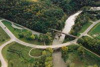
Red Jacket Park
This day-use park is part of the Red Jacket Trail system. A picnic shelter, parking lot, viewing area, and canoe launch are highlights of the park. A public canoe launch allows for easy access to the scenic Le Sueur River. Learn more: Blue Earth County Facilities
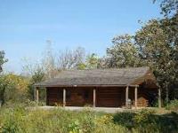
Williams Nature Center
Overlooking the Minnesota River, the land for this park was donated by Williams Pipeline and developed by the Mankato Area Foundation. Williams Nature Center features 1.5 miles of hard-surfaced nature trails,
Learn more: Blue Earth County Facilities
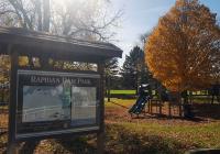
Rapidan Dam Park and Campground
The Rapidan Dam Park is located off of County Road 9, next to the Rapidan Dam . The 38 acres of riverfront property provides public access to the Blue Earth River at the Dam. This stretch of river is one of the most natural and scenic areas in Southern Minnesota, including views of rock bluffs, wooded hills, rapids and waterfalls on side streams. It is a largely undisturbed remnant of the "Big Woods" of Southern Minnesota.
Part of the land is used as a canoe launch, while the rest remains undeveloped conservation land. The land is ideal for fishing, hiking, and primitive camping with tents and pop-up tent campers (size restrictions). Due to the nature of it's acquisition, RV's and full-sized pop-up campers are not allowed. It is equipped with one picnic shelter that can be reserved. The park also has a Horseshoe Pit. This park also provides a unique destination for the Red Jacket Trail Learn more: Blue Earth County Facilities
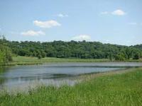
Indian Lake Conservation area
This 120-acre drained wetland was restored to serve as a wetland mitigation site. It provides excellent wildlife viewing and a nature trail for hikers and horseback riders that winds through the east boundary of the park.
Learn more: Blue Earth County Facilities
Weagel Park
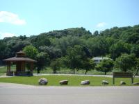
Located on the Red Jacket Trail just off Indian Lake Road, this small 3 acre rest stop provides parking and a shelter for trail users a short distance from Mankato near Mount Kato. The park is also home to the Blue Earth County Community Farm , which utilizes volunteers and community support to grow fresh produce that benefits area hunger assistance programs such as the Salvation Army, ECHO Food Shelf and Campus Kitchens. Learn more: Blue Earth County Facilities
Putnam Park
Located at the south end of Main Street in the City of Blue Earth, this park is home to the municipal pool and the city’s disc golf course. Putnam Park also offers a heated swimming pool, wading pool, basketball courts, tennis courts, restrooms, shelter house, picnic tables, cross country skiing and hiking trails. A new picnic shelter, new playground equipment and bathrooms. Learn more: https://becity.org/parks-and-trails/
Faribault County Fairgrounds/Campgrounds
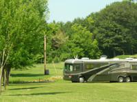
Located along the Blue Earth River, the Faribault County Fairgrounds is a beautiful place to camp or to spend a family afternoon. Along with playground equipment, the Fairgrounds offer ballfields, a walking/biking trail and grandstand. Learn more: https://blueearthchamber.com/index.php/parks-trails
Steinberg Nature Park
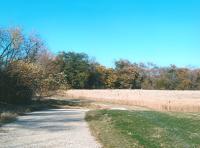
Located ¼ mile east of Blue Earth on County Road 16. The 33-acre park provides a natural setting for visitors to enjoy native prairie plants, river views, woodlands, birding and natural habitat. The Steinberg Nature Park has a ½ mile crushed limestone trail that is accessible for all users. Learn more: https://blueearthchamber.com/index.php/parks-trails
Unity Trail
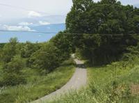
This newly constructed hard surface non-motorized recreational trail links the Faribault County Fairgrounds with the I-90 rest stops. Total length of the trail is 2.86 miles. Learn more: https://blueearthchamber.com/index.php/parks-trails
Leland Park and Beyer Field
Sledding and ice skating are popular at this recreational facility on Leland Parkway on county Road 16 between Main Street and Highway 169 in Blue Earth. Learn more: https://blueearthchamber.com/index.php/parks-trails
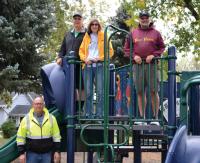
Third Ward Park
Tucked away on the east side of town, Third Ward Park offers a pleasant, shady nook for Blue Earth residents to enjoy.
The park has graced a spot east of the Blue Earth school bus garage since 1987, and Blue Earth’s Parks and Recreation Subcommittee decided it was time the area received a facelift.
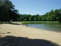
Wood’s Lake Park
This park has 6 RV Sites (50 AMP), 22 RV Sites (30 AMP), Rustic Camping, Dump Station, Picnic Tables, Swimming Pond, Sandy Beach, Restrooms, Showers, Playground, Shelter House, Basketball Hoop, and a Volleyball Net
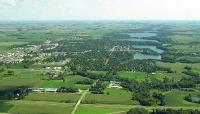
Fairmont City Parks
The city of fairmont has a list of all its city parks. The name, address, and ammenities of each park is included in this list. Find the list using the link below. Learn more: ParksFlyer.indd (fairmont.org)
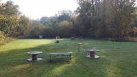
Thunder Valley Archery Park
This park is place to practice archery. It has low and high archery shooting stations. Most all the work and material that is at the park is donated.
Pihl’s Park
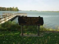
Pihl’s Park was originally built as a private retreat by Joe Pihl who always enjoyed sharing his beautiful land with the public. In the 1960’s he donated his 20-acre retreat to Faribault County to be used as a public park for everyone to come and enjoy. The park is located on 256-acre Rice Lake, where fishing for pan fish like crappie, bluegill, and sunfish is popular.
Today, visitors can come and spend the day, week, or season enjoying all the beauty the park has to offer. This park has 35 electrical sites, rustic camping, dump station, shelter house/picnic area, fire rings & picnic tables at each site, handicap accessible restrooms, shower house, playground, fishing pier, and a nature trail.
Whiting Park
With a picnic shelter, volleyball courts, and a gazebo, this park invites community members and people passing through to stop and enjoy a small part of what Winnebago has to offer. Conveniently located next to the Municipal Center and across the street from Casey's General Store, this park is a great location for your next event.
Cedar Hanson Park
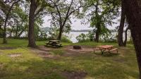
The largest county park in Martin County is located north of Trimont on Cedar Lake .The park features a modern restroom / shower building, 37 modern camp sites with water and electrical hook-ups along with a variety of primitive campsites. Learn more: Martin County Parks https://www.co.martin.mn.us/community/parks/cedar_hanson.php
Timberlane Park
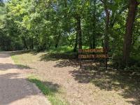
Located on the south side of South Silver Lake, Timberlane Park offers biking and hiking trails, boat launch, fire pits, fishing piers, horseback riding trails, picnic tables, and restrooms. Learn more: Martin County Parks https://www.co.martin.mn.us/community/parks/timberlane.php
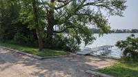
Klessig Park
Klessig Park is located at the southeastern end of Iowa Lake in Silver Lake Township along the Iowa border. This is a small park with boat landing access to Iowa Lake, good shore fishing and picnicking. Learn more: Martin County Parks https://www.co.martin.mn.us/community/parks/klessig.php
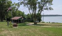
Wolter Park
Wolter park located on the Northwest side of East Chain Lake in Silver lake Township. There are approximately two acres of land in the park, a shelter house, and playground equipment, lake access, and swimming, fishing, and picnicking. The shelter house was donated to the park by the East Chain Sportsmen's Club. Learn more: Martin County Parks https://www.co.martin.mn.us/community/parks/wolter.php
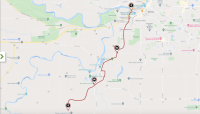
Red Jacket Trail
Named after a Seneca Indian chief who lived in the area until the 1830s, the Red Jacket Trail runs along an old Milwaukee Road (formerly the Minnesota Railroad and the Central Railroad) right-of-way that became inactive in 1978. The Red Jacket Trail begins at the restored depot along the banks of the Minnesota River, west of downtown Mankato, and runs to the village of Rapidan. In Mankato, the trail branches off from the North Minnesota River Trail , which continues along the waterway to the Sakatah Singing Hills State Trail .
Learn more: Blue Earth County Facilities
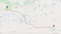
South Route Trail
The South Route Trail begins west of Mankato in Minneopa State Park, known for its beautiful waterfalls and views of the Minnesota River Valley. Heading southeast from the park, following County Road 90, you'll pass through open areas with some hilly terrain. Shortly after crossing the Blue Earth River, the trail connects to the Red Jacket Trail , a 13-mile rail-trail that heads into Mankato. After this connection, the trail flattens out and continues its journey to Minnesota Highway 22.
Learn more:
Minneopa Trail
Extending from just outside Williams Nature Center property to a point at Riverfront Drive, just south of Sibley Park. The trail mostly sits in the grassy shoulders of the road (first Minnesota State Route 68, then US Highway 169). Part of the trail ventures into the right-of-way of the neighboring Union Pacific railroad, making this what is known as a rail-with-trail.
Learn more:
Lake crystal loop/ Rapidan Dam
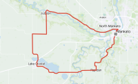
The Lake Crystal Loop has it all. Head out of town on the scenic Red Jacket Trail through the Minnesota River Valley over the Trestle Bridge to the historic Rapidan Dam, where you’ll find a park near a small diner with award winning pie. For a longer trip and more river valley to ride up and down follow the Blue Earth River south to Garden City where the view is endless. Grab lunch in Lake Crystal or cool down in one of the lakes. For a shortcut back, bike through Minneopa State Park where you’ll find a 39 foot waterfall and several hiking trails to explore. For a longer ride, continue on to Judson Bottom road along the Minnesota River Valley and stop at Minnemishinona Falls where you’ll see an even taller 42 foot waterfall. Head back into town following the Minnesota River.
Learn more:
Sakatah Singing Hills State Trail
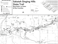
The Sakatah Singing Hills State Trail is a paved, 39 mile multiple-use trail which has been developed on an abandoned railroad grade. The trail begins at Lime Valley Road near State Highway 14, joins the Minnesota River Trail in Mankato, follows a signed route on city streets through Waterville, passes through three miles of Sakatah Lake State Park , and ends east of Interstate 35 in Faribault. It is generally level and wheelchair accessible. Horses can use a parallel treadway from Lime Valley Road to the County Road 12 bridge.
Learn more: Minnesota DNR