GIS Projects
Below are current projects I am working on, as well as maps I have made for previous classes.

Current Projects
My independent projects combine my two passions: GIS and new urbanism. Both will be uploaded upon completion.


GIS Labs
Below are a variety of lab projects I have completed in Intro to GIS and GIS for Urban Sustainability Courses.
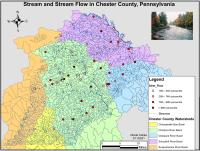
Stream Flow Testing Locations in Chester County, PA.
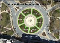
Square footage of Grass in Logan Square

Land-Use Analysis
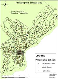
School Distribution in Philadelphia
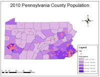
2010 Pennsylvania Population

Fire Stations in Chester County, PA
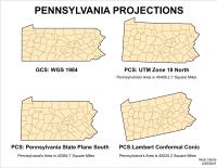
Coordinate Systems
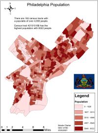
Philadelphia Population
Digitizing Data
I love to self-learn. In my free time, I take Esri Training courses.

