
Historical Timeline of the Maine Geological Survey
Introduction
The Maine Geological Survey has existed under a number of names and in a variety of organizational units over the years. The early years were sporadic, to say the least, but since 1942 the Survey has been in continuous operation. No matter who has been in charge or where the Survey has been housed, the mission has always been to be the primary source of information on the geologic framework of the State, its groundwater resources, and geologic hazards.
State Geologists
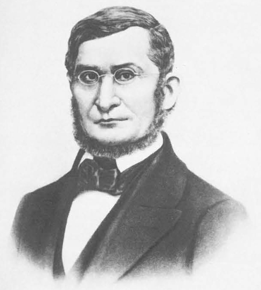
1836-1838
Charles T. Jackson: As Maine became a state in the early 1800's, the need for an inventory of its economic geologic resources became important. Jackson was commissioned to survey the state. Faced with massive logistical challenges like poor transportation and large remote areas covered with soil and trees, his observations still helped guide future geological investigations and development of mining in the state.
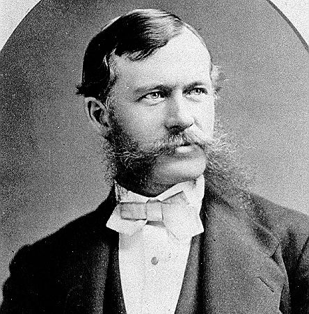
1861-1862
Charles H. Hitchcock completed an impressive amount of work in two years. He compiled the first widely circulated map of bedrock geology for Maine, advanced the new theory of glacial geology, and provided a delineation of Devonian strata.
1903-1908
Leslie A. Lee was both Chairman of the State Survey Commission and State Geologist while he was a professor of geology and biology at Bowdoin College.
1908-1910
Franklin C. Robinson, Professor of chemistry and mineralogy at Bowdoin College
1910-1911
C. Vey Holman
1914-1920
Freeman F. Burr, staff geologist at the Public Utilities Commission
1929-1931
Lucius H. Merrill, professor of biochemistry at the University of Maine in Orono
1931-1932
Joseph C. Twinem, instructor in the Civil Engineering Department of the University of Maine
1934-1942
Freeman F. Burr might have held the position but wasn't paid until 1937.
1942-1956
Dr. Joseph M. Trefethen was state geologist while the Survey was housed at the University of Maine. He was one of the first geology faculty members at the university in 1938.
1956-1959
John R. Rand oversaw the first legislative approval of a distinct geological agency in Maine state government.
1959-1979
During Robert G. Doyle's 20 year term as State Geologist, the Survey underwent a number of organizational changes in state government. Interest in mining and mineral exploration flourished in the 60's and 70's with two new mines opening in the state. As development pressure in southern Maine increased, MGS programs diversified into surficial and coastal geology to meet growing environmental concerns.
1979-1995
Under Walter A. Anderson's leadership, ties with research entities like the University of Maine system and other State and Federal agencies were strengthened. This brought in funding for more mapping and other projects such as educational curriculum development, peat resource inventory, investigations of sea-level change, and offshore mapping.
1995-2021
Dr. Robert G. Marvinney is the longest serving state geologist in Maine history. He brought the survey into the digital information age with a conversion to database and geographic information systems.
2021-2024
Dr. Stephen M. Dickson became the 15th state geologist after 35 years as a marine and coastal geologist at the Maine Geological Survey. He led the survey's efforts to support climate change adaptation through science and policymaking.
2024-present
Dr. Ryan Gordon started with the survey in 2015 as a hydrogeologist and took over as state geologist in July 2024. He continues the tradition of applying geosciences for the benefit of society.
Organizational Structure
1836-1838
Geological Survey: First record of the Maine Geological Survey with the appointment of Charles T. Jackson as state geologist.
1861-1862
Scientific Survey (under Maine Board of Agriculture): In 1861, the Maine legislature authorized Charles H. Hitchcock, professor of geology at Amherst College, to describe the bedrock and surficial geology of Maine, including mineral resources.
1899-1905
Topographic Survey Commission: In 1899, the legislature created the Topographic Survey Commission to administer a cooperative state-federal topographic mapping program. Legislation passed in 1901 enlarged the scope of this commission by giving them supervisory power over both topographic and geologic work.
1905-1911
State Survey Commission
1916-1919
Maine Public Utilities Commission
1919-1920
Maine Water Power Commission
1929-1932
State Geologist
1934-1937
Maine State Planning Board
1937-1943
State Geologist
1943-1955
Maine Development Commission
1955-1957
Department of Development of Industry and Commerce
1957-1969
Division of Geological Survey, Department of Economic Development
1969-1971
Division of Science, Technology, and Mineral Resources, Department of Economic Development
1971-1973
Division of Science, Technology, and Mineral Resources, Forestry Department
1973-1977
Bureau of Geology, Maine Department of Conservation
1977-2012
Maine Geological Survey, Maine Department of Conservation
2012-Current
Maine Geological Survey, Maine Department of Agriculture, Conservation and Forestry
Bedrock Maps of Maine
1885-1932
Geologic Map of Maine: Results of the Maine Scientific Survey of 1861 and 1862 were described in two lengthy reports and embodied in a large Geological Map of Maine presented by C. H. Hitchcock to the State Legislature. The map was exhibited by special permission to the American Association for the Advancement of Science in about 1868 and an abstract of the explanation was published in the AAAS proceedings. Unfortunately, the whereabouts of the original map is not known. Hitchcock produced a smaller, page-sized map that was published in 1885 as part of Colby's Atlas of the State of Maine. It is based largely on his original 1868 map, though his accompanying text indicates some amount of modification. From Historical Bedrock Maps of Maine, Part I: The Hitchcock (1885) Map .
1933-1966
Preliminary geologic map of Maine: The 1933 Maine bedrock map was a spin-off of the U. S. Geological Survey program to publish a geologic map of the United States. Arthur Keith of the U. S. Geological Survey compiled the information for New England at a scale of 1:2,500,000 and transferred it to the 1:1,000,000 scale. From Historical Bedrock Maps of Maine, Part II: The Keith (1933) Map .
1967-1984
Preliminary geologic map of Maine: The 1967 Preliminary Geologic Map of Maine was the first statewide effort that drew on a multitude of compilers, editors and advisors, in contrast to the two earlier bedrock maps which were single-authored compilations. This group of compilers, advisors, and editors worked with many other geologists and cartographers for a year and a half to produce the 1967 Maine bedrock map. From Historical Bedrock Maps of Maine Part III: The 1967 Preliminary Geologic Map of Maine .
1985
Bedrock Map of Maine: The highly charged political climate, significant infusion of federal funds, abundance of new geologic information, and revolutionary change in regional geologic concepts made the 1985 Bedrock Geologic Map of Maine a project unequaled in the history of Maine geology. From Historical Bedrock Maps of Maine, Part IV: The 1985 Bedrock Geologic Map of Maine . Published Bedrock geologic map of Maine .


