
Wandering the Watershed
A tour through the Potomac River Basin
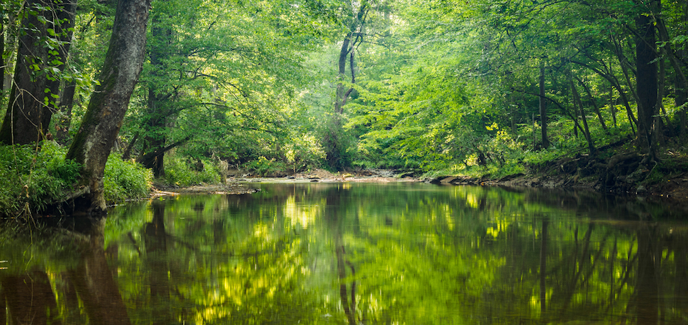
The Potomac River Basin covers about 14,670 square miles through Virginia, Maryland, West Virginia, Pennsylvania, and the District of Columbia. This Story Map only covers a small fraction of the many historical, cultural, and recreational sites across the basin but it is a starting point to the infinite adventures available in the Potomac River Basin. From the headwaters to the mouth of the river, adventure awaits.
The following collection of stories is pulled from the weekly ICPRB publication, About the Basin. Sign up for the ICPRB newsletter for more news and stories about the Potomac River Basin.

Potomac Headwaters: Spruce Knob-Seneca Rocks National Recreation Area
Potomac Headwaters: Spruce Knob-Seneca Rocks National Recreation Area. Click to expand.
Spruce Knob-Seneca Rocks National Recreation Area is within the Monongahela National Forest, one of the of the most ecologically diverse National Forests, on the far western edge of the Potomac River watershed in West Virginia. It is 100,000 acres of outdoor adventures.

Lost River State Park
Lost River State Park. Click to expand.
Lost River State Park is an excellent choice for a weekend away from the DC Metropolitan area. It is only a 2.5-hour drive to the eastern panhandle of West Virginia but the park seems a world away.

Seven Bends State Park
Seven Bends State Park. Click to expand.
The Seven Bends State Park is named for the twists and turns of the North Fork Shenandoah River as it meanders along the base of the Powell Mountain in northwestern Virginia. It is those same twists and turns that makes one feel they are the sole occupant of this small slice of undisturbed nature.

Fairfax Stone State Park
Fairfax Stone State Park. Click to expand.
Fairfax Stone State Park, near Davis, West Virginia, has no boating, no hiking, and no camping. It does not even have a restroom. In fact, it is a diminutive 4-acre park. However, it has immense importance to the Potomac River and the history of the region.

Potomac State Forest
Potomac State Forest. Click to expand.
Archery, hiking, hunting, fishing, equestrian trails, mountain biking are popular in the Potomac State Forest. Winter sports like cross country skiing and snowmobiling are also a possibility.

Waffle Rock
Waffle Rock. Click to expand.
This article takes a close look at a geological phenomenon known as Waffle Rock. This interesting rock stands guard at the West Virginia Overlook above Jennings Randolph Lake.

Nathaniel Mountain Wildlife Management Area
Nathaniel Mountain Wildlife Management Area. Click to expand.
A wildlife management area (WMA) is land owned by the state that is designed to conserve and manage high quality wildlife habitat. Public access is allowed and encouraged, but the amenities at WMAs tend to be more rustic than your typical state park. Nathaniel Mountain Wildlife Management Area is no exception. The roads can be rutted, and the camp sites are primitive, but a trip to Nathaniel Mountain WMA will reward you with the opulent sights and sounds of the wild.

New Germany State Park
New Germany State Park. Click to expand.
Nestled within the expansive arms of Savage River State Forest in Western Maryland, New Germany State Park sits in the valley between Big Savage Mountain and Meadow Mountain.

Jennings Randolph Lake
Jennings Randolph Lake. Click to expand.
Less than 3 hours west of the Washington metropolitan area lies a massive man-made lake with a storied past. Tucked into the Allegany Mountains of West Virginia, Jennings Randolph Lake sits over land that was once a small town called Shaw. In 1981, the residents moved out and water moved in.

Buchanan State Forest
Buchanan State Forest. Click to expand.
Looking for history, hiking, adventures, and a beautiful view in one easy stop? The Buchanan State Forest in south central Pennsylvania is the place to be. The land straddles the northern edge of the Potomac River basin. One side of the mountain range drains to the Potomac while the other side drains to the Susquehanna.

Green Ridge State Forest
Green Ridge State Forest. Click to expand.
About the Basin has featured many luxurious camping spots; large, resort-style houses in state parks (read: Westmoreland State Park) and glamping with all the amenities (read: Cacapon State Park). The park in this About the Basin offers a different take on camping. A 4WD car is recommended, the most luxurious items you will find are a picnic table and a fire ring, and park staff offer A LOT of advice on bears. It is basic, bare-bones, rustic camping. It is Green Ridge State Park in Flinstone, Md.

Path Through Paw Paw
Path Through Paw Paw. Click to expand.
Located in western Maryland along the border of West Virginia, the Paw Paw tunnel started out as a way for the Chesapeake and Ohio Canal to bypass 6 miles of horseshoe-shaped bends in the North Branch of the Potomac River. A seemingly simple task, it was expected to take 2 years to complete. The first boat floated through the tunnel in 1850, fourteen years later.

George Washington’s Bathtub
George Washington’s Bathtub. Click to expand.
George Washington’s Bathtub in Berkeley Springs, West Virginia is touted as the “only outdoor monument to presidential bathing.” However, (spoiler alert!) Washington never actually used the tub. The stone “bathtub” was built to symbolize the bathing conditions of the 1700’s. In his quest for better health, Washington visited the hot springs on many occasions.

Cacapon Resort State Park, Glamping in West Virginia
Cacapon Resort State Park, Glamping in West Virginia. Click to expand.
A scenic 2-hour drive west from the D.C. metro area will land you at a state park that looks more like a resort than a park. Cacapon (pronounced “Ca-cape-un”) Resort State Park, near Berkeley Springs, West Virginia, is still a state park at heart, though. It boasts a small sandy beach for swimming, paddle boat rentals, serene fishing spots, many hiking trails, and a nature center. However, the park’s additional amenities make a weekend at Cacapon more glamping than typical old-fashioned camping. You will also find an 18-hole golf course, horseback riding, a hotel and conference center, and cabins decked out with all the necessities for a weekend away.

Fort Frederick
Fort Frederick. Click to expand.
The Potomac River has served as a strategic avenue of transport since the dawn of river travel. It is no surprise that many forts were built along its banks. This weekend marks the 260th Anniversary of one such stronghold, Fort Frederick in Western Maryland. Built during the French and Indian War, this mid-18th century fort went on to be a strategic post in several future wars. The buildings and state park were restored and rebuilt in the mid-1900s. The State Park runs along a good portion of the Potomac River, providing a variety of recreational opportunities amongst great American relics of the past. This weekend’s anniversary celebration includes living history demonstrations and family activities.

Michaux State Forest
Michaux State Forest. Click to expand.
The southern half of the 85,000+ acres known as Michaux State Forest is on the top edge of the Potomac River watershed near Gettysburg, Pa. The contiguous forestland encompasses several state parks and natural areas.

Cunningham Falls State Park
Cunningham Falls State Park. Click to expand.
Cunningham Falls State Park, near Thurmont, Maryland, has many treasures. It is known for being the largest cascading waterfall in Maryland. Big Hunting Creek, one of Maryland’s premier trout streams, runs through the park. Swimming in the lake is a summertime tradition for many families, both near and far.

Catoctin Mountain Park
Catoctin Mountain Park. Click to expand.
As summer comes to a close and kids start returning to school, our thoughts turn to cooler weather, autumn color changes, and less-sweaty outdoor activities. There are many places to catch the leaves change in the Potomac River basin. Hiking, fishing, and boating in the region can be top notch when the weather is cool and the sun stays up late. The Catoctin Mountain Park near Thurmont, Maryland, is one of the more popular places for “leaf peeping.” It’s not just the fact that it is within an easy drive from the DC Metro Area, but it is also part of a larger area of public lands that stretches through Cunningham Falls State Park, Middletown and Frederick watersheds, and beyond. The contiguous stretch of second-growth mixed hardwood forest creates a dramatic view from both the freeway and the trailway.

Greenbrier State Park
Greenbrier State Park. Click to expand.
Celebrating its 50th year, Greenbrier State Park has not changed much since the doors opened in 1967. Barring the additional bathroom or two, the long, sandy beach and 42-acre man-made lake ringed by beautiful forest looks much the same as it did back when it’s visitors wore bell-bottoms. The area still provides fun and adventure for both local and traveling families.

Brunswick Family Campground
Brunswick Family Campground. Click to expand.
For many families, the Brunswick Family Campground in Brunswick, Maryland is a summertime tradition. Whether you are a hiker, biker, kayaker, history buff, or train enthusiast, there is something for everyone at this campground along the C&O Canal Park.

Frederick Municipal Forest
Frederick Municipal Forest. Click to expand.
When is a forest more than a forest? When it is managed specifically as the source of drinking water for an entire city. Hence, Frederick Municipal Forest is more than a forest. It provides clean, fresh drinking water for the 70,000 people who live downstream. Do you need more of a reason to love it? The well-maintained labyrinth of trails is a locally known secret to many hiking and mountain biking enthusiasts.

Harpers Ferry National Historical Park
Harpers Ferry National Historical Park. Click to expand.
Harpers Ferry National Historical Park, and its dramatic history, have been explored and extolled by many and for good reason. The town is steeped in history, and it is evident as you walk through the historic village with its living history storefronts and gaze upon the imposing cliffs across the river.

Monocacy Aqueduct
Monocacy Aqueduct. Click to expand.
The Monocacy Aqueduct has a storied past. In its long history, it was used as an important transportation route for goods, goods, animals, and arsenals. Placed at the mouth of the Monocacy River, it was a vital passageway during times of peace and war. Thanks to a recent stabilization and reconstruction effort by the National Park Service, you can still see the structure as it was originally constructed almost two centuries ago.
Little Bennett Regional Park
Little Bennett Regional Park. Click to expand.
If you take MD-355 north out of Washington, D.C., you will drive through miles of urban and suburban landscape. Eventually, the houses and shops will turn into bucolic fields and forests. The gateway to this beautiful part of rural Maryland is Little Bennett Regional Park in Clarksburg, Md. The south side of the park is lined by housing developments named for the farms that once stood there, but pass through the park and Maryland becomes agricultural fields and small towns.

Black Hill Regional Park
Black Hill Regional Park. Click to expand.
With a surface area of 505 acres, Little Seneca Lake is anything but little. Built as an important strategic reservoir for drought management in the Potomac watershed, the lake also provides a variety of excellent recreational opportunities. Located just north of Germantown, Md., the lake boasts several boat ramps, plenty of fishing holes, calm sailing waters, a nature center, and so much more.

Seneca Creek State Park
Seneca Creek State Park. Click to expand.
The Seneca Creek State Park runs the length of Seneca Creek from Route 355 until it empties into the Potomac River. It is unique gem in Montgomery County, Maryland. At 6,300-acres, the park covers a lot of ground, allowing for a wide variety of recreational opportunities.

Blockhouse Point Park
Blockhouse Point Park. Click to expand.
Blockhouse Point Park is a little-known park that played a large part in history. The park is just north of Great Falls in the western part of Montgomery County on the Maryland side of the Potomac River. To keep an eye on the Confederate troops across the river, Union soldiers used it as a camp and lookout. From high vistas, the C&O Canal and Potomac crossings could be watched closely to prevent enemy raids. Three blockhouses (hence the name) were used as observation points by the Union army. They were eventually burned down by the Confederate troops in 1864. The land was used post-war to search for the Lincoln assassination co-conspirators and to look for Confederate soldiers returning to Maryland because of the excellent views of the Potomac River and its surrounding areas.
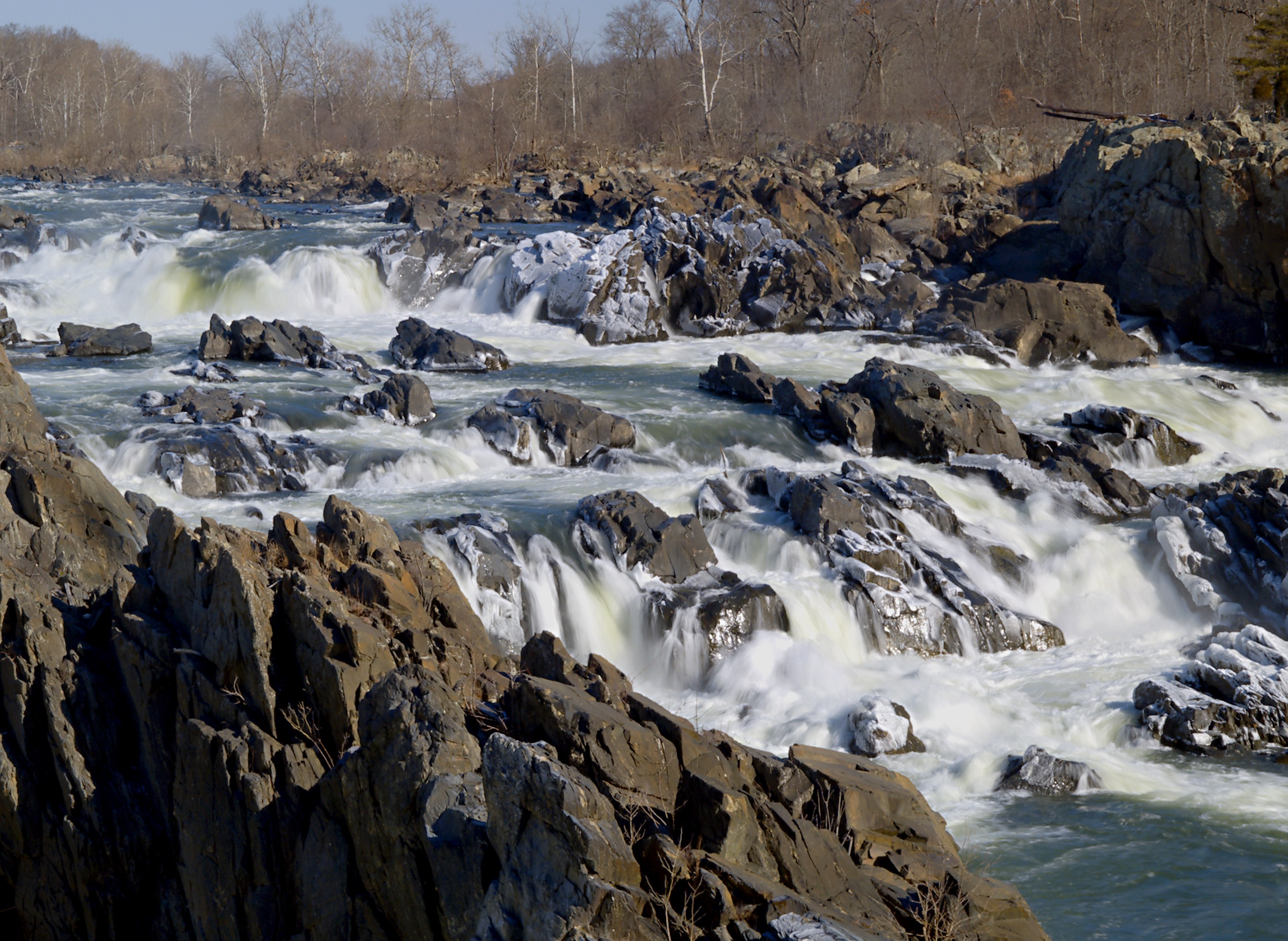
Great Falls
Great Falls. Click to expand.
The dramatic rocky rapids of Great Falls provide the perfect background for yesterday’s history and today’s selfies. Two National Parks flank both sides of the Potomac at Great Falls: (1) Great Falls Park on the Virginia side; and (2) the C&O Canal National Historical Park on the Maryland side.

Scott’s Run Nature Preserve
Scott’s Run Nature Preserve. Click to expand.
Scott’s Run Nature Preserve is a choose your own hiking adventure type of place. Want a short, meandering walk with the kids? There’s a trail for that. Want to jump boulders while clambering up steep, rocky trails? There’s a trail for that. Want breathtaking views of waterfalls and the Potomac River? Yep, there’s that (but for safety reasons, swimming and wading are not allowed).

McKee-Beshers Wildlife Management Area
McKee-Beshers Wildlife Management Area. Click to expand.
You might think field upon field of bright yellow sunflowers are found only in provincial Italy or France and other places known for romance and beauty. But there are 2,000 acres right in our backyard that will make you feel transported to a more magical time and place. Known as the McKee-Beshers Wildlife Management Area (WMA), staff at this park plant acres of sunflowers to attract and feed pollinators and birds. For a couple weeks each year (around the end of July) the WMA is alight with seemingly endless summery flowers.

Banshee Reeks Nature Preserve
Banshee Reeks Nature Preserve. Click to expand.
Just south of Leesburg, Virginia, lies a 725-acre hiking oasis. The Banshee Reeks Nature Preserve feels secluded and quiet even on the busiest of weekends. In 2016, it was designated as a Virginia Treasure. As Loudoun County’s only nature preserve, the land is protected for environmental and cultural resources through a conservation easement with Virginia Outdoors Foundation. These types of easements are important for preserving wildlife and water quality as well as providing outdoor recreational opportunities.

Kenilworth Park and Aquatic Gardens
Kenilworth Park and Aquatic Gardens. Click to expand.
Kenilworth Park and Aquatic Gardens is not your typical national park. “Strikingly beautiful” as one Yelp reviewer called it, it is the only national park solely dedicated to growing
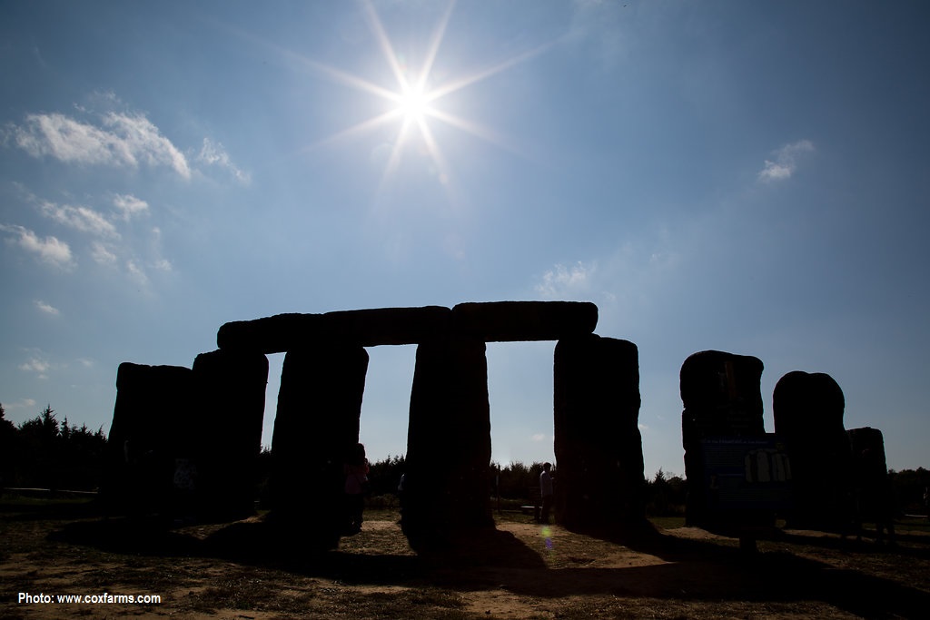
Foamhenge
Foamhenge. Click to expand.
In celebration of the beginning of summer, this week’s About the Basin covers an internationally known pile of rocks that honors the summer solstice. No, not Stonehenge, but the lesser known -henge this side of the pond: Foamhenge.

G. Richard Thompson Wildlife Management Area
G. Richard Thompson Wildlife Management Area. Click to expand.
G. Richard Thompson Wildlife Management Area, or Thompson WMA for short, is a gem of a recreational area in northwestern Fauquier County, Virginia. It is close enough for a day trip from the DC Metro area but far enough to make it feel a world away.

Bull Run Mountains Natural Area Preserve
Bull Run Mountains Natural Area Preserve. Click to expand.
The Bull Run Mountains Natural Area Preserve is an outdoor living laboratory located only an hour drive from the D.C. Metro area. It is staffed with Natural Area Preserve managers who carefully oversee the 2,486 acres to preserve the impressive biodiversity and the unique forest and woodland communities found on the mountain.

The Tidal Basin
The Tidal Basin. Click to expand.
How the Potomac Flats became the Tidal Basin

East Potomac Park
East Potomac Park. Click to expand.
The history of the 400-acre East Potomac Park is a good reminder of what we can accomplish through ingenuity, creativity, and a little extra dirt.

Anacostia Park
Anacostia Park. Click to expand.
On August 31, 1918, Congress passed legislation to bring Anacostia Park into existence. Since that day one hundred years ago, Anacostia Park has become the nation’s neighborhood park. The 1200-acre park is located on the east side of Anacostia River in Southeast D.C. and is one of the biggest parks in the city. The National Park Service works hard to make the park an urban oasis with amenities for all.

Gravelly Point Park
Gravelly Point Park. Click to expand.
Gravelly Point Park is a favorite spot for kids of all ages for one main reason: the love of airplanes. The park is known for being one of the best places for plane spotting in the nation. The grassy strip of land is located just north of Ronald Reagan Washington National Airport in Arlington, Va. and just a few hundred yards from their runways. With your feet planted firmly on the ground, it feels like your fingers could graze the bottom of the Boeing 747’s passing just above your head. The view of the underside of the planes is only complemented by the stunning skyline of our nation’s capital just across the Potomac River.

Dyke Marsh Wildlife Preserve
Dyke Marsh Wildlife Preserve. Click to expand.
Just down the river from Alexandria, Va., exists 485 acres of marsh, swamp forest and flood plain known as Dyke Marsh Wildlife Preserve. It is an oasis amidst the concrete jungle. It is part of the George Washington Memorial Parkway managed by the National Park Service. The Preserve has an impressive diversity of flora and fauna, including more than 270 species of birds and 300 species of plants.

Burke Lake Park
Burke Lake Park. Click to expand.
Are you a golfer? A train enthusiast? Are you into volleyball? Fishing? Or maybe orienteering is your thing. Whatever it is, Burke Lake Park has you covered. This 888-acre park in Fairfax Station, Virginia boasts a variety of activities for all interests, ages, and abilities. Just visit for the day or stay overnight at the Burke Lake campground.

Piscataway Creek
Piscataway Creek. Click to expand.
Beginning just north of Rosaryville, Maryland, the Piscataway runs just 4.5 miles long. The headwaters pass through Piscataway Creek Stream Valley Park. This park is difficult to access and has few trails. However, if you are in the area, stop by Cosca Regional Park. The main feature of this park is Lake Cosca, which runs into Butler Branch, a tributary of Piscataway Creek. Boat rentals and overnight camping are available in this 690-acre park near Clinton, Md.

Cedarville State Park
Cedarville State Park. Click to expand.
The Maryland Forest Service manages 214,000 acres of forest spread among 13 different State Forests. At 3,510-acres, Cedarville State Forest is one of the smallest, but not the smallest, of these managed forestlands.

Gunston Hall
Gunston Hall. Click to expand.
If you like your hiking with a healthy serving of history, then George Mason’s Gunston Hall is the place for you. The Founding Father’s home is situated along Gunston Cove where Pohick and Accotink Creek meet the Potomac River along the Virginia shoreline. This area is the native land of both the Piscataway and Doeg tribes.

Occoquan Regional Park
Occoquan Regional Park. Click to expand.
The Occoquan Regional Park in Lorton, Virginia, provides a steady dose of history, waterfront views, and a relaxed pace.

Smallwood State Park
Smallwood State Park. Click to expand.
Smallwood State Park in southern Maryland offers a variety of activities alongside a picturesque view of Mattawoman Creek, a tributary of the tidal Potomac River.

Leesylvania State Park
Leesylvania State Park. Click to expand.
Located along the Potomac River in Prince William’s County, Virginia, Leesylvania State Park has a lot to offer its multitude of visitors. As one online reviewer states, “This gem of a park offers peace and quiet in the middle of the hubbub of NoVA.” Although small, the park offers a range of amenities for those looking to escape the city for a day, including trails, a boat ramp into the Potomac River, visitor’s center, picnic shelters with barbecues, fishing spots, a playground, and more.

Prince William Forest Park
Prince William Forest Park. Click to expand.
Looking for a “a drop-dead beautiful place” (Tripadvisor review, Oct. 2019) that is also a quiet respite from the activity of the big city and was once training ground for spies? That’s pretty specific, but we found it for you. Prince William Forest Park (PWFP) is located only 35 miles south of Washington, D.C. along the I-95 corridor. At 15,000-acres, it is the largest park in the National Park Service’s Washington Capital Region and one with an eventful past.

Mallow’s Bay, the Graveyard Teeming with Life
Mallow’s Bay, the Graveyard Teeming with Life. Click to expand.
An iconic spot on the Potomac River recently acquired a new name. The ghost fleet of Mallows Bay is now known as the Mallows Bay-Potomac River National Marine Sanctuary thanks to its new designation by NOAA. It is the first such sanctuary in almost two decades.

Widewater State Park
Widewater State Park. Click to expand.
Widewater State Park is close enough for a daytrip from Metro DC but far enough away that the big city light pollution is not an issue for the night astronomy clubs that occasionally hold public events at the park. Stretching between the shore of the Potomac River and the shore of the Aquia Creek, the park provides stunning water views, fishing, and recreational access to water.

Caledon State Park
Caledon State Park. Click to expand.
This National Natural Landmark is 2,587-acres along the banks of the tidal Potomac River in King George, Virginia.

Westmoreland State Park
Westmoreland State Park. Click to expand.
Westmoreland State Park is located along the shores of the Potomac River in Montross, Virginia. The park was one of six Virginia State Parks that opened in 1936 through the Civilian Conservation Corp program. Many of the park’s roads and trails were built by hand during that time.

The Black Panther on the Bottom of the Potomac
The Black Panther on the Bottom of the Potomac. Click to expand.
For 69 years a German submarine, known as U-1105, has sat at the bottom of the Potomac River.
Potomac Headwaters: Spruce Knob-Seneca Rocks National Recreation Area
Spruce Knob-Seneca Rocks National Recreation Area is within the Monongahela National Forest, one of the of the most ecologically diverse National Forests, on the far western edge of the Potomac River watershed in West Virginia. It is 100,000 acres of outdoor adventures.
The mountain peak, Spruce Knob, sports many superlatives: the highest point in the Chesapeake Bay Watershed, the highest point in the Allegheny Mountains and the Appalachian Plateau, the 24th highest point in the United States, and the 13th most isolated peak in the contiguous United States. As you have probably guessed by now, it is high. On top of this massive peak you will find an observation tower with 360-degree views of the surrounding valleys and mountaintops. In addition to beautiful vistas, the extreme altitude changes mean that Spruce Knob has excellent hiking, rock climbing, and mountain biking opportunities.
In addition to many creeks, fishing opportunities are just down the mountainside at Spruce Knob Lake, which is regularly stocked with trout by the West Virginia Division of Natural Resources. A boat ramp and pier are available.
October is an excellent time to enjoy leaf-peeping in the Potomac headwaters. While exploring, stop by the Seneca Rocks Discovery Center to learn more about the site, which was used as a training facility for rock assaults during WWII.
Too much to do in just one day? For overnight stays, campgrounds in the area offer a range of camping possibilities, from rustic walk-in sites to cabin glamping to RV hookups. Temperatures can drop fast in the mountains so remember to pack accordingly!
Lost River State Park
Lost River State Park is an excellent choice for a weekend away from the DC Metropolitan area. It is only a 2.5-hour drive to the eastern panhandle of West Virginia but the park seems a world away.
The namesake for the Lost River State Park is not, in fact, lost. The 31.1-mile river temporarily dips underground near McCauley, W.V. then reappears as the Cacapon River. Around 81 miles later, the Cacapon joins the Potomac River.
Whether you want an easy, kid-friendly stroll along a stream (Howard Lick Trail) or a rigorous climb with a breathtaking summit (Big Ridge Trail), there is a hike for everyone at Lost River State Park. Horses, bikes, and hikers are welcome along the trails. The most popular destination is the Cranny Crow overlook which offers a view of the surrounding 6 counties and two states.
Many visitors enjoy swimming and wading in the river on a hot summer day before enjoying a barbecue at one of the many picnic pavilions.
Several campsites are available, including 6 Tentrr sites. Tentrr are pre-set sturdy canvas tents placed on wooden platforms located throughout the park.
A unique hike-in cabin option, the Primitive Outpost Cabin, is available on top of the Big Ridge Mountain. With no electricity or running water, this is the perfect place to decompress from modern comforts next to a roaring fireplace. For a more luxurious stay, check out their 26 other cabins. These come equipped with water, electricity, and even Wi-Fi.
The land was originally the home of the Massawomeck tribe which was part of the Iroquois Native Americans. The area is part of the Fairfax Grant, the massive area of land promised to the allies of the then exiled English King Charles II as a last-ditch effort to hold onto to the throne. By 1719, Thomas Lord Fairfax had inherited much of the land. In 1756, the Battle of Lost River occurred during the French and Indian War.
After the Revolutionary War, the Fairfax Land Grant property was granted to American patriots. The father of General Robert E. Lee, Henry “Light-Horse Harry” Lee acquired property and built a summer cabin which has since become a museum in Lost River State Park. It is open weekends from Memorial Day to Labor Day.
Seven Bends State Park
The Seven Bends State Park is named for the twists and turns of the North Fork Shenandoah River as it meanders along the base of the Powell Mountain in northwestern Virginia. It is those same twists and turns that makes one feel they are the sole occupant of this small slice of undisturbed nature.
As part of the Massanutten mountain range, the area is on the ancestral land of the Indigenous nations of Manahoac, Massawomeck, and the Shawandasse Tula.
The Park is one of Virginia’s youngest state parks. It quietly opened in 2020, but the official dedication took place in June 2022 to great fanfare as it joined the state’s 40 other state parks.
There are two access points to the park. The Hollingsworth access at 2111 S. Hollingsworth Rd. will bring you to a large open field with plenty of parking and a kayak/canoe access point. It is tough to reach the river here, so if that is your destination, choose the Lupton access point at 1191 Lupton Rd. This provides a smaller parking lot, but easy access to trails and plenty of fishing spots along the 3-miles of riverfront. Alternatively, you can put your canoe, kayak, or tube in at Hollingsworth access and float the 3 miles (and roughly 1-2 hours) down to the Lupton access.
Smallmouth bass are the most popular fish for anglers; however, you may also spot sunfish, fallfish, largemouth bass, and muskellunge (please follow all fishing license requirements).
Picnic tables provide a nice gathering place for before or after your trek on any one of the 8 miles of trails. Interesting sites await if you brave the steep trails, including the remnants of two centuries old water reservoirs. One is in ruins but the other still provides an abundant ecosystem (and good fishing).
The area is open every day from 6 a.m. until dusk. There are no overnight accommodations (yet, anyways). The park’s Master Plan calls for campground and visitors center focused on environmental education.
Fairfax Stone State Park
Fairfax Stone State Park , near Davis, West Virginia, has no boating, no hiking, and no camping. It does not even have a restroom. In fact, it is a diminutive 4-acre park. However, it has immense importance to the Potomac River and the history of the region.
A spring, marked by an organized pile of mossy rocks, is the beginning of the North Branch of the Potomac River. A mere 383 miles downriver, that trickle transforms into the 11-mile wide mouth of the Potomac River, spilling into the Chesapeake Bay.
Before the American Revolution, it was the tradition that English kings would reward loyal friends with large parcels of land in the territories. A plaque on a six-ton rock at the entrance of the park commemorates the western boundary of land granted to Lord Fairfax by King Charles II of England in 1746.
His bounty was, “bounded by and within the heads of the Rivers Rappahannock and Patawomecke”. Known as Fairfax Stone, it is one of the oldest markers in the United States. This plot of land has been part of many boundary disputes.
There may not be many amenities in this charming park, but it is a good reminder that even the largest rivers start as a trickle.
Camping and other amenities can be found at the nearby Canaan Valley Resort State Park and Blackwater Falls State Park .
Potomac State Forest
Archery, hiking, hunting, fishing, equestrian trails, mountain biking are popular in the Potomac State Forest. Winter sports like cross country skiing and snowmobiling are also a possibility.
Don’t expect to see many people enjoying these opportunities as this rural state forest competes with many state parks in the region for outdoor entertainment opportunities. Even in the height of summer, you will feel like the trails and creeks exist only for you.
The cool, shaded streams make for excellent trout fishing. The majority of the forest is a Delayed Harvest Trout Fishing Area ( Group II ) which means an angler can possess up to 5 trout during the summer months (check local licensing restrictions).
A 3-D archery range offers the opportunity to practice your aim at 30 life-size 3-dimensional targets.
Potomac State Forest’s claim to fame is that it has one of the highest elevations of any Maryland state forest. At 3,200 feet, Backbone Mountain reigns over this small state forest in the headwaters of the Potomac River in Western Maryland. It also provides for challenging, and rewarding, hiking trails.
One such trail is the Lostland Run Trail. It is a challenging hike with varied terrain and many stream crossings. With appropriate preparation, this trail will reward you with beautiful views, wildlife sightings, waterfalls, and fun swimming holes. Keep your eye on the trail blazes though, as they are easy to miss.
Waffle Rock
This article takes a close look at a geological phenomenon known as Waffle Rock. This interesting rock stands guard at the West Virginia Overlook above Jennings Randolph Lake.
This massive rock has a large waffle-pattern on one side. Some have claimed it is evidence of visitors from another planet, some say it is the scale pattern of a ginormous lizard, and others say it is just an interesting geological formation. We’re going with the “geological formation” theory.
Several hundred million years ago, according to ICPRB hydrogeologist, Jim Palmer, “Joints opened up in the soft sandstone and allowed iron rich water to seep into cracks and form cement around sand particles.” This cemented sand is highly weather resistant. Regular sandstone is not. The soft sandstone eroded away from the rock while the grid-like pattern of the hard sandstone remained, creating a waffle-y rock.
The rock was originally part of a larger formation that broke off some point in the past few hundred million years. It ended up near Shaw, West Virginia, the ill-fated town that is now at the bottom of Jennings Randolph Lake. The rock had geological (and, according to the story , sentimental) value. Before the lake was filled in during the early 1980’s, the rock was moved to its final resting place. It now welcomes tourists and locals alike to ponder the deeper things in life while overlooking the scenic Jennings Randolph Lake.
Nathaniel Mountain Wildlife Management Area
A wildlife management area (WMA) is land owned by the state that is designed to conserve and manage high quality wildlife habitat. Public access is allowed and encouraged, but the amenities at WMAs tend to be more rustic than your typical state park. Nathaniel Mountain Wildlife Management Area is no exception. The roads can be rutted, and the camp sites are primitive, but a trip to Nathaniel Mountain WMA will reward you with the opulent sights and sounds of the wild.
The mountain range, comprised of Big, Piney, and Nathaniel mountains, is the native home to the people of the Massawomeck and Shawandasse Tula tribes. It crosses Hardy and Hampshire counties, just south of Romney, West Virginia.
As the largest, and considered the most important, WMA in the state, the land provides vital habitat for squirrels, foxes, deer, bobcats, bears and many other species. Hunting, trapping, and fishing are popular activities on the 10,675-acre property.
Mill Run, a tributary to the South Branch Potomac River, is one of the larger streams within the WMA and is a popular fishing spot.
There are hiking trails throughout the area, but they may not be well-marked so have a map handy for navigation. For the 4.5-mile (roundtrip) hike to the historic fire tower , park at the base of Mill Run Road. Built in 1939, the watch tower provides an impressive piece of firefighting history (climbing the tower is not permitted).
Grab one of the 75 primitive camping sites (with pittoilets) for a fully immersive experience in nature.
For hiking, camping, fishing, and hunting, the Nathaniel Mountain Wildlife Management Area is the embodiment of West Virginia state’s motto, Wild and Wonderful.
New Germany State Park
Nestled within the expansive arms of Savage River State Forest in Western Maryland, New Germany State Park sits in the valley between Big Savage Mountain and Meadow Mountain.
The Lake House is where the action is at New Germany. It is where staff hold park-sponsored events, a snack bar provides sustenance and souvenirs to weary adventurers, and the large Black Forest Room is available for events or conferences. A nature center and native plant garden introduce visitors to the local flora and fauna. Canoes, kayaks, standup paddleboards, and row boats are available for rent from the Lake House.
At one point in history this area was known as the “Maryland Alps” when downhill skiing became popular in the 1940s. It was the venerable forester Fred Besley who knew the best way to get public opinion in favor of states forests was to get the public in the forests, so he and a team of foresters worked to install Maryland’s first ski resort in Maryland. Although the resort closed a few decades later, the popularity of cross-country skiing and snowshoeing continues for locals and tourists alike. Rental equipment is available at the Lake House, as well as a chance to get warm after a day playing in the snow.
The New Germany lake is small but provides a picturesque view year-round. Anglers may find largemouth bass, catfish, bluegill, and stocked trout.
Grab your floaties and sunblock to jump into the lake at the designated swimming beach.
A variety of cabins and campsite options include some winter camping possibilities. The twelve rentable cabins are fully furnished and available year-round. They are perfect for a quiet weekend away with family or friends. The campground provides shady spots and a central bathhouse with restrooms and showers. A couple spots are available with RV hook-ups. Two of the campsite loops provide year-round camping opportunities with a heated bathhouse.
There is no cell phone service at the park, so plan accordingly.
Jennings Randolph Lake
Less than 3 hours west of the Washington metropolitan area lies a massive man-made lake with a storied past. Tucked into the Allegany Mountains of West Virginia, Jennings Randolph Lake sits over land that was once a small town called Shaw. In 1981, the residents moved out and water moved in.
As part of the North Branch of the Potomac River, these are the source waters for the 5.1 million people in the Washington metropolitan area. In times of drought, the lake serves as an emergency reservoir to many downstream. In addition to water supply, the project was constructed for flood risk management, water quality, low flow augmentation, and recreational opportunities. The dam was constructed, and is still managed by, the U.S. Army Corps of Engineers (USACE).
But Jennings Randolph is more than just a place to store water for thirsty people downstream. The 4,500 acres of land and water is a recreational hub with an impressive variety of activities. These include boating, camping, waterskiing, scuba-diving, hiking, swimming, archery, birding, hunting, whitewater rafting, and record-breaking fishing.
Walleye is regularly stocked in Jennings Randolph. Patience is required though, as they are known for being large, but also wily and difficult to find in the lake. Smallmouth bass, trout, bluegill, and catfish abound.
The Howell Run Picnic Area is a picturesque picnic spot overlooking the lake. It offers several shelters for rent, many picnic tables, trails, bathrooms, fishing, and more.
A trail from the picnic area leads to a swimming spot known as Shaw Beach. This sandy beach is a great place to soak up the rays while the kids play in the water.
A 3D archery course is available if you are looking for more adventures. The course is for both beginners and advanced shooters, but you will need to bring your own bow.
During the spring (and occasionally during the summer), USACE releases enough water from the dam to make Class I, II, and III rapids in an area below the dam known as Barnum Whitewater Area. The release schedule for the year is posted online .
Whether you are looking for a day on the water, a day on the beach, or even bigger adventures, Jennings Randolph Lake has something for everyone.
Buchanan State Forest
Looking for history, hiking, adventures, and a beautiful view in one easy stop? The Buchanan State Forest in south central Pennsylvania is the place to be. The land straddles the northern edge of the Potomac River basin. One side of the mountain range drains to the Potomac while the other side drains to the Susquehanna.
History
The 69,703-acres of dense forest contains ample United States history. This includes the remnants of a road used to supply British troops during the French and Indian War, a saltpeter mill used during the American Revolution, cemeteries from the antebellum era, and a CCC camp that housed conscientious objectors and German prisoners of war during World War II. The hometown of our 15th president, James Buchanan, is nearby at the compact Buchanan Birthplace State Park where you’ll find a monument to the president as well as picnic areas and a fishing stream with native brook trout.
When the Pennsylvania Turnpike first opened in 1940, two of the tunnels were one-way. Seeing the error of their ways, authorities abandoned the tunnels in favor of a more expedient bypass. The abandoned section is now known as the Pike 2 Bike Trail , an 8-mile stretch of slightly-eerie, graffiti-ridden trail that includes the abandoned tunnels.
Adventure
The Pennsylvania Department of Conservation and Natural Resources (DCNR) provides several maps for recreation in the area, including ATV trails, snowmobiling trails, and cross-country ski trails. There is a wide variety of hiking trails to choose from depending on your interests and skill-level. The short and easy Sideling Hill History Trail leads to an almost 200-year old aqueduct. Most trails allow mountain biking and horseback riding. Hunting and fishing are permitted throughout the state forest (with the right license and within season). Native brook trout can be found in several streams and DCNR stocks some of the streams.
Primitive campsites are available for tents, hike-in or RVs. The sites are free but require a Camping Permit.
The many high mountain ridges provide a variety of scenic overlooks , including the aptly named Big Mountain Overlook. Most of the vistas are accessible by car which make it a popular place for leaf peepers searching for dramatic fall colors.
Feel like getting your hands dirty? Grab your gloves and clippers and join the Friends of Buchanan State Forest (find them on Facebook) for their monthly Trail Work Days.
Green Ridge State Forest
About the Basin has featured many luxurious camping spots; large, resort-style houses in state parks (read: Westmoreland State Park ) and glamping with all the amenities (read: Cacapon State Park ). The park in this About the Basin offers a different take on camping. A 4WD car is recommended, the most luxurious items you will find are a picnic table and a fire ring, and park staff offer A LOT of advice on bears. It is basic, bare-bones, rustic camping. It is Green Ridge State Park in Flinstone, Md.
Although camping amenities may be limited, the options for entertainment are not. As the largest contiguous block of public land, Green Ridge has a lot to offer. There is hunting, fishing, and a shooting range for the sportsmen among us. The 50+ miles of hiking provide many camping opportunities for avid backcountry backpackers. The hiking trails seem limitless, as many connect with Buchanan State Forest and the Chesapeake and Ohio National Historic Park Trails. A 12-mile mountain bike trail, geocaching, and paddling are also an option for recreation. There is even a canoe campsite available on a first-come, first-served basis. Some of these activities require permits, so make sure to stop by the visitor’s center before hitting the trails. A detailed map is available (and recommended, since cell service is spotty).
All of this is only a 2-hour drive from the DC Metro area. If you are looking for a rustic weekend away, Green Ridge State Park is where it’s at.
Path Through Paw Paw
Located in western Maryland along the border of West Virginia, the Paw Paw tunnel started out as a way for the Chesapeake and Ohio Canal to bypass 6 miles of horseshoe-shaped bends in the North Branch of the Potomac River. A seemingly simple task, it was expected to take 2 years to complete. The first boat floated through the tunnel in 1850, fourteen years later.
Only a few short miles down the river the C&O Canal ends in Cumberland, Md., instead of the originally planned stopping point of Pittsburgh, Pa., partly due to the expense of Paw Paw tunnel. What could go wrong did go wrong during the construction of the tunnel. Engineering problems, worker riots, financial issues and more plagued the contractors.
As the saying goes, one man’s trash (or waste of time and money) is another man’s treasure, and this tunnel is a treasure. At 3,118-feet long, it can be enjoyed on foot or by bike, although it is recommended to walk your bike through the tunnel. It is a fun and adventurous look at history, just don’t forget your flashlight (a cell phone flashlight with plenty of battery life would work as well). The trek starts with a .5-mile hike from Paw Paw Tunnel Campground to the entrance of the tunnel. After admiring the archway, breathe in the cool, moist air of the tunnel. A fun walk through the tunnel brings you to a small waterfall on the other end. Once you’ve braved the full length of the tunnel, head back via the 2-mile long Tunnel Hill Trail that goes above the tunnel and includes interpretive signage.
A boat ramp in Paw Paw, W. Va. allows access to those horseshoe-bends in the Potomac River that provide stunning views. Looking for a longer adventure? Enjoy some kayak-camping while you paddle down the twists and turns of the Paw Paw Bends enjoying the rocky gorge. The National Park Service has an example itinerary of a 3-day kayak tour of the area.
George Washington’s Bathtub
George Washington’s Bathtub in Berkeley Springs, West Virginia is touted as the “only outdoor monument to presidential bathing.” However, (spoiler alert!) Washington never actually used the tub. The stone “bathtub” was built to symbolize the bathing conditions of the 1700’s. In his quest for better health, Washington visited the hot springs on many occasions.
It is unclear how effective the the hot springs were. In a letter from 1761, Washington said, “I think my fevers are a good deal abated, though my pains grow rather worse, and my sleep equally disturbed.” Washington enjoyed the hot springs frequently, despite his disturbed sleep. He even bought a property close by in the appropriately named town of “Bath”. The town continues to be a popular destination for a spa retreat.
At less than 5 acres, the stone structure in the shape of a bath is located in one of the smallest parks in the West Virginia State Park system. Nonetheless, the park boasts a museum, a Roman bathhouse with spa services, and a public drinking fountain. People come from miles around to fill jugs with the natural spring water.
There is a yearly celebration of the unusual monument, known as George Washington’s Bathtub Celebration, held in mid-March.
Cacapon Resort State Park, Glamping in West Virginia
A scenic 2-hour drive west from the D.C. metro area will land you at a state park that looks more like a resort than a park. Cacapon (pronounced “Ca-cape-un”) Resort State Park, near Berkeley Springs, West Virginia, is still a state park at heart, though. It boasts a small sandy beach for swimming, paddle boat rentals, serene fishing spots, many hiking trails, and a nature center. However, the park’s additional amenities make a weekend at Cacapon more glamping than typical old-fashioned camping. You will also find an 18-hole golf course, horseback riding, a hotel and conference center, and cabins decked out with all the necessities for a weekend away.
It’s vintage, unostentatious vibe has visitors returning again and again. One online reviewer said it best: “Stop being pretentious and stay here.” Activities at Cacapon bring you back to the good ol’ days. You can make new friends with a pickup game of basketball, get your family together for a game of beach volleyball or challenge your in-laws on the tennis courts. For the techies that just can’t separate themselves from their phone, the hiking trails abound with geocache treasures.
For something a little special, hike up Cacapon Mountain to an observation deck where you can see West Virginia, Virginia, Maryland, and Pennsylvania in one sweeping view. It is always a breathtaking site, but even more so during leaf peeping season in October.
If you are looking for something a bit more primitive, check out the Sleepy Creek Wildlife Management Area just east of Cacapon Resort State Park. This 23,000-acre park offers 75 basic campsites. Many afford an inexpensive waterfront view of Sleepy Creek Lake. Unlike Cacapon Resort State Park, amenities are few and far between in this area that truly embodies West Virginia’s slogan, “Wild and Wonderful”.
Fort Frederick
The Potomac River has served as a strategic avenue of transport since the dawn of river travel. It is no surprise that many forts were built along its banks. This weekend marks the 260th Anniversary of one such stronghold, Fort Frederick in Western Maryland. Built during the French and Indian War, this mid-18th century fort went on to be a strategic post in several future wars. The buildings and state park were restored and rebuilt in the mid-1900s. The State Park runs along a good portion of the Potomac River, providing a variety of recreational opportunities amongst great American relics of the past. This weekend’s anniversary celebration includes living history demonstrations and family activities.
A nice boat ramp leads to Big Pool Lake, a quiet spot for boating or fishing (no gas motors allowed) where you can expect to reel in largemouth bass and catfish. While out on the water, try your hand at birdwatching and log your finds into the Birding Big Year log book at the Visitor Center.
Plenty of rustic campsites along the river are available on a first-come, first-served basis. Picnic tables are available for daytime users.
Opportunities for biking and hiking abound in the park. Along with the C&O Canal trail and paths within the park, the fort is less than a mile from the eastern entrance to the Western Maryland Rail Trail, named one of the top 12 trails in the United States by the Rails-to-Trail Conservancy.
While enjoying the great outdoors, remember to leave no trace. Fort Frederick State Park is a Maryland Green Travel Partner, a Maryland state initiative geared towards reducing the environmental impact of the tourism industry.
Michaux State Forest
The southern half of the 85,000+ acres known as Michaux State Forest is on the top edge of the Potomac River watershed near Gettysburg, Pa. The contiguous forestland encompasses several state parks and natural areas.
Michaux State Forest is part of Pennsylvania’s 1.2 million-acres of state forests, but it boasts a variety of “firsts” for forestry in the Keystone State, including the first tree nursery, the first forestry academy, the first wooden fire tower, the first steel fire tower.
Year-round recreation opportunities abound in Pennsylvania’s “cradle of forestry”. Areas for ATVs, hiking, fishing, boating, horse riding, mountain biking, and camping can be found throughout the park. During the colder months, snowmobiling, ice fishing, and cross-country skiing are popular activities. Maps for most of these activities, plus an auto tour of the forest, are available online .
Michaux State Forest has 60 miles of nicely maintained trails, this includes 36 miles of the Appalachian Trail.
Several lakes and reservoirs offer a tranquil destination for anglers and boaters, including the Long Pine Run Reservoir. Several stocked trout streams offer the chance for excellent cold-water fishing.
Always check with the local authorities regarding permits for recreational activities.
Cunningham Falls State Park
Cunningham Falls State Park , near Thurmont, Maryland, has many treasures. It is known for being the largest cascading waterfall in Maryland. Big Hunting Creek, one of Maryland’s premier trout streams, runs through the park. Swimming in the lake is a summertime tradition for many families, both near and far.
The park has many miles of beautiful hiking trails, but the most popular trail is the short, forested hike to the falls. It is stroller-friendly and great for all ages. The falls have a viewing boardwalk with benches. After enjoying the falls, head back down to lake, grab a picnic table, spread your towel on the sand and spend the rest of the day enjoying food, friends, and family while cooling off in the lake. Grills are available on a first-come first-served basis.
Check out the park map to find some primo catch-and-release fishing spots in the park.
The park is separated into two sections, the William Houck Area and the Manor Area. Check your GPS address carefully before heading out to make sure you are headed to the correct area for your intended adventure. Both areas have a campground.
William Houck Area
This area has the hike to the falls, the swimming lake, and a concession stand that is open during the summer.
Come early on nice weekends because the park will temporarily close when they meet capacity.
Manor Area
Visit the Scales and Tales Aviary for an opportunity to get a close-up look at (mostly native) wildlife.
The Catoctin Mountain Furnace features a furnace that began operations around 1776. The furnace provided ammunition for the Continental Army during the American Revolutionary War.
Catoctin Mountain Park
As summer comes to a close and kids start returning to school, our thoughts turn to cooler weather, autumn color changes, and less-sweaty outdoor activities. There are many places to catch the leaves change in the Potomac River basin. Hiking, fishing, and boating in the region can be top notch when the weather is cool and the sun stays up late. The Catoctin Mountain Park near Thurmont, Maryland, is one of the more popular places for “leaf peeping.” It’s not just the fact that it is within an easy drive from the DC Metro Area, but it is also part of a larger area of public lands that stretches through Cunningham Falls State Park, Middletown and Frederick watersheds, and beyond. The contiguous stretch of second-growth mixed hardwood forest creates a dramatic view from both the freeway and the trailway.
With 25 miles of hiking trails in Catoctin Mountain Park, and even more trails connected to Cunningham Falls State Park, there are many opportunities to get your fall fix.
There are also plenty of opportunities for grabbing a cozy blanket and a pumpkin spice latte and watching the wildlife go by as you sit by a cozy campfire. Owens Creek Campground, Camp Round Meadow, and Camp Misty Mount have a variety of campsites and cabins.
The creeks are clear and clean. It is common to see folks fly fishing for brook, brown, and rainbow trout in the cool water. Big Hunting Creek, one of the largest creeks in the area, was one of the first Maryland streams to be designated as a “fly-fishing only” stream. There are some regulations to know, so make sure to read-up before you grab your tackle box.
For the more adventurous out there, the rock climbing and bouldering opportunities abound.
The park started as the Catoctin Recreation Demonstration Area to allow “city folk” a chance to enjoy the outdoors during the Depression. It was part of the many Civilian Conservation Corps programs that we still benefit from today. Stone from local quarries and logs from recently-felled American Chestnut trees affected by the blight were used to build the cabins in the 1930s. A decade later, those same cabins were used for military training during WWII, with the added bonus of providing additional protection for nearby Camp David.
As part of the National Park System, rangers at the visitor’s center (open daily) provide maps, a bookstore, history of the park, and educational materials on the flora and fauna you will experience there.
Greenbrier State Park
Celebrating its 50th year, Greenbrier State Park has not changed much since the doors opened in 1967. Barring the additional bathroom or two, the long, sandy beach and 42-acre man-made lake ringed by beautiful forest looks much the same as it did back when it’s visitors wore bell-bottoms. The area still provides fun and adventure for both local and traveling families.
Along with Gathland, Washington Monument, and South Mountain, Greenbrier is one of four connected state parks known as the South Mountain Recreation Area, located between Frederick and Hagerstown in western Maryland. There is something for everyone in this neck of the woods, fishing, wildlife, swimming, boating, camping, picnicking, hunting, and even a visitor’s center to tell you all about it. If that’s not enough, the Appalachian Trail runs through the park as well.
You can rent a boat to spend an afternoon on the lake fishing for trout, largemouth bass or bluegill, rent a gazebo with friends for a casual, lakeside get together, or just park your chair in the sand to enjoy the sights and sounds of nature while enjoying the cool feel of water on your toes.
The park was as popular back in 1967 as it is now (the budget had to be doubled shortly after opening to accommodate for the underestimated number of visitors). Come early to ensure a parking spot and a prime beach spot.
Brunswick Family Campground
For many families, the Brunswick Family Campground in Brunswick, Maryland is a summertime tradition. Whether you are a hiker, biker, kayaker, history buff, or train enthusiast, there is something for everyone at this campground along the C&O Canal Park.
This campground is known for two things: access to the river and trains. Campers launch from the boat ramp for a paddle down the Potomac River. Organize boat rentals and transportation with camp staff. Some campers park their beach chair in the shallow waters along the edge to cool-off on a hot day.
Train enthusiasts can enjoy the trains that come rumbling down the tracks along the campground throughout the day. Don’t forget your earplugs for the nighttime rumbles! Learn more about the town’s rich transportation history at the Brunswick Heritage Museum .
Plan to spend a few days exploring the area. The historical powerhouses, Harpers Ferry National Park, Antietam National Park, and Monocacy National Battlefield are all an easy drive from the campground.
One of the perks of staying at a campground managed by River & Trail Outfitters is that many of their boating trips launch directly from the boat ramp at the campground. They offer a variety of adventures along the Potomac River. We would like to thank River & Trail Outfitters for their help as “river watchers” for ICPRB’s weekly newsletter, River Watch, with information and events around the basin.
Frederick Municipal Forest
When is a forest more than a forest? When it is managed specifically as the source of drinking water for an entire city. Hence, Frederick Municipal Forest is more than a forest. It provides clean, fresh drinking water for the 70,000 people who live downstream. Do you need more of a reason to love it? The well-maintained labyrinth of trails is a locally known secret to many hiking and mountain biking enthusiasts.
“The Frederick Watershed is a gem, a forest that protects the water supply and critical habitat for 22 threatened and endangered species, while providing a backcountry experience just outside the city,” says Jenny Willoughby, Sustainability Manager for the City of Frederick.
Located along the ridge of Catoctin Mountain in western Maryland, the forest is accessible off Gambrill Park Road. It is also a short drive from the charming town of Frederick, Maryland. Although camping is not allowed in the Frederick Municipal Forest, Gambrill State Park is just down the road and provides a variety of camping options.
Harpers Ferry National Historical Park
Harpers Ferry National Historical Park , and its dramatic history, have been explored and extolled by many and for good reason. The town is steeped in history, and it is evident as you walk through the historic village with its living history storefronts and gaze upon the imposing cliffs across the river.
Harpers Ferry sits at the confluence of the Shenandoah and the Potomac rivers in West Virginia. It also “sits at the confluence of history and nature” (National Park Service). It is said that history repeats itself, and that is no different for this small town perched at the meeting spot of two large rivers. Few people have made the area home in the past few hundred years, but the transportation possibilities and natural resources meant, “The region was used as a highway, a hunting ground, and a place for raiding and trade,” according to a 2017 NPS Report . The Tuscarora and Shawnee tribes built temporary villages in the area, and it was where Catawba and Delaware tribes would clash.
After a series of treaties, broken promises, and finally, the French and Indian War, the indigenous population moved West and European settlers eventually moved into the area in the early eighteenth century. It continued to be a place of transition as it was repeatedly razed by floods, fires, and war. The people were resilient and continued to populate the area, build up the town, and then rebuild after disaster strikes.
The area is best known for the raid by the abolitionist John Brown , which was considered a pivotal step towards civil war. The town was torn apart by the Civil War. It changed hands, from Confederate to the Union forces, eight times during the war. A beacon of hope that came from the ashes of war was the development of Storer College , a post-war institute of higher education for formally enslaved people. Supported by the Freewill Baptists, Storer College used many of the wartime buildings to grow their campus. Beyond education, the college provided a sense of community. The college closed its doors in 1955 but you can still explore the former campus.
In addition to history, the Park provides access to the Appalachian Trail/C&O Canal Tow Path by way of an adventurous pedestrian bridge next paralleling a busy railway over the Potomac River. Take a detour off the tow path and hike up to Maryland Heights for a stunning view of the town and the rivers.
Each Saturday and Sunday throughout the summer, you can join National Park Service staff as they tell “The Story Behind the Scenery.”
Monocacy Aqueduct
The Monocacy Aqueduct has a storied past. In its long history, it was used as an important transportation route for goods, goods, animals, and arsenals. Placed at the mouth of the Monocacy River, it was a vital passageway during times of peace and war. Thanks to a recent stabilization and reconstruction effort by the National Park Service, you can still see the structure as it was originally constructed almost two centuries ago.
The aqueduct spans 560 feet across the Monocacy River, connecting the 184.5 miles of the C&O Canal towpath from Cumberland, MD to Washington, D.C. The trail on the canal is flat and easy, making it especially nice for families with bikes, strollers, and bike trailers.
A boat ramp at the Monocacy side of the aqueduct is the final exit point for boaters on the Monocacy Scenic Water Trail and a popular entrance point for anglers.
There is ample parking and a restroom available should you need it.
Little Bennett Regional Park
If you take MD-355 north out of Washington, D.C., you will drive through miles of urban and suburban landscape. Eventually, the houses and shops will turn into bucolic fields and forests. The gateway to this beautiful part of rural Maryland is Little Bennett Regional Park in Clarksburg, Md. The south side of the park is lined by housing developments named for the farms that once stood there, but pass through the park and Maryland becomes agricultural fields and small towns.
Just as it is the gateway from urban to rural, Little Bennett also inhabits the ambiguous space between the past and the present. The park boasts 14 historic sites and 25 miles of forested hiking trails, but it also has a golf course, playgrounds, and more-than-adequate facilities for both glampers and campers. At 3,700 acres, there is a lot to do and see at Little Bennett.
Eastern bluebirds and timberdoodles are just some of the notable wildlife in the park. If you see a large mound of dirt, admire the handiwork from afar but do not touch it. Those mounds are home to Allegheny mound-builder ants. They can become aggressive if disturbed.
The park’s historic sites celebrate the agricultural and small-scale industries that covered Montgomery County, Maryland in the 18th, 19th, and 20th centuries. One of the 14 historic sites is a one-room schoolhouse built in 1893 and restored to its original appearance in the 1920s.
Black Hill Regional Park
With a surface area of 505 acres, Little Seneca Lake is anything but little. Built as an important strategic reservoir for drought management in the Potomac watershed, the lake also provides a variety of excellent recreational opportunities. Located just north of Germantown, Md., the lake boasts several boat ramps, plenty of fishing holes, calm sailing waters, a nature center, and so much more.
Activities on the lake center around Black Hill Regional Park . This nature center offers a variety of events for all ages but has a special focus on children’s programs. Art, yoga, campfires and scavenger hunts, all geared towards the littlest family members. Monarch Fiesta Day, held every September, celebrates the exalted butterflies migration to Mexico.
Rent a kayak or take a ride on their pontoon boat Kingfisher to explore the many nooks and crannies of the lake. Fishing kayaks, SUP boards and sail boats are a common weekend sight. A water trail map offers an ecological and historical take on the area.
This bucolic jewel in northern Montgomery County, Md. maintains many miles of paved and natural surface hiking trails. A trail connector project is in the works on the western side of the lake that will soon add 6 miles of scenic hiking opportunities.
Little Seneca Lake is close to the busy cities of the Washington metropolitan area but it feels a world away. Why not take a break and check out all that it has to offer this weekend?
Seneca Creek State Park
The Seneca Creek State Park runs the length of Seneca Creek from Route 355 until it empties into the Potomac River. It is unique gem in Montgomery County, Maryland. At 6,300-acres, the park covers a lot of ground, allowing for a wide variety of recreational opportunities.
Many of the park activities are centered around a 90-acre body of water called Clopper Lake. Boat rentals, picnic pavilions, playgrounds, and trails surround the lake. Hiking, biking, kayaking, boating (electric motors only), fishing, and hunting are popular activities. A 32-acre Disc Golf course at the park has 36 holes and positive reviews online.
For those brave enough, the Seneca Creek Greenway Trail runs 16.5-miles from the northeastern edge of the park to the southwestern edge, where Seneca Creek meets the Potomac River. There are plenty of other trails for the less intrepid, including the 3.4-mile Lake Shore Trail that takes you around the lake. Schaeffer Farm Area is especially popular with mountain bikers. An online trail map provides trail options and parking lot locations.
Historical features of the park include the Seneca Schoolhouse, a one-room historic schoolhouse built in 1865 of red Seneca Sandstone. The Black Rock Mill, an old mill, has some mill equipment on display.
The park has a popular winter lights display that opens Thanksgiving weekend where you can take your family on a slow 3.5-mile drive through 350 holiday light displays.
Blockhouse Point Park
Blockhouse Point Park is a little-known park that played a large part in history. The park is just north of Great Falls in the western part of Montgomery County on the Maryland side of the Potomac River. To keep an eye on the Confederate troops across the river, Union soldiers used it as a camp and lookout. From high vistas, the C&O Canal and Potomac crossings could be watched closely to prevent enemy raids. Three blockhouses (hence the name) were used as observation points by the Union army. They were eventually burned down by the Confederate troops in 1864. The land was used post-war to search for the Lincoln assassination co-conspirators and to look for Confederate soldiers returning to Maryland because of the excellent views of the Potomac River and its surrounding areas.
Today, the 630-acre park is used by hikers, bikers, and equestrians. Considered by Maryland-National Capital Park and Planning Commission Department of Parks as one of the Best Natural Areas, it is a microcosm of landscapes with mature upland forest, floodplain forest, palustrine wetlands, streams, river-rock outcrops, and more. It is also home to at least nine species of threatened, endangered, or watchlist plants.
There are 7+ miles of natural surface trails. Much of the trails are designated for hikers only, but there are some “hiker/equestrian” trails and some “shared use” trails. The sole biking trail is the Muddy Branch Greenway Trail that originates in North Potomac, follows the edge of the park, then connects to the C&O Canal Towpath. Two small parking lots are located on the south side of River Road.
The park provides a map and a brochure for more information.
Great Falls
The dramatic rocky rapids of Great Falls provide the perfect background for yesterday’s history and today’s selfies. Two National Parks flank both sides of the Potomac at Great Falls: (1) Great Falls Park on the Virginia side; and (2) the C&O Canal National Historical Park on the Maryland side.
According to archaeological records, this area has been a meeting place for thousands of years. The Piscataway and Powhatan tribes used the area for trading missions from 8000-1700 BC. Much of the modern history of the area involves the boom-and-bust cycle of towns built around one industry: the construction of the canal. The ruins of one such town, Matildaville which was named after the mother of Robert E. Lee, are still visible today.
Starting in the early 1800s, city folk would venture up the river via a 6 to 8-hour boat ride to eat, dance, and spend a mere $.25 to stay the night at the lodge. A carousel, installed in 1906, was a big draw for the Great Falls Amusement Park. The amusement park closed in 1952 but the carousel stuck around until Hurricane Agnes blew through and destroyed it in 1972.
Today, getting to the falls is much more convenient. Whether accessed from the Virginia or Maryland side , the falls are possibly the most photographed section of the Potomac River. As one of the more popular parks in the area, the riverside retreat is still a popular meeting place and can get crowded on nice days. Both sides of the river have visitor’s center with maps and history of the area and picnic tables to enjoy an alfresco meal.
On the Maryland side, visitors can get a small taste of the history by taking a boat ride through the 8-foot rise of the canal while park attendants, dressed in period costumes, tell the story of the area.
The falls are a natural boundary between the navigable tidal Potomac below and the river’s freshwater mainstem above, thwarting those who travel by water. This holds true for both humans and aquatic species, as this area is the natural upstream boundary of the American shad migration .
The variety of hiking levels go from “Easy Stroll” to “Mountain Goat-Inspired.” If you are of the mountain goat-variety hiker, check out the 1.7-mile Section A of the Billy Goat Trail . Make sure to bring water, snacks, sunscreen, and a map, as the short distance can be deceivingly hard, especially on warm days.
The rapids are for admiring, not for swimming or wading. It is dangerous and illegal to swim anywhere in Great Falls. The 15-mile Potomac River Gorge can create unexpected treacherous conditions even for the most skilled swimmers and paddlers.
Always check Current Park Conditions before visiting the park as trails or other areas of interest could be closed.
Scott’s Run Nature Preserve
Scott’s Run Nature Preserve is a choose your own hiking adventure type of place. Want a short, meandering walk with the kids? There’s a trail for that . Want to jump boulders while clambering up steep, rocky trails? There’s a trail for that. Want breathtaking views of waterfalls and the Potomac River? Yep, there’s that (but for safety reasons, swimming and wading are not allowed).
The trails are not blazed, but the park is small enough that there is little chance of getting lost. The park’s 384 acres is bordered by I-495, Georgetown Pike, the Potomac River, and a subdivision. The Fairfax County Park Authority provides a detailed topographic map online as well as at kiosks throughout the park.
The only blazed trail is the Potomac Heritage Trail (PHT), which runs through the park. The PHT is a network of trails that run from the tidal Potomac to the upper Youghiogheny river basin.
Spring is a popular time to visit the park due to the carpets of wildflowers found amongst the trees.
The park truly is an oasis amongst the traffic, noise, and hubbub of city life. That was by design. The land was bought in the 1920s by a D.C. attorney, Edward Burling, as an escape from the city. Mr. Burling would visit his cabin well into his 90s and yet refused to let trees be cut down to install a phone line. When Mr. Burling passed in 1966, the parcel of land became the poster child for the nascent environmental movement when the local community fought developers from turning it into a subdivision. The story even made it into the New York Times ( The Making of a Park , 1970).
Study the topography of the map before heading to the park. This will help decide which of the two parking lots to use and which adventure to choose.
McKee-Beshers Wildlife Management Area
You might think field upon field of bright yellow sunflowers are found only in provincial Italy or France and other places known for romance and beauty. But there are 2,000 acres right in our backyard that will make you feel transported to a more magical time and place. Known as the McKee-Beshers Wildlife Management Area (WMA), staff at this park plant acres of sunflowers to attract and feed pollinators and birds. For a couple weeks each year (around the end of July) the WMA is alight with seemingly endless summery flowers.
Just like birds, people flock to the area for family photos, nature photography, and just to enjoy the sites. Catch the flowers at full bloom over the next couple weeks. Meandering trails throughout the fields let you explore without damaging the flowers. However, look but don’t pick; plucking one of these beauties is prohibited at the WMA.
When the sunflowers aren’t the main attraction, there are plenty of trails to hike or bike in the area. Since they are connected to the C&O Canal trail system, the WMA trails makes for a nice side trip or starting point on the Canal. Hunting waterfowl, deer, wild turkey and other animals is allowed (within hunting regulations). There is even a specially managed dove field open to the public for hunting. Birding and wildlife photography are popular activities at the WMA due to the abundance of wildlife, including 200 species of songbirds found in the area. The more adventurous can take a boat across the Potomac to reach Maddux Island, which is part of the WMA.
A beautiful trail follows some of the perennial marshy flatlands where waterlilies and other aquatic plants abound. Parts of the WMA are managed as a greentree reservoir, a term used for bottomland hardwood forest that is flooded in the fall and winter. This attracts colorful migrating waterfowl, such as wood ducks.
The park, in western Montgomery County, Maryland, is conveniently located right off River Road. It is not difficult to find, just plug “McKee Banshee Management Area” into your GPS and look for the parking lots full of cars and people in incongruously fancy dress for a hike. After all, this is a popular place to take family photos. There are several ways to access the fields, but most involve a short walk through the woods that is often muddy, so make sure to wear appropriate footwear. No bathroom facilities or benches are provided, so please plan accordingly.
Banshee Reeks Nature Preserve
Just south of Leesburg, Virginia, lies a 725-acre hiking oasis. The Banshee Reeks Nature Preserve feels secluded and quiet even on the busiest of weekends. In 2016, it was designated as a Virginia Treasure. As Loudoun County’s only nature preserve, the land is protected for environmental and cultural resources through a conservation easement with Virginia Outdoors Foundation. These types of easements are important for preserving wildlife and water quality as well as providing outdoor recreational opportunities.
Interesting old farm buildings, springs, and other historic sites can be seen from the trail, but park staff request that visitors refrain from entering the archeological sites, historic sites, nature study areas, and environmental study areas.
The visitors center provides information on these various sites, the flora and fauna at the park, plus events for the public like a weekly children’s storytime. Want to get more involved? Join park staff on the third Saturday of each month for the designated Volunteer Day to help maintain trails, remove invasive plants, restore native plants, and more.
An abundance of hiking trails criss-cross through the preserve. They are well-marked, but hikers should keep their eyes on the trail blazes (those colored marks on trees that designate the correct path) to stay on their desired trail. That may be hard to do if you’re also admiring the profusion of wildflowers along the way. Dogs are allowed but horses and bicycles are not. Ticks can be an issue, so bug spray or protective clothing are recommended.
A small fishing pond provides time for quiet reflection so grab a pole and try your cast for catfish and blue gill (license required).
Kenilworth Park and Aquatic Gardens
Kenilworth Park and Aquatic Gardens is not your typical national park. “Strikingly beautiful” as one Yelp reviewer called it, it is the only national park solely dedicated to growing
aquatic plants for your viewing pleasure. And they are really good at it. Located in northeast Washington, D.C., along the Anacostia River, it is known as one of the premier sites for engagement, wedding, baby photoshoots. The colorful aquatic flowers abound throughout the gardens, especially during late June and July when the lotus and lily flowers are in full bloom.
The aquatic gardens are mainly marshland with many walking paths and boardwalks to enjoy. Pack a picnic to enjoy on one of the many shaded benches or bring a blanket to dine in true picnic-fashion next door at Kenilworth Park. Turtles, beavers, swans, muskrats and a wide variety of other wildlife can be spotted swimming or flying among the flowers. But don’t forget your bug spray!
Summer hours are 9:00am-5:00pm, but it is suggested to get there early as some of the flowers close up due to the summer heat. Many of the trails at the aquatic gardens are wheelchair accessible (but not paved, so it may be muddy after a rain). Wheelchairs are available at the visitor’s center. Want to paddle around the marsh? Head up to Bladensburg Waterfront Park to rent a kayak ($20/day), then paddle the short trip down the Anacostia River to Kenilworth park for an adventurous float through the tidal marshes and water trails. Start out a couple hours before high-tide so you don’t get stranded in the mud.
Foamhenge
In celebration of the beginning of summer, this week’s About the Basin covers an internationally known pile of rocks that honors the summer solstice. No, not Stonehenge, but the lesser known -henge this side of the pond: Foamhenge.
At Foamhenge, the life-size blocks of foam are chiseled, painted, and arranged to be an exact replica of the slightly-more-famous prehistoric wonder of the world, Stonehenge, in Wiltshire, England. However, this one is closer to home.
Located at Cox Farms , Foamhenge is less than an hour’s drive from the D.C. Metro Area. This homage to Stonehenge is open to the public on Saturdays (12:00-2:00pm) during the summer and spring seasons. Admission to this quintessential American roadside attraction is free but only accessible via a shuttle provided by the farm. Part of the weekly event called “Smokin’ Saturdays”, farm activities also include food, feeding farm animals, produce, and live music. Over-sized games of Yahtzee, Jenga, Connect 4, and Checkers are also available for entertaining the whole family. This weekend, check out Foamhenge for a European-style staycation and marvel at the wonders that the Potomac basin have to offer right here at home.
G. Richard Thompson Wildlife Management Area
G. Richard Thompson Wildlife Management Area, or Thompson WMA for short, is a gem of a recreational area in northwestern Fauquier County, Virginia. It is close enough for a day trip from the DC Metro area but far enough to make it feel a world away.
The highlight of Thompson WMA is the abundance of large-flowered trillium in the spring. Each spring, around Mother’s Day, the forest floor is carpeted with these showy, colorful flowers for as far as the eye can see. It’s not just the flowers that put on a show. The birds are in competition with the trillium for Best in Show. The stunning colors of birds like the cerulean warbler and scarlet tanager mix with the sights and sounds of a plethora of migrating and residential birds, creating a bird-watchers paradise. A Virginia Department of Wildlife Resource video, Trillium Bloom at Thompson WMA , shares some of the treasures you can find on a spring morning.
The Appalachian Trail runs through Thompson WMA along the crest of the Blue Ridge mountains. Various trails branch off the Appalachian, creating a network of rugged, but rewarding, hiking trails. The trails are multi-use, including equestrians, so don’t be surprised if you come upon a horse or two.
Dress in your finest orange attire during hunting season since this is a popular area for hunters. Deer are the most sought after, but turkey, woodcock, grouse, and other small game are possibilities.
Wildlife management areas are managed for wildlife and humans get the benefit. But that also means that there are few amenities, trails can be rugged, and roads can be rutted. Plan accordingly.
There are 11 designated parking areas throughout the WMA. Cell reception is spotty, so if you plan to meet a friend, make sure to agree on a specific parking area in advance.
Please make sure to follow the permitting requirements when utilizing public land. Anyone over the age of 17 requires an access permit to visit a Virginia Department of Wildlife Resources-owned wildlife management area. Hunting and fishing licenses are required for their respective activities. Additionally, there are special permitting requirements for camping in Virginia’s wildlife management areas.
Bull Run Mountains Natural Area Preserve
The Bull Run Mountains Natural Area Preserve is an outdoor living laboratory located only an hour drive from the D.C. Metro area. It is staffed with Natural Area Preserve managers who carefully oversee the 2,486 acres to preserve the impressive biodiversity and the unique forest and woodland communities found on the mountain.
Since 2002, Bull Run has been owned and managed by the Virginia Outdoors Foundation (VOF) which was established to promote the preservation of open-space lands and to encourage private gifts of money, securities, land or other property to preserve the natural, scenic, historic, scientific, open-space and recreational areas of the Commonwealth. They protect 850,000 acres across Virginia.
In an effort to balance public use with the preservation of the natural ecosystem, the northern section has restricted access, and the southern section is only open to the public Fridays, Saturdays, and Sundays. The public can access the area by way of 7-miles of hiking trails, public programming, and volunteer opportunities. Grab a trail map to find the hikes that lead to picturesque views of the Blue Ridge mountains. A few simple rules apply during your visit: please stay on the designated trails, no dogs are allowed, and practice Leave No Trace principles. They also host school-aged children, university students, and researchers. There is an active stream restoration and monitoring program on site.
Cultural history is an important part of the VOF program. The area is part of the ancestral land of the Manahoac Indigenous people who practiced prescribed burning to create a wildlife habitat conducive for hunting. However, according to notes by the explorer John Smith, they did not burn the hills along Bull Run and throughout the Blue Ridge mountains. The VOF protects many regionally important cultural history sites on the land. Staff provide guided hikes with titles such as Black and African American History of the Preserve and a spooky Cemetery Night Hike. Volunteers are a vital part of the program, so if this sounds interesting, contact them to find out more.
Not too far from Bull Run Mountains Natural Area Preserve, the Bull Run Mountains Conservancy works to protect the region through education, research, and stewardship. They provide engagement opportunities throughout the year at nearby areas like Leopold's Preserve . The Halloween Safari is an annual event at Leopold's Preserve which is a not-as-spooky-as-it-sounds nighttime hike followed by a bonfire and live music.
Contact these organizations to learn more about the recreation, education, and volunteer opportunities in the area.
The Tidal Basin
How the Potomac Flats became the Tidal Basin
The Tidal Basin in Washington, D.C. is probably most notable for its breathtaking cherry trees that drip soft pink blossoms into the water as spring emerges. However, there is more to this appendage of the Potomac River than meets the eye.
In the mid-1800’s, commerce in the popular shipping ports in the District was hampered by silt build-up along the shores. It was also a health issue. The silt build-up, known as Potomac Flats, sat with stagnant raw sewage and was a breeding ground for malaria-laden mosquitoes.
Authorities decided something needed to be done with this unhealthy eyesore in the Nation’s capital. Congress agreed it should be enjoyed by the people of the city, ordering it as “forever held and used as a park for the recreation and pleasure of people.”
Around the turn of the century, the U.S. Army Corps of Engineers (USACE) developed a plan to dredge the river, create the Washington Channel (the stream of water that runs through the basin and then between Potomac Park and the mainland), and dump the dredged silt onto the remaining part of Potomac Flats. This created the East Potomac Park portion of the basin and the modern shape of the Tidal Basin that we all know and love.
To keep silt, raw sewage, and other unwanted problems from building up, USACE installed a gate at each entrance of the basin. During high tide, the gate at the river allows water to enter the basin while the gate at the channel closes, filling the basin. As the tide ebbs, the gate to the Washington Channel opens while the gate at the Potomac River closes. Silt and other pollutants quickly drain through the channel. The Library of Congress has some diagrams of how the Tidal Basin functions to prevents stagnation and all the problems that come with it, such as algae growth, funky smells, and silt build-up.
This engineering marvel ensures that visitors from around the corner and around the world can enjoy the beautiful sites of the Tidal Basin. The Franklin Delano Roosevelt Memorial, the Martin Luther King, Jr. Memorial, and the Thomas Jefferson Memorial can all be seen along the 2-mile loop around the basin. Walking and running along basin trails are popular activities for both locals and tourists alike. Pedal boats, available for rent, can provide a unique perspective of the natural beauty in this wholly man-made structure.
East Potomac Park
The history of the 400-acre East Potomac Park is a good reminder of what we can accomplish through ingenuity, creativity, and a little extra dirt.
The park is on the District side of the Potomac River just north of the confluence with Anacostia River. Prior to the late 1800s, this area was mostly underwater, with muddy flats only appearing during low tide. At the time the city was struggling with this stagnant, stinky, mosquito-infested, raw sewage-filled wasteland known as the Potomac Flats. The Army Corps of Engineers decided to dredge the river while using the dredged material to build an island and creating a shipping channel that would allow ships to reach downtown D.C. It was then that the engineering marvel of the Tidal Basin was developed to keep silt from building up in the channel.
Formalized as “Potomac Park” in 1897, from the beginning, the park was designated as a recreational area for the benefit of city residents. Many would escape the heat of the city to picnic, fish, or bike under the cool canopy of the trees along the river. It is still enjoyed by residents and is considered one of D.C.’s best kept secrets.
In 1917, soldier’s barracks were built and a portion of the land was turned into Victory Gardens by the Boy Scouts of America. Through the years there was a campground, a tea house, and horse stables.
In the 1960s, the park benefited from Lady Bird Johnson’s efforts to beautify the capital city. She planted many of the cherry trees along in the park that were gifted by the Japanese government. Additionally, she donated a charming floating fountain which was installed just off Hain’s Point at the southern end of the island. Unfortunately, the fountain was soon removed as it was deemed a public health hazard for spraying high levels of coliform onto the park.
Thankfully, spray from the river is no longer a public health threat. Many enjoy stand up paddleboarding, kayaking, and canoeing in the river, especially during the magical couple weeks in spring when the cherry blossoms are popping with color.
Golf courses (both mini and regular-sized), a pool, tennis courts, athletic fields, playgrounds, and picnic facilities provide plenty of opportunities to get outside and get active on this island with a rich, but short, history.
Anacostia Park
On August 31, 1918, Congress passed legislation to bring Anacostia Park into existence. Since that day one hundred years ago, Anacostia Park has become the nation’s neighborhood park. The 1200-acre park is located on the east side of Anacostia River in Southeast D.C. and is one of the biggest parks in the city. The National Park Service works hard to make the park an urban oasis with amenities for all.
The Anacostia Riverwalk Trail is a favorite among Washingtonian runners. Its 12-miles of smooth, wide trails with a beautiful river view is great for walkers, runners, and bike-riders alike.
Sports fields, a swimming pool, picnic tables, and acres of green grass are all popular amenities at Anacostia Park.
For a bit of vintage fun, strap on your rollers skates and check out their rolling rink. Don’t have a cool set of wheels? They offer free rentals throughout the season, Memorial Day through Labor Day.
Gravelly Point Park
Gravelly Point Park is a favorite spot for kids of all ages for one main reason: the love of airplanes. The park is known for being one of the best places for plane spotting in the nation. The grassy strip of land is located just north of Ronald Reagan Washington National Airport in Arlington, Va. and just a few hundred yards from their runways. With your feet planted firmly on the ground, it feels like your fingers could graze the bottom of the Boeing 747’s passing just above your head. The view of the underside of the planes is only complemented by the stunning skyline of our nation’s capital just across the Potomac River.
Launch a boat from the ramp at Gravelly Point to get an even closer look at these flying behemoths. The strip of water that leads from the ramp to the Potomac River is located directly between the runway and Gravelly Park. Paddle across the Potomac River for a new perspective of D.C.’s famous monuments and a close-up look at the bridges that span the river.
Gravelly Point is located alongside the 18-mile Mount Vernon Trail, which runs from Theodore Roosevelt Island to George Washington’s Mount Vernon Estate. This trail is a favorite of bicyclists, runners, and walkers for its smooth surface and beautiful views. The rocky shoreline is a prime spot for anglers.
It gets busy on weekends, so come early to find a parking spot or use the Mount Vernon Trail for access. Please note that the park is only accessible while traveling north on the George Washington Parkway. Bring a picnic because there are limited amenities.
Dyke Marsh Wildlife Preserve
Just down the river from Alexandria, Va., exists 485 acres of marsh, swamp forest and flood plain known as Dyke Marsh Wildlife Preserve . It is an oasis amidst the concrete jungle. It is part of the George Washington Memorial Parkway managed by the National Park Service. The Preserve has an impressive diversity of flora and fauna, including more than 270 species of birds and 300 species of plants.
Many runners, walkers, and bikers enjoy the Mount Vernon Trail, a 17-mile paved path, that winds through the marsh. The Haul Road Trail is short at .75 miles, but provides a look at each type of habitat in Dyke Marsh.
Kayaking, canoeing, and paddleboarding are the primary activities at Dyke Marsh. They allow visitors a more intimate view of the river and the wildlife that calls the area home. Rent a boat at the marina next door, then paddle south along the shore for the short trip to the marsh.
The U.S. Army Corps of Engineers is in the process of restoring the marsh that is currently eroding at an average of 6 to 7.8 feet per year. Restoration efforts, which include planting native aquatic vegetation, are scheduled to be completed by 2019.
An active volunteer group, Friends of Dyke Marsh , holds a variety of events open to the public.
Burke Lake Park
Are you a golfer? A train enthusiast? Are you into volleyball? Fishing? Or maybe orienteering is your thing. Whatever it is, Burke Lake Park has you covered. This 888-acre park in Fairfax Station, Virginia boasts a variety of activities for all interests, ages, and abilities. Just visit for the day or stay overnight at the Burke Lake campground .
Burke Lake has a 4.7-mile scenic trail along its shoreline that is perfect for bikers, hikers, and walkers. It was voted one of the top best fitness trails in the nation by American Hiking Society.
Bring your boat or rent one to get out on the lake. They have fishing kayaks, canoes, or electric motorboat available on a first-come, first-served basis. The lake is known for the strong largemouth bass population so don’t forget your fishing pole.
Kids and adults adore riding the Miniature Central Specific Huntington Steam Engine. A $5 ticket gets you a 10-minute ride through the woods on the mini-train. After your train ride, head over to the carousel for some old-fashioned fun.
Amenities at the Park will provide a sporting-good time. There are three types of golf—mini-, regular-sized, and frisbee golf—plus, a driving range to practice your swing. You can feel the sand beneath your feet as you spike a ball on their volleyball courts.
Adventurers can try their hand at orienteering, a navigational sport that uses a map and compass. There are three different maps to choose from: beginner, intermediate, and advanced. Geocaching sites are located throughout the park as well.
Join Park staff for one of the many interesting classes and activities, like Twilight by Kayak, Campfire Cooking, and Birdwatching for Beginners.
Visit the Burke Lake Information Center for orienteering maps, frisbee golf score cards, and more information on ways to enjoy your visit to the Park.
Don’t forget to wrap-up the fun day with a hand-dipped scoop at the Burke Lake Park ice cream parlor.
Piscataway Creek
Beginning just north of Rosaryville, Maryland, the Piscataway runs just 4.5 miles long. The headwaters pass through Piscataway Creek Stream Valley Park. This park is difficult to access and has few trails. However, if you are in the area, stop by Cosca Regional Park . The main feature of this park is Lake Cosca, which runs into Butler Branch, a tributary of Piscataway Creek. Boat rentals and overnight camping are available in this 690-acre park near Clinton, Md.
Beginning just north of Rosaryville, Maryland, the Piscataway runs just 4.5 miles long. The headwaters pass through Piscataway Creek Stream Valley Park. This park is difficult to access and has few trails. However, if you are in the area, stop by Cosca Regional Park . The main feature of this park is Lake Cosca, which runs into Butler Branch, a tributary of Piscataway Creek. Boat rentals and overnight camping are available in this 690-acre park near Clinton, Md.
About the time Piscataway Creek flows under Indian Head Highway (Route 210), it opens-up into an embayment that provides a variety of recreational opportunities, including hiking, boating, fishing , and educational adventures. The Piscataway Creek Trail can be found on the north side of the embayment. The highlight of this park is a short, easy hike with beautiful views of the river. Just west of the trail is Fort Washington Marina which offers two boat ramps and lots of parking.
Beyond the recreational opportunities, this area is rich with history. The mouth of the river is directly across from George Washington’s Mount Vernon and is largely protected because of its view of this historic piece of land. But long before George Washington dug a hoe into the ground, the Native Americans considered the area a special place. Many organizations work to preserve the history of this creek and its embayment.
On the west side of the marina is Fort Washington Park , one of the few forts still in its original form along the east coast of the United States. An important Potomac River stronghold, this fort showcases how it has adapted to the advances in artillery, ships, and warfare over the past two centuries.
Across the river from the fort is National Colonial Farm at Piscataway Park. In addition to a boat ramp, hiking trails, arboretum, and forest restoration projects, the park hosts a living history farm from the colonial period. Visit the farm to learn what it was like to live as a middle-class family before the American revolution (spoiler alert: they didn’t have wifi!). Join the farm this Saturday (and every Saturday) for Green History Saturday, a look at environmental issues and their relation to contemporary sustainability.
Just west of National Colonial Farm is Alice Ferguson Foundation’s Hard Bargain Farm , an environmental center focused on sustainable agriculture and cultural heritage. Most of the farm’s programs are for local students and teachers, but the center occasionally opens to the public for special events.
Cedarville State Park
The Maryland Forest Service manages 214,000 acres of forest spread among 13 different State Forests. At 3,510-acres, Cedarville State Forest is one of the smallest, but not the smallest, of these managed forestlands.
Before European settlers arrived, the Piscataway Indian Tribe would travel to this area of Maryland to enjoy the cooler climate and plentiful hunting and fishing during the summer months. On the fourth Sunday of the month (other times by appointment), stop by the Piscataway Indian Museum and Cultural Center in the nearby town of Waldorf to dive deep into the history and culture of the Piscataway Indians and other native people.
The headwaters of Zekiah Swamp Natural Environment Area are found within Cedarville State Park. The swamp drains into the Wicomico River, a tributary of the Potomac River. This area has been claimed to be one of the most significant ecological areas in the Chesapeake Bay watershed.
The Cedarville State Forest campground has 27 family camping sites. Twelve of the sites include an electric hookup and several water spigots are located throughout the campground. Dogs are allowed throughout the campground. There are also sites especially reserved for youth group camping and equestrian camping.
Picnic tables are located throughout the area on a first-come first-served basis. Two pavilions are available for rent for large groups.
Fishing and hunting are allowed (within designated areas and with the correct license). A fishing pond, with benches and shade, is stocked with bluegill, catfish, sunfish and bass.
There are 19-miles of hiking trails throughout the forest, including mountain biking and equestrian trails.
Gunston Hall
If you like your hiking with a healthy serving of history, then George Mason’s Gunston Hall is the place for you. The Founding Father’s home is situated along Gunston Cove where Pohick and Accotink Creek meet the Potomac River along the Virginia shoreline. This area is the native land of both the Piscataway and Doeg tribes.
Gunston Hall may not have the grandeur of other Founding Father’s homes, but it also doesn’t have the crowds and traffic. It is a low-key experience that is rich in history and nature. Purchase a $5 pass to explore the grounds which portray the high stature of George Mason with graceful European-style landscaping. A $10 pass will get you access to both the museum and the grounds, which are open from 9:30 am to 6:00 pm.
The website offers short snippets to read or listen to while you wonder the grounds. Up for exploration is the kitchen, the dairy, the laundry facilities, the quarters where enslaved people lived, the school house, and more. After traveling through history, enjoy a little nature by choosing one of the three short hiking trails . The Bluebird trail takes you on a tour of the bluebird boxes, while the Bluff Trail and River Trail are a bit more difficult but offer beautiful views of the Gunston cove and the Potomac River.
Summer Saturdays at the hall provide a themed event with a different theme each Saturday. These drop-in days hold archaeology, gardening, food, and other historical programs.
Looking for more activities in the area? Gunston Hall is near Mason Neck Occoquan Bay National Wildlife Refuge and Occoquan Bay National Wildlife Refuge.
Occoquan Regional Park
The Occoquan Regional Park in Lorton, Virginia, provides a steady dose of history, waterfront views, and a relaxed pace.
Before it was a public park, the Occoquan Regional Park was home to a plethora of brickmaking kilns run by prisoners housed at the nearby Lorton Work House Prison. The ovens were known as beehive kilns for their rounded form, a shape that has been used since the Middle Ages. The bricks from this area were used to build public buildings in Washington, D.C. and throughout northern Virginia. Visitors can explore the last remaining beehive kiln at the park.
The park has baseball fields and a boat launch (for carried craft only) and beautiful views of the Potomac River. The highlight of this park is the recently renovated trail. The paved, easy trail was expanded to a 5k-length in 2018. This park is ideal for families with strollers or kids learning to ride a bike.
Just downstream of the Occoquan Reserve, the river is an important source of drinking water for the region. The Occoquan Regional Park sits at the intersection of hiking and history, where water resources meet water demand.
Smallwood State Park
Smallwood State Park in southern Maryland offers a variety of activities alongside a picturesque view of Mattawoman Creek, a tributary of the tidal Potomac River.
The area was the ancestral land of the Piscataway Conoy tribe. Eventually the land became a thriving tobacco plantation as part of a large tract of land known as the Mattawoman Plantation. The park is named after General William Smallwood, who was born and raised on the plantation in the 1700s. He was both a decorated soldier in the American Revolution and a popular politician in the Maryland assembly. Smallwood’s economic success was built on the backs of the 56 enslaved people who lived on the property during his time. Many worked as field hands, vegetable gardeners, blacksmiths, and carpenters.
The Smallwood Retreat House, built in 1760, was used as a respite from Smallwood’s aristocratic life as a politician and military-man. In 1792, Smallwood passed away without heirs. The house and land eventually fell into disrepair. In the 1930s a group of enthusiastic locals organized the restoration and put the gears in motion for the area to eventually become Smallwood State Park in 1957.
Tours of the restored Retreat House and the 19th century tobacco barn are available. A Colonial Christmas open house, showcasing historically accurate holiday decorations, is held each December.
At only 628-acres, the Smallwood State Park as an impressive variety of activities. Birding, especially for waterfowl, is a popular activity due to the wide variety of species to see and hear. However, you will want your binoculars in one hand and your fishing pole in the other. Anglers rave about the fish caught from the piers along Sweden Point Marina (please follow local licensing requirements). The park is the launch location of several fishing tournaments.
At only 2 miles of trails, the hiking opportunities in the park are short but beautiful. Want to go further? Jump onto a section of the Potomac Heritage National Scenic Trail which runs alongside the park. This 710-mile trail follows the Potomac River while highlighting historical and cultural features along the way.
The Mattawoman Creek Art Center within the park features local as well as up-and-coming artists. The center provides several art shows throughout the year showcasing a variety of fine art pieces.
A campground offers 8 rustic cabins and 15 tent and RV-friendly campsites. There is a playground, picnic area and pavilions.
With quick and easy access to the Potomac River, the Sweden Point Marina is a popular place to launch boats.
If you can’t make it down to southern Maryland, you can still enjoy the view with the Smallwood State Park Osprey Cam . The birds are most active late-spring through early-summer, but the camera provides a nice view of the river all year long.
Leesylvania State Park
Located along the Potomac River in Prince William’s County, Virginia, Leesylvania State Park has a lot to offer its multitude of visitors. As one online reviewer states, “This gem of a park offers peace and quiet in the middle of the hubbub of NoVA.” Although small, the park offers a range of amenities for those looking to escape the city for a day, including trails, a boat ramp into the Potomac River, visitor’s center, picnic shelters with barbecues, fishing spots, a playground, and more.
A Living Shoreline project is currently in progress at the park to prevent erosion and create a habitat for aquatic plants and animals. This type of restoration project builds up the shoreline using natural materials to create a wetland environment that protects the shore from erosion and provides valuable habitat.
Having only been open since 1992, the park itself is relatively young. However, the area is full of history, with some spots within the park listed in the National Register of Historic Places. The land was once owned by some of the more famous residents of northern Virginia, the Lee and Fairfax families. Chimneys are all that remain of these notable residences though. A few members are buried in a cemetery within the park. These historic sites are accessible by trail.
In addition to the events above, the staff at Leesylvania State Park provide weekly events for people of all ages. Walks, talks, and other adventures explore the wildlife of the area, from the bottom of the ponds to the sky above. If you can’t make it to a scheduled event, park staff are usually on hand to discuss wildlife, fishing spots, or history of the park.
Prince William Forest Park
Looking for a “a drop-dead beautiful place” (Tripadvisor review, Oct. 2019) that is also a quiet respite from the activity of the big city and was once training ground for spies? That’s pretty specific, but we found it for you. Prince William Forest Park (PWFP) is located only 35 miles south of Washington, D.C. along the I-95 corridor. At 15,000-acres, it is the largest park in the National Park Service’s Washington Capital Region and one with an eventful past.
Recreation
The park has 37 miles of hiking trails, rustic cabins, an RV campground, and primitive hike-in campsites. The park covers much of the Quantico Creek watershed with several streams and ponds for fishing and exploring.
Are you up for a navigational challenge? Grab a map and a compass from the visitor’s center to try your hand at orienteering. This Scandinavian sport uses a map and compass to navigate to various checkpoints throughout the forest. The park has 30 orienteering courses for all navigational skill levels. You will have a chance to practice your spy skills, like park residents of the past.
Park’s Past
Like many parks in the National Park Service, PWFP has a storied past. Prior to the Great Depression there were several well-populated African American communities in the area including Hickory Ridge and Batestown. These towns had been well established for hundreds of years. The towns grew after the Civil War as many formally enslaved people moved in and called it home. Many of the residents worked in the local Cabin Branch Pyrite Mine until the mine closed in 1920.
When the federal government instituted the Resettlement Administration (RA) program in 1935 to provide land to struggling farmers, they bought or condemned much of the property and forced the community out of their homes. Many residents resisted. The federal government continued to acquire land as part of the Recreational Demonstration Area program which claimed to protect forestland, provide jobs, and create recreational opportunities for nearby city-dwellers. This stretch of Eastern Piedmont forest would soon become the Chopawamsic Recreational Demonstration Area. It was thought to be a shining example of what the RA program could do. In 1948 the park was renamed Prince William Forest Park.
War-time Efforts
After the attack on Pearl Harbor, area residents who had not left by the 1940s were forcibly removed to make way for a training camp for the Office of Strategic Services (now known as the CIA). The Quantico Marine Corps Base abuts the park to the south. The park’s relationship with the base was fraught, but fruitful, for both parties. The military used the camp cabins, built by the Civilian Conservation Corps, to train spies and radio operators. There was even a “Little Tokyo” training facility. At one point, the park administrator convinced the military to build roads and other infrastructure in the park as part of their training operations. In honor of its war-time history, the park now holds a 3-day Spy Camp each summer.
A more detailed account of the park’s fascinating history can be found in Prince William Forest Park: An Administrative History .
A Visitor’s Center with maps and information is located at 18170 Park Entrance Road in Triangle, Virginia. The PWFP staff frequently update the COVID-19 operating status so please check online prior to heading out.
Mallow’s Bay, the Graveyard Teeming with Life
An iconic spot on the Potomac River recently acquired a new name. The ghost fleet of Mallows Bay is now known as the Mallows Bay-Potomac River National Marine Sanctuary thanks to its new designation by NOAA. It is the first such sanctuary in almost two decades.
On the Maryland side of the Potomac, just south of Washington, D.C., historic ships sit at the bottom of the river like an apocalyptic scene in a war movie. Mallow’s Bay is the final resting place for almost 200 boats that cover two centuries of history. Paddleboarders and kayakers alike feel a sense of magic while floating through the water, knowing that at any given time they are only inches from rich history. As the largest concentration of shipwrecks in the Western Hemisphere, there is nary a spot in the bay where there is not a ship decaying on the floor below. These salvaged, and then sunk, ships are now home to a wide variety of fish, crustaceans, and aquatic vegetation. Some ships have created islands where osprey nest and crabs skitter across the sand.
The next few years will most likely see many changes for Mallows Bay. Possible plans for the area include paddle-in campsites, hiking trails, interpretative signage and additional public access amenities. Designation as a National Marine Sanctuary will only increase the speed and intensity of the additions and the public exposure it receives. These changes will bring their own benefits, but in the meantime, now is a great time to visit this primitive and isolated area. Take advantage of the quiet, meditative bay with the beautiful, sunken boats.
Widewater State Park
Widewater State Park is close enough for a daytrip from Metro DC but far enough away that the big city light pollution is not an issue for the night astronomy clubs that occasionally hold public events at the park. Stretching between the shore of the Potomac River and the shore of the Aquia Creek, the park provides stunning water views, fishing, and recreational access to water.
The park is split between two parcels of land, the Aquia side and the Potomac side. Although these two areas appear small, the park is deceptively big as much of the park land is undeveloped and unavailable to the public, yet anyways. The visitors center and gift shop are on the Aquia side. Park rangers provide children’s fishing clinics, guided kayaking tours, and many more fun and interactive activities. Find more information on at the park’s website or on the Friends of Widewater State Park Facebook page.
For those visiting from the water (from Mallows Bay, for example, which is just up the river), there are four paddle-in primitive campsites available.
Fishing is a popular activity along the shores of the park. The Potomac is tidal in this area but is considered freshwater for fishing licensing purposes.
There are two car-top launches, one in each river, for canoes, kayaks, and standup paddleboards. If you launch your craft on the Potomac side then head upriver a couple miles, you’ll find a sunken ship. The scuttled ship provides excellent fishing and birding opportunities.
Don’t expect a dip in the river. There are no designated swimming areas due to hazardous swimming conditions in the river.
This quiet, unassuming state park is only a few years old and still has room to grow. This is one to watch, as they say. Future plans for the park include extended trails, a motorboat launch, and a campground.
Caledon State Park
This National Natural Landmark is 2,587-acres along the banks of the tidal Potomac River in King George, Virginia.
Visitors love the well-maintained trails with plenty of easy, moderate, and difficult levels to choose from. Park staff offer a variety of fun and informational events from full moon kayak tours to fossil finding adventures.
At one point in history sharks roamed the park. At least when the park was underwater during prehistoric times. In modern times people enjoy spending a day looking for the dental remains of the prehistoric sharks along the shore of the river.
The park boasts more than 200 species of birds, but bald eagles are the crown jewel of Caledon State Park birding. The area has the largest concentration of the national icon on the East Coast and as many as 60 eagles have been spotted in the park. The staff holds several eagle tours throughout the year. Check out their Events page to find an upcoming option.
The park offers 6 campsites that are available as hike-in, bike-in or paddle-in only. They are first come first serve. Call (800)933-7275 to reserve your spot since the online reservation system will not work for these spots. The camp sites are part of the Captain John Smith Chesapeake National Historic Trail , a series of water trails that trace the voyage of the English explorer. The sites are located roughly 3-miles from the parking lot, so be prepared to pack or bike in supplies, including drinking water. This is the tidal Potomac, the water is brackish and therefore too salty to drink.
A welcoming visitor’s center is open 10:00am – 4:00pm, Wednesday through Sunday. They provide historic information, maps, and advice on how best to enjoy the park. Please note that park staff request that unvaccinated visitors must wear face coverings inside all park facilities and where social distancing is not possible.
Caledon State Park is one place you need to look both up and down to enjoy everything the park has to offer. You may spot a bald eagle soaring above or spot a shark tooth along the shore, but either way, you will enjoy your day at the park.
Westmoreland State Park
Westmoreland State Park is located along the shores of the Potomac River in Montross, Virginia. The park was one of six Virginia State Parks that opened in 1936 through the Civilian Conservation Corp program. Many of the park’s roads and trails were built by hand during that time.
Westmoreland is about a 2-hour trip south of Washington, D.C., and it is worth the drive. But don’t just go for a day, stay for a night or two. Better yet, stay for three nights. That is the only way to experience all this park has to offer.
Grab a Discovery Pack filled with identification guides and sieves from the visitor’s center and head down to the beach to try your luck at dinosaur hunting. Fossilized shark teeth are a common treasure found on Westmoreland beaches.
But that’s just day one. After you’ve gathered up all your shark teeth, join park staff for a variety of classes for the young and the young at heart. A fossil hike along the beach provides an introduction to the ancient history of the Potomac River. A program on crabbing will introduce you to crabbing techniques used by watermen on the Potomac. They also offer classes on ice cream making, sharks tooth necklace making and more.
Exhausted from your day of dinosaur chasing? The park offers everything from basic tent camping to luxurious cabin glamping and everything in between. Did you bring the in-laws, the grandkids, and all of their friends? The waterfront Potomac River Retreat sleeps 16 with 5-bedrooms and 5-baths.
There is something for everyone at Westmoreland State Park.
The Black Panther on the Bottom of the Potomac
For 69 years a German submarine, known as U-1105, has sat at the bottom of the Potomac River.
Commissioned in June 1944, the submarine lived a short but eventful life. Serving as a wartime patrol near Ireland, it killed 32 men while disabling the British HMS Redmill. Less than a year later, Germany surrendered. The war was over.
U-1105 became a spoil of war as it was valuable for research and testing purposes. Nicknamed the Black Panther due to its “skin” of black synthetic rubber meant to evade sonar devices, the U.S. Navy soon acquired it to conduct research. Only a few years later the submarine took a 20-second trip to the abyss.
It remained forgotten in its watery grave for the next 40 years. Rediscovered in the 1980’s, the shipwreck site just off Piney Point, Maryland, soon became Maryland’s first historic shipwreck preserve and it is now part of NOAA’s National System of Marine Protected Areas.
Although the submarine is a tourist attraction for civilian divers, at 91 feet below the surface, it is considered a highly technical dive with a strong current and low visibility. For armchair adventurers, a video of the Black Panther is available on YouTube.
It is just one of several submarines with intriguing stories found on the bottom of the Chesapeake Bay and its rivers. Learn more about the fascinating history of the Black Panther on the Maryland Historical Trust website.
Don't see your favorite spot on the map? Contact us to get it featured!