Marvelous Long Branch Nature Center & Glencarlyn Park
This StoryMaps tour will help you explore this park complex in Arlington VA
A tiny waterfall along lower Long Branch near the dog park
Note to users: "Just keep scrolling" to navigate through this site and see the various places in the park. Click on a place to see more information.
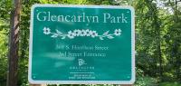
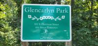
Beautiful and secluded 95.5 acre Glencarlyn Park offers a host of family activities including two picnic shelters, nature trails, connections to Four Mile Run and W&OD trails, two playgrounds, Long Branch Nature Center and a nearby dog park (closes at sunset). Also located at Glencarlyn Park (4955 Columbia Pike) you’ll find a learning loop for young cyclists, a water bottle filler, a bike repair station and a rain garden. [From the official park web page .]
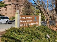
Long Branch Nature Center in Glencarlyn Park features exhibits, a children’s Discovery Room, live animal displays, interpretive gardens, a viewing pond, space for birthday parties and a Nature Discovery Area. The Center hosts year-round programs and special events, including story times, campfires, invasive plant removals and nature walks. Long Branch stream flows through the woods, past two ponds full of frogs and turtles. Long Branch’s wooded stream valley is home to a diverse population of wildlife including raccoons, foxes, flying squirrels, salamanders and more. A wide variety of butterflies and other invertebrates are also found. [From the official nature center web page .]
In 1994 the Glencarlyn community published " Glencarlyn Remembered: The First 100 Years ."
Another great resource is History of Glencarlyn Park and Long Branch Nature Center published by the Arlington Historical Society in 1985.
Also feel free to visit the Wonderful Trees of Glencarlyn self-guided tour storymap and the Glencarlyn Neighborhood Tour .
TOUR MAP
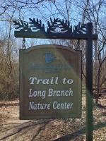
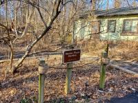
Trailhead to Nature Center
A short footpath heads from the end of S Jefferson Street downhill to the Long Branch Nature Center.
Public Access Footpath to Meadow
From the gravel southward extension of S Illinois Street a public path angles to the right to access the Meadow from 5th Street S.
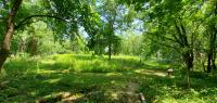
The Meadow
This area is a managed wildlife meadow, part of the Nature Center. This plot of land was rescued from development by a community purchase in 1970 and purchased by the County in 1971 to add to the park. Neighbors mow a loop path around the meadow.
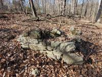
Site of the Old School, in the Park just east of the end of 4th St
A few foundation stones remain at this site of the old community school, which was abandoned after approximately 1916. The northeast and southeast corners are visible from the unpaved unofficial trail that parallels S Harrison St between 3rd and 4th.
3rd Street Park Vehicle Entrance
This vehicle entrance leads to Pavilion 2, which has EXTREMELY limited parking. The road is steep, winding, and narrow. Consider parking at the nearby Overflow Parking lot. There is NOT a vehicle connection from Pavilion 2 to Pavilion 1 and the Dog Park, which must be accessed from 4th Street.
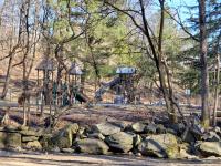
Glencarlyn Old-Growth Forest
A section of old trees in the park has been designated as the "Glencarlyn Park Old-Growth Forest" by the Old-Growth Forest Network.
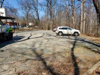
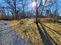
Overflow Parking area
Gravel lot provides additional parking and park access.
4th Street Park Vehicle Entrance
This road leads to Pavilion 1, a general picnic area, and the Dog Park. The road is steep, winding, and narrow. A fair amount of parking is available. There is NOT a vehicle connection between sites accessed on this road and Pavilion 2 which is accessed from 3rd Street.
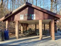
Picnic Pavilion 1
Also more tables along Long Branch nearby. Some limited parking. Accessed by a narrow, steep, curving road off 4th Street S.
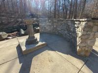
George Washington Survey Point Monument
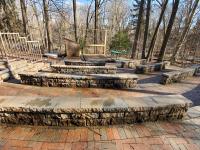
The monument is where once stood a White Oak tree that George Washington used as a survey point by the confluence of Long Branch and Four Mile Run. A section of the long-gone oak tree is in the Library. The monument was erected by the Daughters of the American Revolution in 1914, bearing the inscription "On this spot stood an Oak Tree bearing a survey mark made by George Washington, which became a monumental survey mark named in many deeds." A modern wall was built to help protect against flooding.
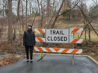
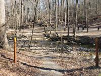
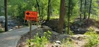
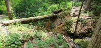
Washed-out Footbridge 1
Unfortunately this footbridge was washed away in catastrophic flash flooding July 8, 2019. At this writing our understanding is that Arlington County plans to rebuild this bridge, targeted for 2022.
Glencarlyn Dog Park
Parking is very limited. But there is more parking near Picnic Pavilion 1.
Glencarlyn Park Playground
This new playground is accessed by the Four Mile Run paved trail. The W&OD Railroad Trail also passes just above.
Washed-out Footbridge 2
Unfortunately this footbridge was washed away in catastrophic flash flooding July 8, 2019. At this writing it appears that Arlington County does not plan to rebuild this bridge.
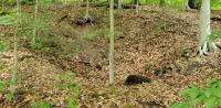
The Glencarlyn Mystery Pit
This is, literally, a hole in the ground along the Four Mile Run trail. It's unknown who made it, when, or why. But it is fairly large and deep. Civil War remnant? Mining prospect pit? Meteor crater? If anyone knows more about it, please let us know!
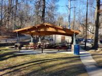
Picnic Pavilion 2
Recently rebuilt, the site of the famous annual Glencarlyn Pancake Breakfast. A bathroom is adjacent. Parking is very limited. Access is by a steep, narrow, curving road from 3rd Street S.
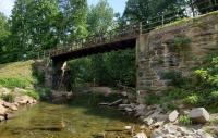
W&OD High Bridge over Four Mile Run
The Washington and Old Dominion (W&OD) Railroad was built in the 1850s and operated intermittently from 1859 through 1968. Dominion Energy acquired the right-of-way and runs transmission lines along much of its length. The Northern Virginia Regional Parks Authority (NoVA Parks) acquired rights in 1977 and established the W&OD Trail for walkers, runners, and bikers that extends almost 45 miles from Shirlington to Purcellville. These bridge abutments date in part to the 1800s but of course the current bridge structure is recent. See more at History of the Trail.
Confluence of Lubber Run and Four Mile Run
Tucked away a few feet from the W&OD, Lubber Run flows into Four Mile Run here.
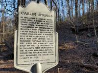
Carlin Springs
This is the original site of the Carlin Springs. Remnants of old springheads are located near the historical marker.
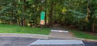
2nd Street Walk/Bike Park Entrance
This paved trail entrance point offers the most direct access to the W&OD Trail and the historic Carlin Springs site. Warning: VERY steep grade!
Unnamed Intermittent Stream
This tiny stream descends from the corner of 2nd Street S and S Jefferson to flow past the Carlin Springs into Four Mile Run. The deep gorge it has cut demonstrates the impacts of heavy rains and excessive runoff from all the impervious surfaces above in the neighborhood. The water has eroded deeply until it has reached resistant bedrock.
Entrance to Nature Center access road
At the bottom of the hill on S Carlin Springs Road, an access road leads both to the medical offices and to Long Branch Nature Center. The road is narrow (one lane in places) with limited sight lines and wildlife and pedestrians.
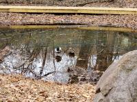
Willow Pond
This little pond is a man-made vernal pool. In the early Spring it is a hot spot for breeding amphibians, especially Wood Frogs. The pond is allowed to dry out in the late summer to keep invasive species out.
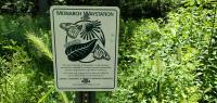
Monarch Waystation
A small native plant meadow across the access road from Willow Pond.
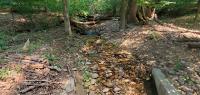
"Salamander Creek"
This small stream is informally named Salamander Creek. It is fed by the Moses Ball Spring and a headwaters with the storm sewer system near the intersection of 5th Road S and Kensington. The stream empties into Long Branch and provides the water source for Willow Pond. The access road to the Nature Center bridges the creek near Willow Pond.
Long Branch Nature Center parking lot
The parking lot has about 20 spaces and does fill on busy days. The pay parking garage for the medical offices closer to S Carlin Springs Road can be used for overflow parking.
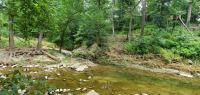
Long Branch Stream
Long Branch stream runs in a generally west-to-east direction from its headwaters approximately underneath the Home Depot at Seven Corners to its confluence with Four Mile Run in Glencarlyn Park. Much of the western portion is channelized within a concrete canal, ending before it enters Arlington County and passes under S Carlin Springs Road. The stream goes through 2 large culverts under the road and enters the scenic "Long Branch Gorge" in between Campbell Elementary and the medical offices and garage. Much of the lower stream is lined with large boulders called rip-rap that were brought in to help reduce erosion during floods. Flash floods are frequent because so much of the watershed is roofed and paved over. The lower part of the stream from near the Long Branch Nature Center building and downstream to near the dog park has several small but pleasant mini-waterfalls. There are 2 low concrete bridges for the walk-bike path that parallels the stream. Arlington has a separate, unrelated "Long Branch" in the southeastern part of the county.
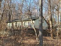
Long Branch Nature Center
The original building was the residence of Ida Mae Hickman, who was known in the neighborhood as "The Bird Lady." She was a pioneer wildlife rehabilitator and co-author of Care of the Wild Feathered and Furred, originally published in 1973. The County bought the home and 6 acres from Mrs. Hickman and her husband during the period 1963-66. The County appropriated $30,000 to develop the residence into the county's second nature center (after Gulf Branch). The Center was dedicated in November 1972. The building houses wildlife exhibits, and pre-school indoor playroom, offices, a classroom, and wildlife rehabilitation facilities specializing in turtles.
Native Wildflower Garden
Nature Center staff and volunteers, including Master Gardeners and Master Naturalists, maintain this garden of native plants that are attractive to pollinators and other wildlife.
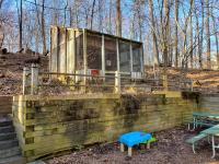
Bird Enclosure
This enclosure behind the nature center building currently holds Aggie the Fish Crow.
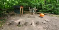
Long Branch Nature Center Amphitheater
Also has a fire pit for park-organized campfire events. Rebuilt circa 2018. This site also was the historic "Drop Site Lewis" in the infamous Robert Hanssen spy case.
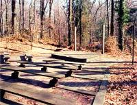
Drop Site Lewis for Spy Robert Hanssen
This is arguably Glencarlyn's most infamous site! In February 2001 two Russian agents hid $50,000 in used $100 bills under the rear left corner of the stage at the old Long Branch amphitheater. This was intended to be a payment for their spy, Robert Hanssen, who himself worked for the FBI. This site was called "Drop Site LEWIS." The FBI retrieved the money, did evidence work on it remotely, and then put it back and kept the location under surveillance. Ultimately Hanssen never retrieved his money and was arrested when he was observed hiding classified documents for the Russians at a different drop site.
Poplar Pond
This pond is a popular spot for watching turtles, frogs, and dragonflies in warm weather. It has a small boardwalk and two viewing platforms. It does have a problem with invasive, non-native Goldfish and we ask visitors NOT to add anything else to the pond. And please don't feed the wildlife.
Young Children's Play Area
A small nature play area for very young children a few feet from the Nature Center building near the Long Branch stream. There are two musical devices for children (or adults) to play with. And a blackboard and sand pit.
"Dome Home"
Dome Home was a temporary artwork built in 2011. One photo from summer 2014 shows the remains of two domes which already are decomposing and washing away, as intended. Ten years later, only the sign remains.
Unnamed Intermittent Stream
An unnamed intermittent stream flows (sometimes) starting from behind the houses on the 500 block of S Jefferson St and below the Meadow southward to just west of the Nature Center building and into Long Branch.
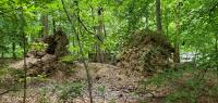
Tree Walls
Our area has been hit by a number of major storms, including Hurricane Isabel in 2003 and the derecho in 2012, plus various strong thunderstorms. These events have brought down many large trees in the park, some snapped off, many others uprooted. When a large tree is uprooted, it can leave a pit in the ground and a "wall" of its spreading root system attached to the fallen trunk. A good example is two trees that the derecho brought down above the nature center building. The exposed soil provides nesting habitat for small native bees which are important pollinators.
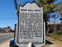
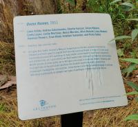
Moses Ball Grant Historical Marker
[Need description although the marker text is pretty self-explanatory]
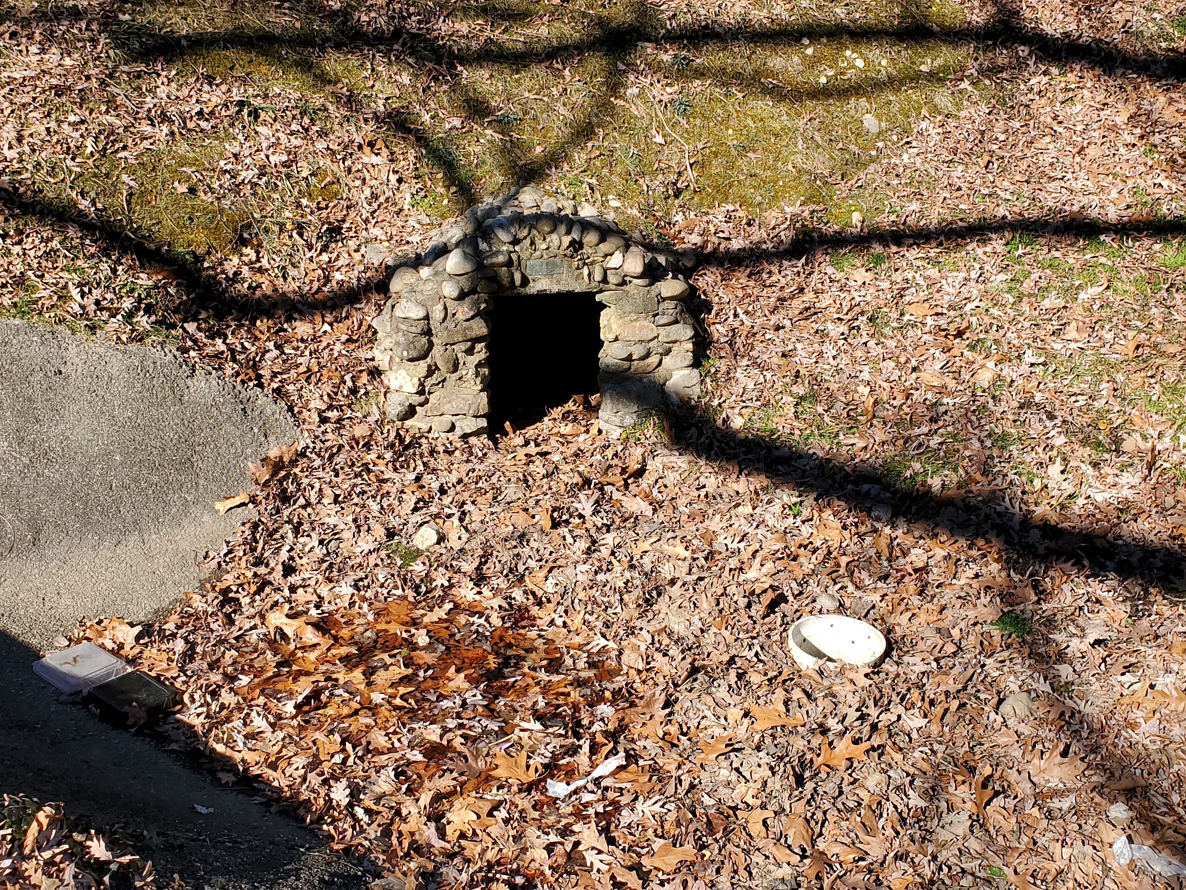
Moses Ball Spring
This obscure site is on the grounds of the former Northern Virginia Doctors Hospital/Virginia Hospital Urgent Care facility, now owned by Arlington County. The Glencarlyn community built the little spring house structure and placed the small plaque, sometime in the early 20th century. The spring was water source for Moses Ball's cabin nearby, possibly in the vicinity of today's 5700 block of 5th Road S, circa 1745. Moses Ball Spring is a water source for "Salamander Creek" which flows into Long Branch at the bottom of the hill. The plaque reads: "In memory of Moses Ball who patented this land 1748 1717-1792".
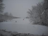
The Sledding Hill
This grassy hillside on the east side of the former hospital and current medical offices has been a popular (unofficial) sledding hill for decades!
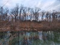
Sparrow Pond
Before around 2002, this site was known as Sparrow Swamp. Over the last 20 years, at least 3 different groups of beavers have built dams here, with a family present for much of 2021. A "beaver baffle" system was installed to keep the water level from rising too high and threatening the W&OD Trail embankment. A stormwater mitigation project in 2002 rebuilt the area to capture sediment runoff and keep it out of the Chesapeake Bay watershed. In the near future (2022-23?) a new project will rebuild the site and remove the large amount of sediment that has accumulated and silted up the pond. A good site for wildlife viewing and there is a small observation platform along the W&OD Trail.
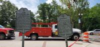
Arlington Mill and Barcroft Historical Markers
[Need description]
W&OD Trail Learning Loop
An exercise area and learning loop for beginner bicyclists along the W&OD by Columbia Pike.
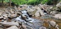
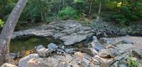
Huffman's Falls, also known as Huffman's Whitewater
This is a nice little waterfall on Four Mile Run with a total drop of about 8 feet. While it isn't Great Falls, it's still a cool natural feature to have right next door.
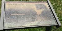
Glencarlyn Station W&OD Trail Marker
The marker notes the approximate location of the old Glencarlyn Station along the W&OD Raiload. It can be noted that Route 50, Arlington Boulevard, did not exist until long after the station was gone. The marker is aged and needs replacement. The legend reads:
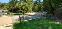
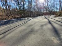
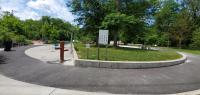
Parking Lot and Park Access Point on N Carlin Springs Rd
Convenient access point near the intersection of N Carlin Springs Rd and Route 50. The parking lot has spaces for close to 20 cars.
Potential future enhancements --
a house/architecture-focused tour;
a history-focused tour;
a "gardens, etc" tour;
focus on Long Branch Nature Center and Glencarlyn Park;
more on trees;
playing fields and the pool;
bridges
Other ideas?