Wilderness Orientation
Wilderness Orientation in Barbershop Canyon and Haigler Canyon
Prescott College offers a three-week backpacking trip for orientation. This shows what to expect in the Barbershop and Haigler route, it also includes...
Some other important and fun things
- What is Wilderness Orientation?
- Who will be your Instructors/Leaders?
- A large map overview
- The drive to the start: Barbershop Canyon
- Ecological regions
- Map of Barbershop Canyon and Haigler Canyon
What is Wilderness Orientation?
The college has been putting on Wilderness Orientation for 50 years. Now the college offers Wilderness, Community-Based, and Hybrid Wilderness and Community-based orientations.
Who will be your Instructors/Leaders
Prescott College has many alumni who return to instructor Wilderness Orientation. Sometimes students will co-instruct Wilderness Orientation as well, for a graduation requirement. There will always be two instructors, sometimes there can be three instructors.
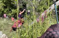
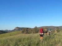
You will mostly be in a group of 8-12 incoming students.
Left to right. Brenna student instructor, students, lead instructor Gabby.
Large Map Overview
Prescott College is located in Prescott Arizona.
Prescott College Wilderness Orientation: Gear Basics
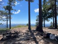
The Drive to Barbershop Canyon
01 / 05
1
Traveling on Indigenous lands
Wilderness Orientation happens on the unceded lands of the Yavapai-Prescott Indian, Yavapai-Apache, and Tonto Apache tribes.
2
Prescott
Jumping off point! A view of Granite Mountain and Madrean pine-oak woodlands outside of the city of Prescott.
Roads you will take:
Main road out of Prescott 69-169 rd.
169 - I-17hwy. Note I-17 is also a way to get to Flagstaff or South to Phoenix.
I-17-260 going to the small towns of Strawberry, Pine, and Payson.
United States Forest Service Rd 95
3
Camp Verde
Driving from Prescott to Camp Verde you will see grassland and descend from the Black Hills into the Verde Valley at 3,147 ft.
The Verde starts north of Prescott and provides water to this region. It is a free-flowing river! The city of Prescott is in it's watershed. Keep your eyes out for the Verde River.
4
Payson
Is the last town you will pass through before you start your trip. It is at the same elevation as Prescott. It is also on the edge of the Mogollon Rim.
5
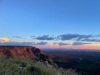
Mogollon Rim
During Wilderness Orientation the instructors will go over the landscape you are traveling in. The route starts atop the Mogollon Rim , on the Colorado Plateau, and ends below it.
Ecological Regions
You will be driving through five different ecological regions of Arizona to get to Barbershop Canyon!
- Prescott and Payson -Madrean Lower Montane Woodlands
- Prescott Vally- Chino/Coconino Grasslands and Shrub-Steppe
- Camp Verde Lower Mogollon Transition
- Driving and hiking Montane Conifer Forests
- Driving and hiking Mogollon Transition Conifer Forests
Map of Ecoregions. Yellow line represents the drive to the starting point of Wilderness Orientation.
Map of Barbershop Canyon and Haigler Canyon
The Beginning
Settling into Backcountry Life
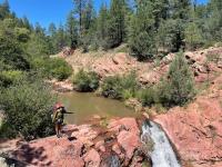
Creek Walking
Big trees and ferns in AZ!
Community

Group Map Briefing
Academic Work
Camps
On the Mogollon Rim
Taking it all in, or maybe a nap.
Time for enjoying
Re-Supply
Entering New Terrain!
Pack Swiming
Creek Walk or Bushwhack
At this point, you might have many questions.
Passing by small communities
Hiking out of the Tonto Canyon
Camp
Safety
Hells Gate
Haiger Canyon
Expect a lot of pack swimming
Canyon Miles
Marsh Creek
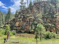
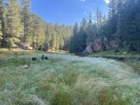
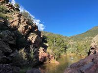
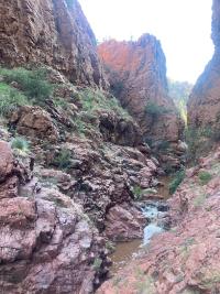
The Beginning
Wilderness Orientation starts at the confluence of East Clear Creek and Barbershop Canyon
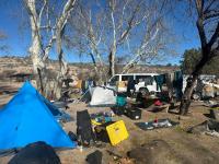
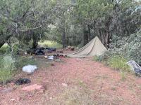
Settling into Backcountry Life
The instructors will go over the group functions and responsibilities of camp and group living the first night or two.
Cooking group meals. Provided by college.
Stove Safety
How to set up a tarp for shelter
Purifying water
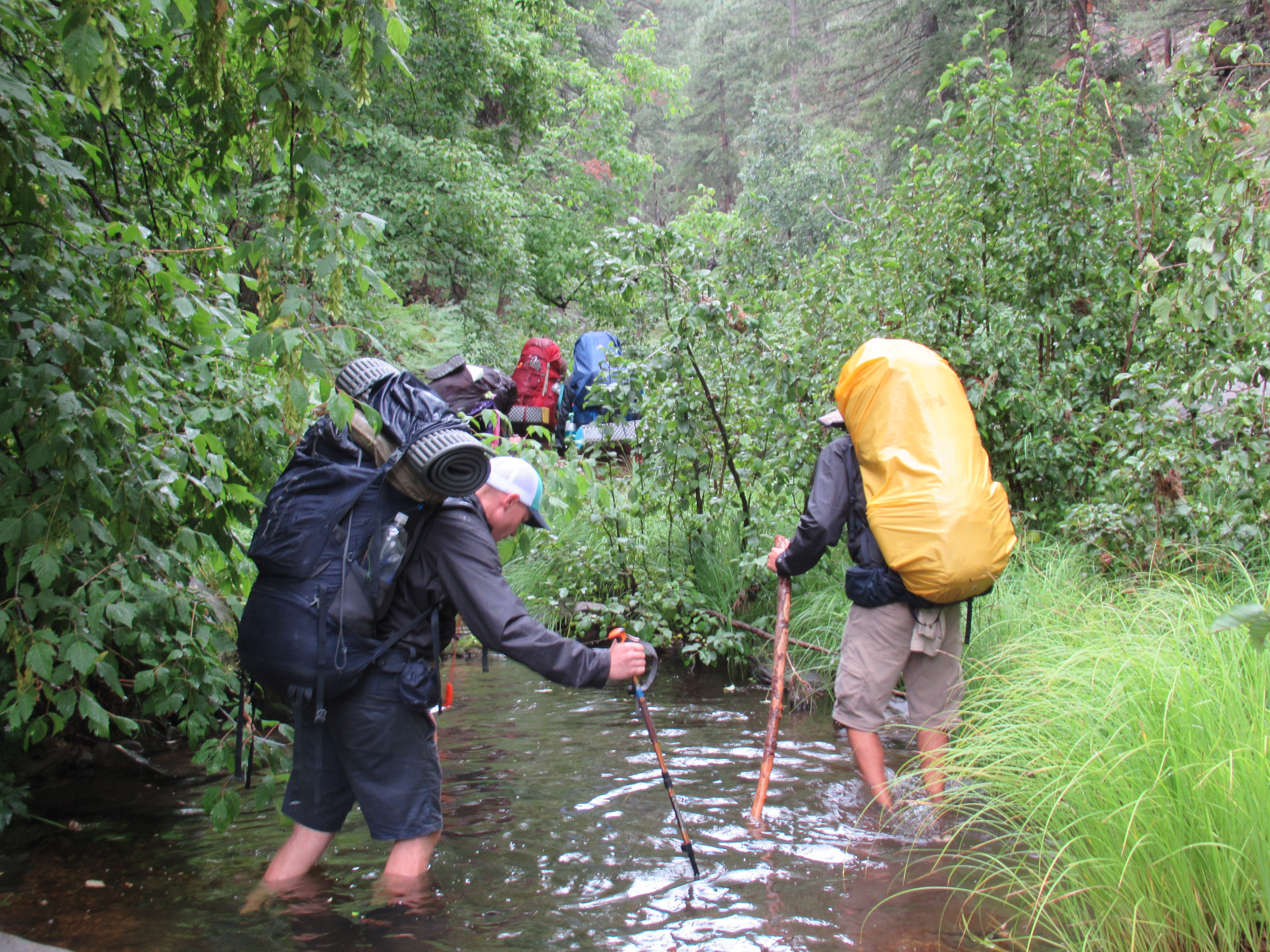
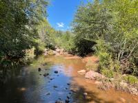
Creek Walking
Barbershop Canyon has mostly a trail through the entire canyon. Due to being in a canyon, there is normally a creek to cross. This is the first part of the trip, which has many creek crossings- you get your feet wet! The next part of the trip has pack-swimming... more about that later.
Big trees and ferns in AZ!
The geology, flora & fauna, amount of moisture, and cool night temperatures might not be what you'd expect if you haven't been to AZ before. Turns out AZ isn't just cacti and sand.
Community
At camp there is time to get to hangout with students, instructors, or take time for yourself.
Group Map Briefing
Every morning you will go over the map as a group and throughout the day to keep on course.
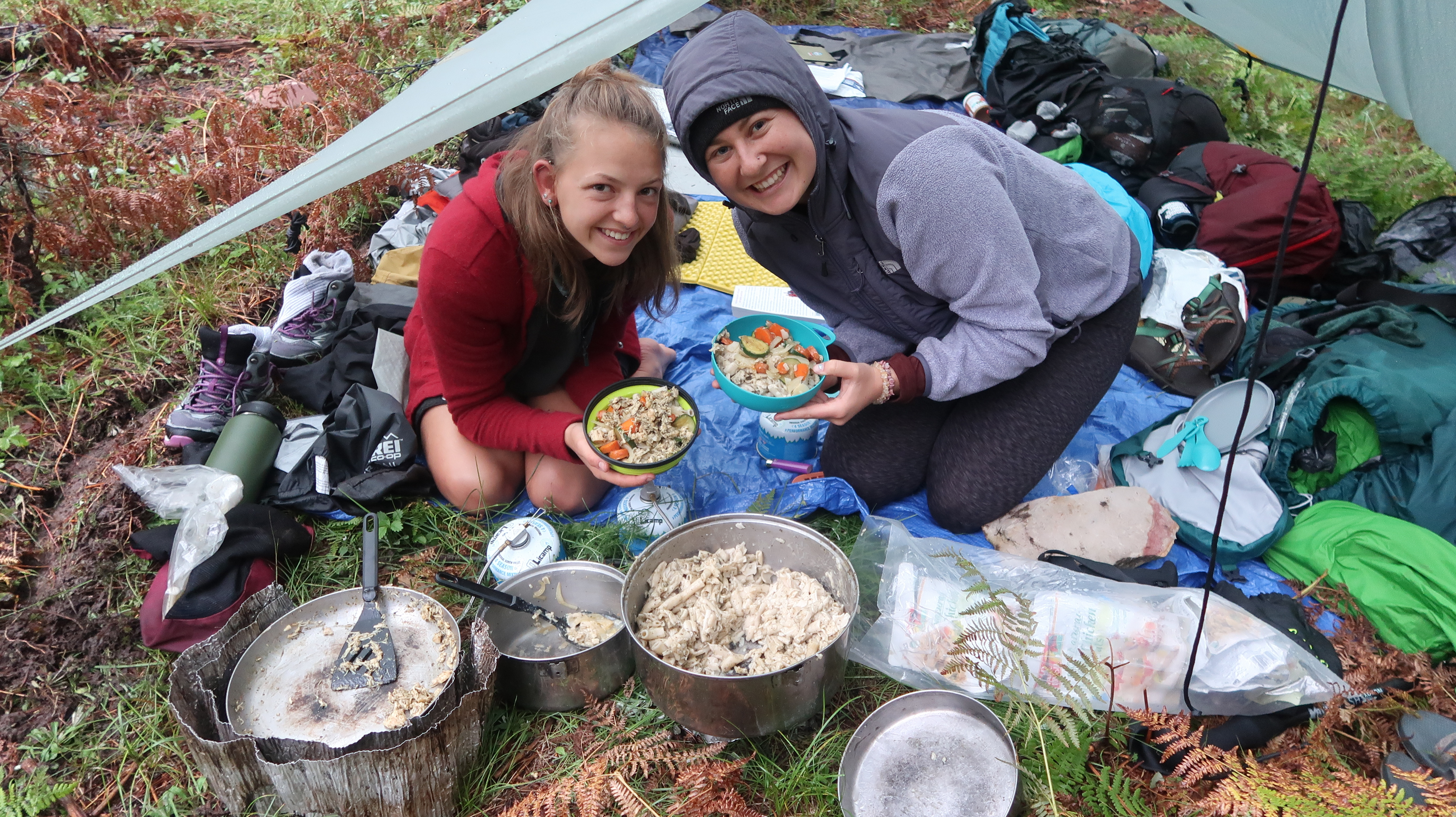
Academic Work
Students will have to take notes on the presentations the instructors give. Students will be preparing and delivering presentations that are relevant to Wilderness Orientation and personal interests. There will also be some additional readings and discussions. Students will keep track of their educational journey in portfolios.
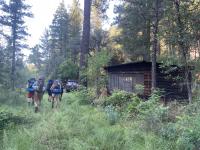
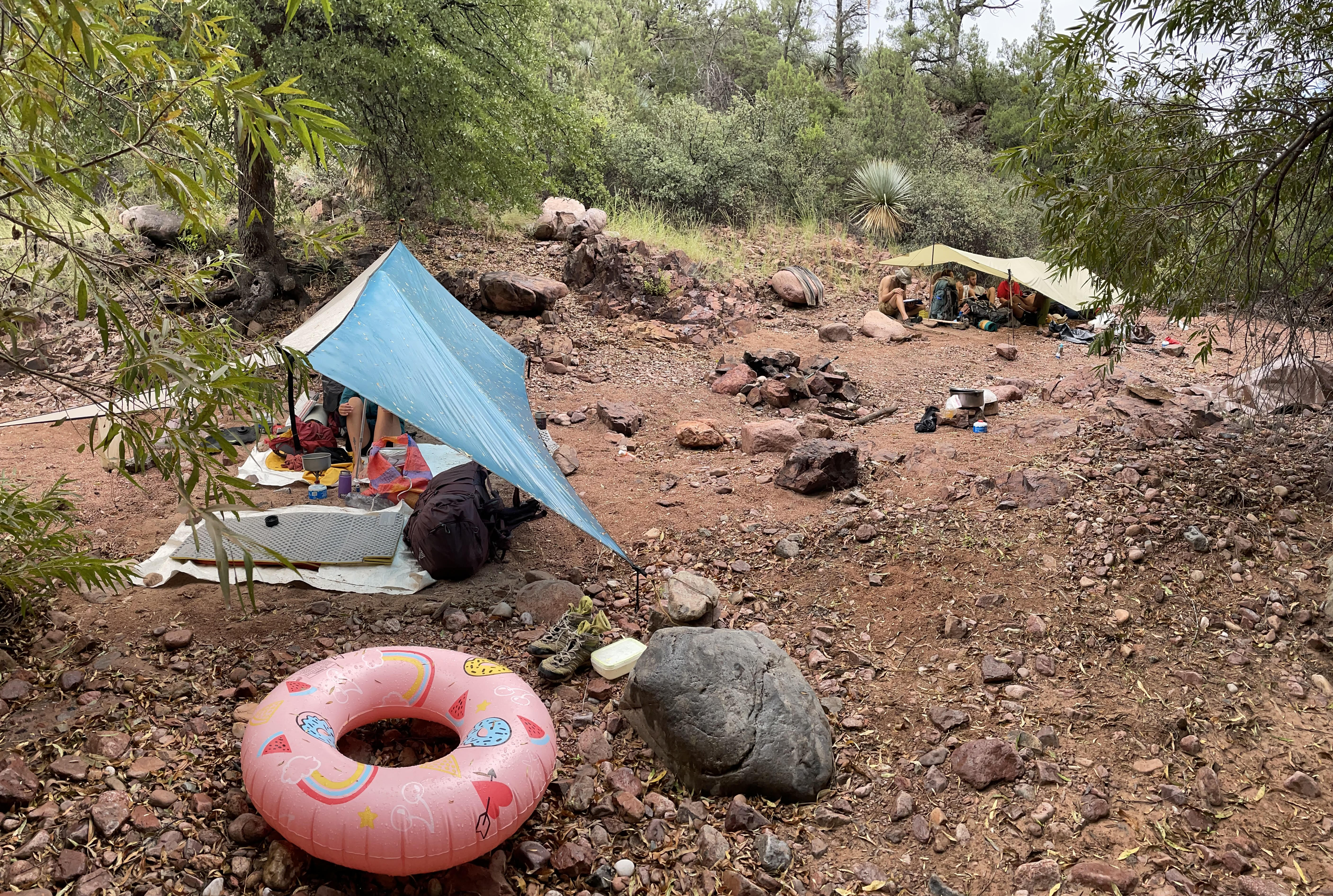
Camps
Camps are found every night. The first few nights the instructors will find the camps. Later on, the students who are The Leader(s) of the Day (LOD) will find camp.
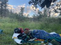
Students have the option to sleep under the tarp or out under the stars.
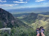
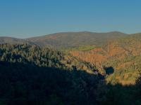
On the Mogollon Rim
The Mogollon Rim is a prominent landmark along the route and one that nearly spans across the entire state.
Taking it all in, or maybe a nap.
The Mogollon Rim is the geographic southern edge of the much larger Colorado Plateau; the views from the rim are spectacular!
Time for enjoying
The rim marks a notable benchmark in your trip worth celebrating. You're almost to resupply!
Re-Supply
A layover day. This happens halfway into Wilderness Oriteantion. A box of food and supplies you made for yourself during preparation week will be given to you for the second half. A great big dinner will be made for you and your group!
Entering New Terrain!
This next part of the trip is in Tonto Canyon, which will ultimately lead you to Haigler.
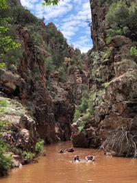
Pack Swiming
Pack swimming is a part of this route. Your backpack will be lined with large garbage bags to keep your things dry. The backpack will also help float you, as it acts like a giant air bubble. The instructors will facilitate how to pack swim and make sure people are comfortable and safe.
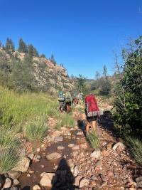
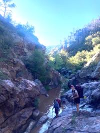
Creek Walk or Bushwhack
Students will take turns leading the group through the canyons. They will be developing route finding and map reading skills.
At this point, you might have many questions.
Some can be answered! Some questions can not be answered due to the variability of weather, people, pace, gear, cool things to stop and look at etc. Wilderness Orinatation is different for every group.
Passing by small communities
The Barbershop/Haigler route passes through the small communities of Bear Flat and Kohl's Ranch.
Hiking out of the Tonto Canyon
This the part of the trip that is called "overland", meaning we walk out of the canyon on higher lands.
Camp
You might still be working on how tarp set up works... and that's ok!
Safety
Instructors are certified Wilderness First Responders. They carry satellite communication and check-in with the college frequently.
Hells Gate
Students have the opportunity to participate in a Solo camping experience. It is a good time to reflect, do school work, journal, sleep, or whatever you need; it is your time.
There is a safety protocol in place regarding solo.
Haiger Canyon
There is no trail in this canyon. It is also a constricted canyon, or "slot" canyon, where instructors are on the lookout for flash floods.
Expect a lot of pack swimming
Depending on the weather sometimes the water can be nice and refreshing or it can be a little chilly.
Canyon Miles
Canyon miles are slow going; there is no trail and there are many rocks to maneuver around.
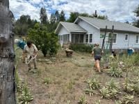
Marsh Creek
Orientation will end at Marsh Creek Ranch- a private ranch deep in the Tonto National Forest. Students will help with any work on the property and eat a delicious meal and have time to hangout.
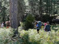
Sunflowers and Hikers
Hope this helped in understanding Wilderness Orientation in Barbershop Canyon and Haigler Canyon.
Food Shopping
Helpful Links
- Prescott College Orientation
- Fall Wilderness Orientation Gear List


