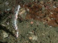
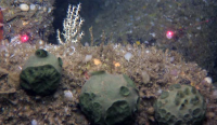
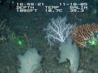
Characterizing U.S. Deep-Sea Corals and Sponges
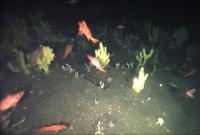
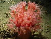
Imagine a world of total darkness and numbing cold. It may be difficult for sun-loving humans to believe, but certain hardy beings can not only survive, but thrive in such an environment. Lush coral reefs are an example of animals that flourish in this type of habitat found 10,000 ft (3,000 m) below the ocean’s surface.
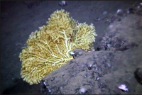
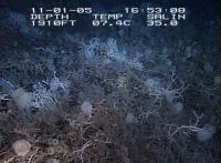
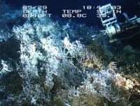
Source: NOAA Okeanos Explorer Program
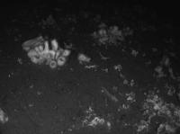
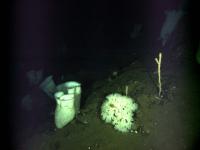
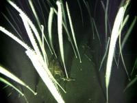
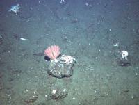
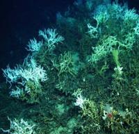
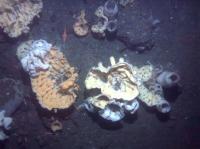
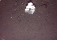
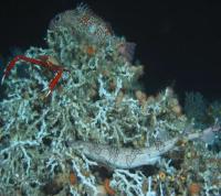
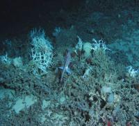
Deep-sea corals and sponges live mostly unseen and untouched by humans at ocean depths of at least 164 ft (50 m), though most species are found several hundreds of feet deep. As they live in a dark, desolate setting, it would be easy to assume that these organisms would have a drab appearance to match their surroundings. However, most of them come in a variety of beautiful colors—purple, red, blue, gold, pink, and orange to name a few. With over 3,000 identified species of deep-sea coral and 4,000 species of sponges worldwide, they are clearly a major part of the ocean ecosystem.
Crucial Corals and Sponges
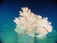
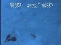
Deep-sea corals and sponges can live for hundreds or thousands of years, and most grow extremely slowly. Once damaged, corals and the communities they support may take centuries to recover, if they recover at all. They are vulnerable to disturbances from fishing, mining, and toxic waste dumping that happen on the seafloor. Additionally, ocean acidification, a result of the ocean absorbing increased carbon dioxide, can affect corals’ ability to grow and maintain their structures.
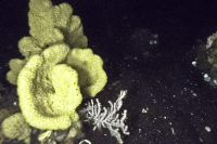
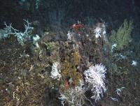
Source: NOAA Okeanos Explorer Program
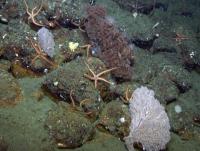
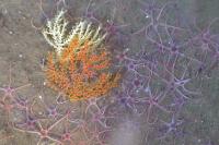
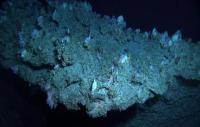
While most of us may never have the chance to see these deep-sea corals and sponges in their natural setting, it’s still in our best interests to protect them from harm. They provide a vital habitat for numerous fish and invertebrate species, including commercially important grouper, snapper, sea bass, rockfish, shrimp, and crab. Deep-sea corals and sponges are also home to organisms that produce chemicals with great potential for biomedical uses.
Exploring the Deep
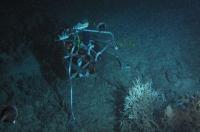
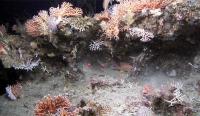
Though scientists have discovered deep-sea coral and sponge habitats on continental shelves, slopes, canyons, and seamounts, their full geographic extent is still unknown. NOAA’s Deep Sea Coral Research and Technology Program (DSCRTP) studies and provides scientific information needed to conserve deep-sea coral and sponge ecosystems. This information is also necessary in order to manage these ecosystems and the human activities surrounding them.
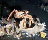
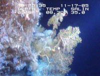
Source: NOAA Okeanos Explorer Program
One of the efforts of NOAA’s DSCRTP and its partners is site characterization, which describes the biodiversity, habitats, populations, communities, and ecological processes of a particular area. Using diving robots, camera systems, and seafloor mapping sonar, scientists explore, study and compile a summary of each site, which can be viewed throughout this StoryMap.
Dive in to explore a fascinating and significant piece of our ocean’s ecosystem. In the following regional sections, you’ll find site summaries, images, and maps of our vitally important deep-sea coral habitat. Whether you’re a research scientist or simply an ocean lover, you’ll find a plethora of coral data to look at.
An interactive map of site characterizations that are highlighted in this StoryMap. Zoom in to view deep-sea coral and sponge observations.
Each region in this StoryMap is displayed as a "map tour". Explore the site characterizations by either clicking on the thumbnail images, or on the points on the map. When a site characterization is selected, the map will zoom in to that area. Return to the main map by clicking the "X" button. For reference, deep-sea coral and sponge observations are shown as black circles, or dots.
Alaska
Aleutian Islands
The central and western Aleutian Islands may have the most abundant cold-water coral and sponge communities in the world. Covering 64,415 square kilometers, the islands stretch westward from the Alaska Peninsula across the North Pacific Ocean. The chain of islands comprises a series of active volcanoes with a relatively deep continental shelf (250 meters).
Dominant currents on the south side of the islands include the Alaskan Stream and the Alaska Coastal Current (ACC), which flow westward, as opposed to the eastward flowing Aleutian North Slope Current on the north side of the islands in the Bering Sea.
A naturally occurring faunal division in fish and invertebrate species occurs for abundance and diversity near Samalga Pass (170° W). To the west of Samalga Pass, deep-sea coral and sponge diversity and abundance are greater than many other comparable locations around the world with 104 coral or subspecies of coral (104 coral taxa in the Aleutians, 62 are found nowhere else in Alaska, 50 of 62 have complete taxonomy), of which 34 are endemic, along with 136 confirmed species or subspecies of sponges ( Stone et al., 2023 ).
Akutan Island to Samalga Pass
Samalga Pass to Seguam Pass
Seguam Pass to Amchitka Pass
Amchitka Pass to Buldir Pass
Buldir Pass to Near Pass
Bowers Bank
Akutan Island to Samalga Pass
- Fish: Eelpouts (family Zoarcidae), Irish Lords (family Cottidae), and rockfishes (Sebastes sp) were the most observed fishes by far.
- Corals: Corals, hydrocorals, and sea whips were identified with five species of the Acanthogorgiidae being the most abundant. Stylasteridae was only present at the western edge of the region.
- Sponges: Sponges were the most abundant with the most representatives among the Demospongiae and Hexactinellida.
Samalga Pass to Seguam Pass
- Corals: Primnoid coral were the most abundant coral. Stylasterids and plexaurids were the next most abundant. Keratoisididae was only present on four deep transects and Antipathidae was not observed at all. Stylasteridae occurred at 29 stations.
- Sponges: Demospongiae and hexactinellids were evenly distributed. Demospongids represented 99% of the sponge density.
- Fish: Rockfishes (Sebastes sp.) were the most noted species. Atka mackerel (Pleurogrammus monopterygius), sculpins, and flatfishes were also observed.
Seguam Pass to Amchitka Pass
- Corals: Sea whips occurred across the region. Primnoid and plexaurid corals were noted west to east while Paragorgiidae and Acanthogorgiidae corals were found towards the west. Stylasterids were also identified throughout the region.
- Sponges: Sponges were the most abundant organism found with Demospongiae occurring at 35 of the 36 transects.
- Fish: Rockfishes (Sebastes sp.) were the most dominant fish observed.
Amchitka Pass to Buldir Pass
- Corals: Primnoidae coral were the dominant vertical invertebrate habitat observed. Primnoids and plexaurids were the most common coral, noted at every surveyed area. Acanthogorgiidae coral were also relatively common with stylasterid coral evenly distributed throughout.
- Sponges: Demosponges were the most common sponge group, present at every surveyed area. Hexactinellids were thee next more common.
- Fish: Rockfishes were the most abundant fish observed followed by Atka mackerel (Pleurogrammus monopterygius), and searchers/ronquils (Family Bathymasteridae).
Buldir Pass to Near Pass
- Corals: Stylasterids were the most common structure-forming coral. Plexauridae and Primnoidae were distributed around Attu Island and south of Agattu Island.
- Sponges: Demospongids were the common structure-forming sponge. Calcarea occurred infrequently. Hexactinellids were frequently observed in the north.
- Fish: Rockfishes (Sebastes sp.) outnumbered all other fish and other mobile megafauna in the region.
Bowers Bank
- Corals: Primnoidae provided over 50% of the structure-forming invertebrates. All regularly occurring types of coral observed throughout the Aleutians were observed here. Antipathid (black corals) were only found on Bowers Bank. Stylasteridae coral were found to the north and south of Bowers Bank middle region.
- Sponges: Demospongiae and Hexactinellida co-occurred frequently, with demospongids the most common structure-forming type.
- Fish: Rockfishes (Sebastes sp.) were the most commonly noted fish group, seconded by grenadiers (Subfamilty Macrourinae) and searchers/ronquils (Family Bathymasteridae).
Bering Sea
The Bering Sea is known for its booming fishing industry. Over 300 fish species call this area home with 50 deep-sea commercial species, of which 25 are fished at high rates. The salmon, cod, herring, halibut, flounder, and pollock industries generate the highest revenue of fisheries in the region.
There is an abundance of life throughout the Bering Sea canyons from numerous major taxonomic groups of fish and crab species -- Chionoecetes crabs, grenadiers, and rockfish being the most common.
Bering Canyon
Bering Canyon to Pribilof Canyon
Pribilof Canyon
Pribilof Canyon to Zhemchug Canyon
Zhemchug Canyon
Zhemchug Canyon to Pervenets Canyon
Pervenets Canyon
Bering Sea Shelf
Bering Canyon
- Corals: The only coral species found was Balticina sp., outnumbering most other benthic invertebrate organisms in this region.
- Sponges: Demosponges and glass sponges were observed in very small densities.
- Fish and Crabs: Eelpouts (Family Zoarcidae), snailfishes (Family Liparidae), giant grenadiers (Subfamily Macrourinae), and poachers were observed the most frequently. Only 2 crustacean groups were observed, golden king crab and Chionoecetes sp.
Bering Canyon to Pribilof Canyon
- Corals: Balticina coral was the only coral observed over 2,000 times especially among vertical structures.
- Sponges: Demosponges dominated sponge sightings followed by a single observation of a glass sponge.
- Fish and Crabs: Over 20 fish species were observed, dominated by eelpouts and snailfishes. The most dominant crustacean were Chionoecetes sp. crabs.
Pribilof Canyon
- Corals: Plumarella sp were the most observed coral followed by Isdidae coral by a distant second.
- Sponges: Sponges were the most abundant with the most representatives demosponges chief among them with more than 4,400 noted occurrences. Hexactinellid glass sponges trailed very far with 290 occurrences.
- Fish and Crabs: The most abundant species was the Golden king crab (Coryphaenoides cinereus) followed by eelpout (Family Zoarcidae), snailfish (Family Liparidae), and Chionoectes crabs.
Pribilof Canyon to Zhemchug Canyon
- Corals: Four coral groups dominated this section of the expedition: Balticina sp., Keratoisididae, Plumarella sp., and Swiftia sp.
- Sponges: Sponges were the most abundant with the most representatives among the Demospongiae and Hexactinellida. Balticina sp. were the most abundant.
- Fish and Crabs: Popeye grenadier (Coryphaenoides cinereus), sculpins, and eelpouts (Family Zoarcidae) were the most abundant fishes followed by Pacific ocean perch (Sebastes alutus).
Zhemchug Canyon
- Corals: Balticina and Swiftia sp. were the first and second most abundant coral taxa.
- Sponges: Sponge density outstripped corals by almost 2 orders of magnitude with nearly 10,000 individuals observed, predominantly demosponges and a very minor representation from glass sponges.
- Fish and Crabs: Pacific Ocean perch (Sebastes alutus), harlequin rockfish (Sebastes variegatus) were by far the most abundant. One of the least observed was the Atka mackerel (Pleurogrammus monopterygius). One of the only species of mackerel in Alaska that can survive extreme depths.
Zhemchug Canyon to Pervenets Canyon
- Corals: Only Balticina sp. were observed at similar abundances to the dominant sponge group with 195 recorded occurrences.
- Sponges: Demosponges were the most abundant at 239 individuals. The other living organisms in this category were just damaged sponges.
- Fish and Crabs: Twenty-three groups of crab and fish were observed in the region. Popeye grenadier was the most abundant fish trailed by eelpouts and sculpins. Chionoecetes were the most abundant crustacean group.
Pervenets Canyon
- Corals: Only Balticina sp. were observed.
- Sponges: Two groupings of sponge were found, demosponges and hexactinellid glass sponges two to three orders of magnitude, respectively, behind the coral abundances.
- Fish and Crabs: Popeye grenadier (Coryphaenoides cinereus), Chionoecetes crabs, and eelpouts were the top three groups of fish or crabs found.
Bering Sea Shelf
- Corals: Balticina willemoesi was the most abundantly identified coral in the area and Balticina sp. were generally very common. Plumarella sp. were also frequently seen.
- Sponges: Demosponges were by far the most observed sponge groups.
- Fish and Crabs: Chionoecetes crabs were identified more frequently than any other fish or crab. Eelpouts were the most common fish group identified.
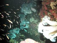
California
California coastal waters are characterized by the seasonal upwelling of cold, nutrient-rich bottom water that drives productivity. The California coast is the meeting point of cold northern California Current waters and warm southern waters coming from Mexico. This produces a dynamic environment where many different species converge.
California has a diverse assemblage of deep-sea geological features, including a number of rocky banks, seamounts, basins, and submarine canyons.
Bodega Canyon
Channel Islands NMS (2011)
Channel Islands NMS (2013)
Christmas Tree Black Coral Community
Cordell Bank NMS
Greater Farallones Expansion
Greater Farallones NMS
Greater Farallones NMS: Rittenburg Bank
Greater Farallones NMS: Cochrane Bank
Greater Farallones NMS: Farallon Escarpment
Piggy Bank AUV
Piggy Bank ROV
Bodega Canyon
Bodega Canyon is located west of the California town of Bodega Bay and is one of the significant features of the Cordell Bank National Marine Sanctuary (NMS). Bodega Canyon is a prominent seafloor feature that cuts across the continental slope and into the shelf north of Cordell Bank. The canyon is about 12.4 mi long and over 5,200 ft deep.
A broad-scale characterization of deep-sea coral/sponge habitats and communities was conducted in Bodega Canyon during late summer of 2011 using still photo observations from an autonomous underwater vehicle (AUV). Researchers enumerated a total of 310 corals and anemones, 469 sponges and 2,166 fishes.
Most abundant corals: Mushroom corals (Anthomastus ritteri), and various fan-like gorgonians (Parastenella sp. and Plumerella sp.).
Most abundant sponge morphotypes: Branching and vase sponges and potentially Asbestopluma spp.
Most abundant fishes: Varied greatly by dive, with different dives favoring flatfish (Dover sole, Microstomus pacificus and slender sole, Lyopsetta exilis), thornyheads (Sebastolobus sp.) and rockfish (Sebastes sp.).
Channel Islands NMS (2011)
The Channel Islands NMS is of significance due to its natural beauty and resources. It encompasses 1,470 mi 2 (1,110 nmi 2 ) surrounding Anacapa, Santa Cruz, Santa Rosa, San Miguel, and Santa Barbara Islands.
In 2011, the NOAA Ship Okeanos Explorer began their field season with a shakedown cruise through the Channel Islands NMS. The ship’s remotely operated vehicle (ROV) captured video observations of 4,118 species, including 271 corals, 264 sponges, 261 fish and 3,322 other invertebrates. The sea floor consisted mostly of soft sediment with occasional boulders and rock outcrops.
Most abundant fishes: Thornyhead rockfish (Sebastolobus sp.), brown cat sharks (Apristurus brunneus), and Dover sole (Microstomus pacificus).
Most abundant corals: Multiple sea pen species, Swiftia sp., and Paragorgia sp.
Most abundant sponges: Globular and columnar morphs.
Channel Islands NMS (2013)
In June 2013, Marine Applied Research and Exploration (MARE) conducted nine dives covering 22 km 2 in the Channel Islands NMS using the ROV) Beagle.
The Institute for Applied Marine Ecology (IfAME) at California State University-Monterey Bay was contracted to conduct a “first pass” through the video imagery to quantify the abundance/density of selected organisms. Of the 11,127 video frames:
Corals: Present in 1,713 frames; 491 contained hard corals, 69 contained soft corals, and 1,251 contained pens/whips.
Sponges: Present in 2,282 frames; 1,205 contained sponges ranging in size from 0 to10 cm, 1,168 contained sponges from 10 to 20 cm, and 537 contained sponges larger than 20 cm.
Christmas Tree Black Coral Community
In 2010, the NOAA DSCRTP initiated a three-year study to better understand corals in the Channel Islands NMS.
DSCRTP conducted a cruise that focused on the biology and ecology of the Christmas tree black coral and its use by demersal fishes on three deep offshore banks in the Sanctuary: Hidden Reef, Footprint, and Piggy Bank.
They identified at least 20 taxa of corals, 17 taxa of sponges, and 56 taxa of fishes from the quantitative transects on 11 dives conducted on Hidden Reef (21 fifteen-minute transects), Footprint (5 longer transects), and Piggy Bank (2 longer transects). They identified 1,543 corals, 3,300 sponges, and 18,357 fishes.
Most abundant corals: Christmas tree black coral, primnoid Plumarella longispina, and Lophelia pertusa. Most abundant fishes: Unidentified Sebastomus, squarespot, pygmy, and shortbelly rockfishes. Most abundant sponges: Vase, barrel, branching, and upright flat groups.
Cordell Bank NMS
The Cordell Bank NMS is a productive marine area off the west coast of California, north of the Gulf of the Farallones. The sanctuary is entirely offshore, with the eastern boundary 6 mi from shore.
In 2010, researchers used an ROV to survey potential deep-sea coral habitats in order to understand their value, collect specimens to confirm taxonomic identification, and to refine habitat classifications derived from multibeam sonar data.
They enumerated 697 individual corals from four taxa and 22 individual sponges from at least five taxa from nine quantitative segments. They also found 343 fishes from at least 28 different taxa.
Most abundant corals: Sea pens (Virgulariidae), and fan gorgonians (Plumerella longispina).
Most abundant sponges: Barrel and boot sponge morphs.
Most abundant fishes: Rockfish (Sebastes), hagfish, and flatfish.
Greater Farallones Expansion
In 2015, NOAA expanded the Cordell Bank and Gulf of the Farallones NMSs to create the Greater Farallones NMS. The Greater Farallones NMS is influenced by the Point Arena upwelling, which provides abundant underwater biological communities.
In 2014, scientists characterized the seafloor habitats, fishes and invertebrates by using an ROV) near Bodega Canyon and a rocky feature to the north, known as “The Football”.
20 transects: 9 at Bodega Canyon and 11 at The Football, at depths of 180 to 306 m.
Bodega Canyon: 30 taxa of fish, 6 coral taxa and 6 sponge taxa.
The Football: 34 taxa of fish, 5 coral taxa and 4 sponge taxa.
Large sedimentary outcrop provide an ideal habitat. Hundreds of rockfish were observed on The Football transect HC-30.
Sea whip in The Football was determined to be a new species: Swiftia farallonesica.
Large aggregations of catshark and skate egg cases at The Football.
Derelict fishing gear.
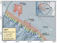
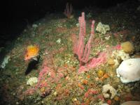
Greater Farallones NMS
The Greater Farallones NMS protects 3,295 mi 2 off northern and central California. As part of a nationally significant marine ecosystem, it supports an abundance of life, including many threatened or endangered species. Formerly known as the Gulf of the Farallones NMS, the sanctuary expanded its boundaries in 2015 and received a new name.
Researchers conducted benthic surveys in the former Gulf of Farallones NMS aboard R/V Fulmar in 2012 using the large observation-class ROV Beagle. The purpose was to ground-truth mapping data collected in 2011, and to characterize the seafloor biota, particularly corals and sponges, to support Essential Fish Habitat (EFH) designations . 25,416 m 2 of sea floor was surveyed during 34 ROV transects. Study areas included Rittenburg Bank, Cochrane Bank, and the Farallon Escarpment.
Greater Farallones NMS: Rittenburg Bank
Rittenburg Bank is an arrowhead-shaped, rocky feature located in the northwest corner of the Gulf of Farallones NMS. Researchers conducted a total of five dives, with depths ranging from 71 to111 m. Researchers enumerated a total of 2,002 corals and anemones, 2,673 sponges and 35 taxa of fishes.
Most abundant corals: Sea pens (Pennatulacea), red sea fan (Chromoplexaura markii), pink lace coral (Stylaster californicus), and cluster cup coral (Coenocyathus sp.).
Most abundant sponges: Yellow vase sponge (Mycale sp.), brown potato sponge (Halichondria panicea), aureoled grey lobe sponge (Xestospongia diprosopia), white finger/catcher's mitt (Iophon piceum var. pacifica), and honeycomb vase sponge (Heterochone sp.).
Most abundant fishes: Estimated from a total of 808 images and include a variety of rockfish.
Greater Farallones NMS: Cochrane Bank
Cochrane Bank is a rocky feature near the continental shelf break, located 6 km south of Rittenburg Bank. Researchers surveyed a total of 8,626 m 2 of seafloor. During three dives, researchers enumerated a total of 1,275 corals and anemones, 549 sponges and 27 taxa of fishes.
Most abundant corals: Sea pens (Pennatulacea). There was also an abundance of white plume anemones (Metridium sp.).
Most abundant sponges: White finger/catcher's mitt (Iophon piceus var. pacifica), followed distantly by brown potato sponge (Halichondria panicea) and aureoled grey lobe sponge (Xestospongia diprosopea).
Most abundant fishes: Estimated from a total of 714 images and included a variety of rockfish with the pygmy rockfish (Sebastes wilsoni) being the most observed.
Greater Farallones NMS: Farallon Escarpment
The Farallon Escarpment encompasses a steep section of the continental slope west of the Farallon Islands. Researchers surveyed a total area of 2,229 m 2 of seafloor on the Farallon Escarpment, within the Gulf of the Farallones NMS, using the ROV Beagle from the research vessel Fulmar. This site characterization showed a total of 200 corals and anemones, 69 sponges and 10 taxa of fishes.
Most abundant corals: Mushroom coral (Anthomastus ritteri) and small red sea fan (Swiftia sp.).
Most abundant sponges: White finger/catcher's mitt (Iophon piceus var. pacifica) and shelf sponge (Poecillastra sp.).
Most abundant fishes: Estimated from still images taken along each transect (50 per transect) that depicted a variety of rockfish of at least four species, as well as flatfish (Pleuronectiformes) and thornyheads (Sebastolobus spp.).
Piggy Bank AUV
In 2010, a team of researchers on board the NOAA Ship McArthur II used an ROV and a SeaBED AUV to document the biology and ecology of the deep-sea coral community and habitats on Piggy Bank, a deep offshore bank in the Channel Islands NMS. From the seven analyzed dives, the researchers counted 1,518 fishes and enumerated a total of 5,619 corals, 9,312 sponges and 35,944 invertebrates.
Most abundant corals: Hard corals (Lophelia pertusa and unidentified cup corals), Christmas tree black coral (Antipathes dendrochristos), and the droopy sea pen (Umbellula lindahli) in sediment areas.
Most abundant sponge morphotypes: Mound, foliose (Thenea muricata) and vase sponges.
Most abundant fishes: Poachers (family Agonidae) and rockfish (genus Sebastes), with thornyheads (genus Sebastolobus) becoming the dominant species in the deeper areas.
Piggy Bank ROV
Piggy Bank seamount is located in the Channel Islands NMS and Footprint Marine Reserve. It is designated as an essential fish habitat by NOAA Fisheries and the Pacific Fisheries Management Council.
In 2010, researchers on the NOAA Ship McArthur II used an ROV to collect abundance, size, condition, and distribution of deep-sea corals. They found 3,160 corals, 16,153 sponges, and 2,190 fishes along 48 transects.
Most abundant corals: Christmas tree black coral (Antipathes dendrochristos), mushroom coral (Anthomastus ritteri), several Primnoidae and Plexauridae (Swiftia spp.), dense stands of cup corals (Lophelia pertusa, now known as Desmophyllum pertusum, and Desmophyllum dianthus), and the sea pen (Halipteris californica, now Balticina) on soft sediment.
Most abundant sponges: Mound, foliose, upright flat, vase, and barrel groups.
Most abundant fishes: Bank rockfish (Sebastes rufus) and thornyhead rockfish (both Sebastolobus alascanus and S. altivelis) at deeper depths on soft sediment.
Gulf of America
This region is unique in many ways, partly due to unusual geological history and resulting physiographic features that provide substrate for deep corals and sponges. Another reason is the Loop Current, which flows from the Caribbean through the Florida Straits.
The Gulf spans from the outer portions of the continental shelf almost 150 m in depth across the continental slope to some of the deepest portions nearly 3,000 m in depth. It is considered one of the most geologically complex continental slopes in the world.
The geological complexity supports a high diversity of deep corals, each adapted to different environmental conditions.
West Florida Slope
West Florida Slope
In 2010, researchers aboard the NOAA Ship Ronald H. Brown set out to explore the deep coral banks of the West Florida Slope. Using video from underwater vehicles, the researchers were able to describe the characteristics of this ecosystem. The dive encountered fewer fishes and invertebrates than previously documented in this area, even though there was a well developed habitat.
Most abundant corals: Lophelia pertusa, though other corals (Madrepora oculata, cup corals, alcyonaceans) also occurred frequently. In certain places there was a high percentage of living coral (tops of mounds or ridges), but most of the coral cover was dead.
Most abundant fishes: Nezumia spp., and Laemonema spp., while golden crabs, crinoids, and squid were the most abundant mobile invertebrates.
Northwest
The Oregon and Washington continental margin in this region is characterized by a relatively narrow (5 to 40 km in width) shelf and a steep continental slope, with the shelf break existing at a water depth of approximately 200 m.
This area is wholly within the California Current Large Marine Ecosystem (LME). The California Current LME is a transition ecosystem between subtropical and subarctic water masses and is characterized by seasonal upwelling.
Relatively large estuaries border the area, including those associated with the Puget Sound and Columbia River. Fishing for salmon, groundfish, small coastal pelagic species, highly migratory species, and invertebrates (most notably squid, crab, shrimp, and sea urchins) is significant throughout this region.
Grays Canyon
Olympic Coast NMS: AUV 2010
Olympic Coast NMS: ROV 2006
Olympic Coast NMS: ROV 2008
Olympic Coast NMS: ROV 2010
Grays Canyon
Habitat: Of the area surveyed, 68 percent was sediment/mud, 25 percent was mixed and the remainder was hard. A total of 10,634 sponges were enumerated with an overall density of 620 per km 2 .
Corals: Only three types of corals were encountered, with most specimens being an unidentified type of small branching coral along with a few sea whips and cup corals.
Sponges: Ten groups of sponges were identified with the predominant structure-forming sponges being vase sponges Aphrocallistes sp. (possibly A. vastus) and Heterochrone calyx, as well as the fringed demosponge, Poecillastra spp.
Fish: A total of 3,112 fishes were enumerated for an overall density of 182 per km 2 . Many of the sponges had fishes associated with them.
Olympic Coast NMS: AUV 2010
Habitat: Several habitat types were encountered but the predominant habitat was sand. Gravel, pebble, cobble, and boulder fields were also observed.
Corals and Sponges: Corals, except for sea pens, were not abundant on either dive. The gorgonian Swiftia beringi was observed twice on Dive 1, and sponges were abundant. On Dive 2, sea pens dominated but sponges were also abundant.
Fish: Spotted ratfish (Hydrolagus colliei) was the most abundant fish species encountered on Dive 1, and greenstriped rockfish (Sebastes elongates) was the most abundant on Dive 2.
Olympic Coast NMS: ROV 2006
Habitat: The substrates varied greatly between sites and dives. There were observed areas and combinations of mud, gravel, cobble, boulders, small rock outcrops, rock walls, and a mud wall. Some areas of sand waves were also noted. Trawl tracks were evident at this site, which is located outside the Olympic 2 Conservation Area.
Corals: With regionally patchy distributions across dives and sites, the most abundant corals were gorgonians, in particular Paragorgia arborea pacifica, and Swiftia, including species S. beringi and S. pacifica. One site included a long rock wall where live colonies of Lophelia pertusa and the giant cup coral Desmophyllum dianthus were found on the vertical wall surfaces.
Sponges: Many different sponge morphs were observed during the cruise, including globular sponge, branching sponge, cloud sponge, and boot sponge. The globular morphs observed were primarily green lunar sponges (Latrunculia sp.) found on boulders. Small patches of the reef building sponge Farrea occa were present.
Fish: There were many rockfish species observed during the cruise, including aurora (Sebastes aurora), darkblotched (Sebastes crameri), and greenstriped (Sebastes elongatus). Also seen were spotted ratfish (Hydrolagus colliei), hagfish (Eptatretus sp.), big skate (Beringraja binoculata), longnose skate (Raja rhina), and multiple flatfish species. There were observations of shark egg cases attached to Primnoa pacifica colonies.
Olympic Coast NMS: ROV 2008
Habitat: The cruise traversed many different seafloor types, including mud, sand, pebble, cobble, and small boulder. Observed seafloor features included high relief mud wall, steep rock walls, burrows, sand slopes, mud terrace, and sand waves.
Corals: Paragorgia arborea pacifica, Primnoa pacifica, Plumarella longispina, Stylaster sp., Balanophyllia elegans, Muriceides sp., Lophelia pertusa, Swiftia sp., and Leptogorgia sp.
Sponges: Demosponges and Hexactinellids were both observed, with identifications including Farrea occa, Latrunculia sp., and Rhabdocalyptus dawsoni.
Fish: Flatfish, Pacific halibut (Hippoglossus stenolepis), lingcod (Ophiodon elongatus), spotted ratfish (Hydrolagus colliei), cat shark, and skate. Multiple rockfish species were observed, and many appeared gravid with swollen bellies. Small, unidentified rockfish species, possibly juvenile, were observed in close proximity with some sponges.
Olympic Coast NMS: ROV 2010
Habitat: The dive crossed several different geological habitat types, including cobble (10 percent of total area), pebble (11 percent), and pebble cobble (11 percent). Boulder fields were the dominant habitat type (48 percent). Most fish species were observed either resting or swimming in the water column along the boulder fields.
Corals: A total of 241 individual corals were seen on five transects covering 7,374 per km 2 . An average density of 33 corals per km 2 was estimated. The Swiftia beringi dominated the coral observations at 94 percent of the total density.
Sponges: A total of 4,362 individual sponges were seen on five transects covering 7298 m² from 12 different sponge morphs. An average density of 598 sponges per km 2 was estimated.
Fish: A few of the rockfish species observed during the dive were rosethorn (Sebastes helvomaculatus), yellowtail (Sebastes flavidus), and yelloweye (Sebastes ruberrimus). A few rockfish were possibly gravid. Other fish species observed consisted of lingcod (Ophiodon elongatus), Pacific halibut (Hippoglossus stenolepis), and kelp greenling (Hexagrammos decagrammus).
Southeast
The Southeast U.S. region stretches from the Straits of Florida to Cape Hatteras, North Carolina and encompasses associated deeper waters of the Blake Plateau, as well as a small portion of the Caribbean off the Florida Keys.
Within U.S. waters, deep-sea stony coral reefs reach their greatest abundance and development in this region. This warm temperate region is strongly influenced by the northern-flowing Gulf Stream ocean current.
Cape Canaveral North
Cape Canaveral Shallow
Cape Canaveral South
Cape Fear Lophelia Banks

Cape Lookout
Charleston Bump
Florida Straits (2005)
Florida Straits (2007)
Jacksonville Lithoherms (2005)
Jacksonville Lithoherms (2010)
Miami Terrace (2005)
Miami Terrace (2007)
Pourtalès Terrace (2005)
Pourtalès Terrace (2007)
Pourtalès Terrace (2010)
Pourtalès Terrace (2011)
Savannah Banks
St. Augustine
St. Lucie Bump
West Palm Beach
Cape Canaveral North
Habitat: The Cape Canaveral Deep North site is distinguished from the Cape Canaveral Deep South site by having a higher proportion of dead coral, mostly Lophelia pertusa. This dead coral creates a series of low to medium profile L. pertusa bioherms surrounded by coral rubble in waters deeper than 700 m. The greatest amount of living coral occurs on the mound and ridge tops. Enallopsammia profunda is common in places and forms a harder substrate habitat here than in most other locations off the southeastern United States.
Corals and Sponges: Other attached sessile fauna included Anthomastus sp., abundant sponges (hexactinellids and demospongids), Plumarella sp., isidid corals, anemones, hydroids, and Madrepora oculata (rare).
Fish: Chimaera sp., hagfish, rattails, scorpionfish, and synaphobranchid eels.
Cape Canaveral Shallow
Habitat: This site is composed of a southern part that contains three adjacent mounds separated from each other by about 500 m, collectively called Triceratops (Area III). The three mounds are Lophelia pertusa bioherms surrounded by coral rubble and coarse sand substrata. The central mound is the largest, reaching a depth of just under 400 m, and the smallest mound is to the east.
Corals and Sponges: All three mounds exhibit rugged topography and are capped by extensive fields of living L. pertusa. Diversity of other corals (Madrepora oculata and Enallopsammia profunda), sponges, and other sessile fauna is quite high on these mounds.
Mobile Invertebrates: Triceratops represents one of the most faunistically diverse deep-coral sites of the region. Besides a high species richness in cnidarians and sponges, abundant mobile invertebrates (urchins, squat lobsters, crinoids, octopods) were observed. Golden crabs (Chaceon fenneri) are particularly abundant in the coral habitat.
Fish: Fishes were abundant and included Laemonema spp., catsharks, blackbelly rosefish, roughies, rattails, and conger eels.
Dive Logs: J2-550 | JSLI-4913 | JSLII-3700 | JSLII-3708 | JSLII-3709 | JSLII-3711 | JSLII-3712 | JSLII-3713 | JSLII-3714 | JSLII-3715 | JSLII-3716
Cape Canaveral South
Habitat: Compared to the Cape Canaveral Deep North site, in comparable depths (greater than 630 meters), the Cape Canaveral Deep South site seems more diverse in habitat and fauna. It contains comparable bioherms formed by Lophelia pertusa, with similar ridges and valleys. Most of the L. pertusa were dead.
Corals and Sponges: Sponges of many types, especially hexactinellids and demospongia, were very abundant. Other sessile fauna included Enallopsammia sp., Anthomastus sp., Chrysogorgia sp., Stylasteridae, isidid corals, gorgonians, hydroids, and Madrepora oculata (rare).
Fish: Rattails, synaphobranchid eels, Chimaera sp., Laemonema spp., blackbelly rosefish, skates, and Lophiodes sp.
Dive Logs: J2-549 | JSLII-3704 | JSLII-3707 | JSLII-3710 JSLII-3717 | JSLII-3718 | JSLII-3719 | JSLII-3720 | JSLII-3721
Cape Fear Lophelia Banks
Habitat: The dives traversed ridges and troughs of hard coral habitat the entire time, except for a small section of rubble in a valley. Coverage was moderately dense and areas of soft sand substrate were consistently visible beneath the coral. Coral rubble and fallen L. pertusa matrices were present throughout the dive. A current of 0.1 to 0.2 kN from the south was present throughout the dive, except at the top of the mound where currents reached 0.5 kN.
Corals: The dives took place over a dense Lophelia pertusa reef made up of primarily dead L. pertusa boulders and rubble. Only about 5 to 10 percent of the observed coral was living. Cup corals and orange anemones were abundant on the dead L. pertusa structure.
Fish: Helicolenus dactylopterus, Laemonema melanurum, L. barbatulum, Conger oceanicus, Beryx decadactylus, Nezumia spp., and Polyprion americanus.
Cape Lookout
Habitat: The dives were characterized by a progressive upslope of soft sandy substrate, gently sloping coral rubble that transitioned into a dense dead coral matrix with small growths of living L. pertusa. The coral mound consisted of medium to high-relief hard corals along a series of ridges and valleys; currents were enhanced in the valleys.
Corals and Sponges: Coral species observed on the Lophelia pertusa bioherms included Gorgonians (unidentified), Aphrocallistes spp., Plumarella sp., and Madrepora oculata. Sponges included both hexactinellid and glass sponges.
Fish: Common fish seen on the coral mounds included scorpaenids, Laemonema sp., C. oceanicus, Anthias woodsi, Chloropthalmus agassizi, as well as sharks. A manta ray swimming over the top of a mound was recorded by internal cameras.
Charleston Bump
Habitat: This cruise transected five habitat types: (1) hard corals with attached fauna, (2) rubble, (3) mixed, (4) soft bottom and (5) rock ledge with attached fauna. Rubble habitat was the least common. The majority of the area was mixed habitat with numerous attached corals and sponges. Hard corals did not dominate this area and were rarely observed creating matrices characteristic of hard coral habitat. Hard coral habitat was a mix of L. pertusa and E. profunda.
Corals and Sponges: Observed sessile invertebrates included: Lophelia pertusa, Plumarella sp., Enallopsammia profunda, Stylaster sp., Madrepora oculata, small octocorals, barrel sponges, glass sponges, demosponges, cup corals, and a few gorgonians.
Fish: Several fishes were seen throughout this area. Laemonema melanurum and Nezumia sclerorhynchus were most abundant and were observed throughout all habitats.
Florida Straits (2005)
Habitat: The physical environment reflected a soft substrate with low-relief coral rubble. The bioherm consisted of frequent ridges of hard coral interspersed with valleys of soft sediment and coral rubble.
Corals and Sponges: Coral ridges consisted of moderate to high-relief, 90 percent dead Enallopsammia profunda. The hard coral habitats supported attached animals such as abundant small hydrozoan corals (e.g. Stylasteridae), aggregations of Anthomastus spp., purple Stoloniferan octocorals, gorgonians, and hexactinellid sponges.
Mobile Animals: Atlantic deep lobsters, shrimp, eels, rattail fish, and a dogfish were seen during the dive.
Florida Straits (2007)
Habitat: The physical environment consisted of frequent ridges of hard, completely dead coral covered and interspersed with soft sediment and mixed coral rubble. Around waypoint 12, the habitat changed at the base of an incline composed of large rocks and slabs that were mostly barren of fauna.
Corals and Sponges: Coral ridges were composed primarily of low-relief, completely dead Enallopsammia profunda matrix interspersed with a mix of soft sediment and coral rubble. The dead hard coral rubble and matrix habitats supported attached fauna such as small hydrozoan corals (Stylasteridae), slender whip-like gorgonians and numerous hexactinellid sponges.
Mobile Animals: Included crinoids, golden crabs, rock lobsters, shrimp, eels, a skate, and a dogfish.
Jacksonville Lithoherms (2005)
Habitat: Characterized by extremely abundant attached fauna and transected four habitat types: (1) hard corals with attached fauna, (2) mixed, (3) rubble, and (4) rock ledge with attached fauna. An intact matrix of hard corals, Enallopsammia profunda, Lophelia pertusa, and Madrepora oculata covered the sea floor and housed numerous sponges and other corals.
Corals: Enallopsammia profunda was the most common scleractinian. Solitary cup corals were abundant, and Stylaster spp. was common. Small Gorgonians were extremely abundant and covered hard coral and mixed habitats.
Sponges: Various forms of hexactinellid sponges were abundant. Aphrocallistes beatrix was the dominant sponge, although other vase sponges were also abundant. Demosponges were present in high numbers, but less so than hexactinellids.
Fish: The very few fishes that were observed included Laemonema melanurum and Scyliorhinus meadi.
Jacksonville Lithoherms (2010)
Corals and Habitat: One of the three 2010 dives in this area was in shallower depths (less than 250 m) where an extensive number of L. pertusa colonies were encountered. Bioherms composed of this coral were also observed. This is the shallowest yet known occurrence of significant colonies of L. pertusa in the western North Atlantic Ocean. It is suspected that this system is maintained by a nearly permanent upwelling of cold, nutrient-rich waters driven by Gulf Stream dynamics.
Fish: Most of the abundant deep-reef fishes observed on Jacksonville reefs were blackbelly rosefish, Dysommina rugosa, Laemonema spp., and rattails.
Miami Terrace (2005)
Habitat: The three dives reported Lophelia pertusa, both dead and living. While the percentage alive ranged from 0 to 100 percent from dive to dive, most of them reported the figure to be greater than 50 percent.
Corals and Sponges: Both rock features and the hard corals supported significant attached fauna including anemones (e.g. venus flytrap), ball-shaped hexactinellid sponges, gorgonians (e.g. Plumerella sp. and Eunicella sp.), bamboo coral, black coral, Anthomastus sp., cup corals, and zooanthids.
Mobile Animals: Mobile fauna was abundant and included cidaroid urchins, crinoids, brittlestars, sea stars, galatheid crabs, golden crabs, squid, scorpionfish (e.g. blackbelly rosefish), wreckfish, coral hakes, cat sharks, a chimera, and a large and persistent school of Trachurus lathami, also known as rough scad.
Miami Terrace (2007)
Habitat: The soft sediment and rock habitat leading up to the north side of the terrace had a diverse assemblage of invertebrates. The terrace supported rock ledges with fauna and hard coral habitat with areas of dense, 50-to-70 percent live Lophelia pertusa.
Corals and Sponges: Attached fauna included hydrozoan corals (Stylasteridae), cup corals, anemones (white and venus flytrap), hexactinellid sponges, gorgonians (e.g. Acanella sp.), and zoanthids.
Mobile Animals: Mobile fauna were abundant and included cidaroid and echinoid urchins, galatheid crabs, basket stars, crinoids, sea stars, grouper, conger eel, dogfish, and a large school of wreckfish.
Pourtalès Terrace (2005)
Habitat: Dive 1 began to the northwest of a rock ridge over a mix of soft substrate and rock with fauna, traversing a region with periodic boulders and low-lying rock slabs with attached fauna. The southern extent of the dive covered mixed habitats with dense assemblages of hydrozoan corals and sponges.
Habitat: Dive 2 began to the west of Jordan Sinkhole on a steady decline across rock pavement habitat with attached fauna. The submersible reached an abrupt ledge of barren pavement before rapidly descending 175 m into Jordon Sinkhole. At the bottom of the sinkhole, a northerly transect crossed soft sediment habitat before meeting a 90° vertical wall.
Corals: A large variety of hydrozoan corals (family Stylasteridae), black coral (e.g. Antipathes sp.), bamboo coral, small white gorgonians, and anemones (e.g. venus flytrap anemone) as well as small patches of Lophelia pertusa and Madrepora oculata were seen.
Sponges: Abundant sessile fauna attached to the low-relief rock, pavement and ledge habitats included numerous species of hexactinellid and demospongia sponges, ranging from small vase, ball and large plate forms.
Mobile Animals: Mobile fauna included sea stars (e.g. brissingids), galatheid crabs, shrimp, cidaroid urchins, comatulid crinoids, scorpionfish (including blackbelly rosefish), coral hake, short beard codling, western roughy, a conger eel, a requiem shark, a slit shell snail, and a large school of squid.
Pourtalès Terrace (2007)
Habitat: A steep rock ledge surrounds the main sinkhole, then plateaus into flat, thin slabs of limestone with very sparse attached fauna and some fishes. Soft sediment continued upslope of the rock ledges with sparse benthic and demersal fauna and continued in all regions lacking rock/ledge habitat.
Corals and Sponges: Small aggregations of the black coral Stichopathes sp. were present on the limestone blocks. Stalked and puffball hexactinellid sponges were present in the soft sediment.
Fish: The fishes consisted of numerous fishes including grenadiers, codling, coral and offshore hake, eel, dogfish, goosefish, gaper, tripodfish, and armored searobin. Crustaceans included galatheid and golden crabs, shrimp and lobster.
Pourtalès Terrace (2010)
Habitat: Some sandy patches were encountered, but most of these dives traversed rocky ledges and pavements.
Corals and Sponges: Lophelia pertusa colonies were generally small and widely scattered. Various stylasterid hydrocorals, cup corals, and gorgonians were attached to the rocky bottom. Sponges in particular were abundant and diverse on this site. Trash was observed in places.
Fish: The fishes observed were typical of depth transition zones between the outer shelf and upper slope and included boarfish, blackbelly rosefish, codlings (Moridae) and amberjacks.
Pourtalès Terrace (2011)
Animals: A total of 150 specimens were collected, including 49 Cnidaria (11 Scleractinia, 11 Octocorallia, 7 Antipatharia), 29 Porifera, 11 Echinodermata, and 6 Mollusca. A large, live, deepwater Lophelia coral mound known to be the southernmost Lophelia mound in U.S. waters was discovered.
Savannah Banks
Habitat: Mound substrate of rock ledge and rubble was covered with abundant mixed fauna.
Corals: Hard corals were represented by colonies of Lophelia pertusa, Madrepora oculata, Enallopsammia profunda, and numerous cup corals.
Fish: Very few fish species represented by very few individuals were observed on this dive. The most common fish was Laemonema melanurum in all habitats observed. A few Nezumia spp. and squalid sharks were observed on the mound.
St. Augustine
Habitat: This site is a carbonate substrate lithoherm with rock slabs and outcrops covered in coral rubble both consolidated and unconsolidated. Carbonate rock outcrops were common. The ridges along the periphery and the flat plateau of the top of the mound were characterized as mixed habitat with a variety of soft corals and sponges attached to the coral rubble substrate.
Corals: The St. Augustine lithoherm was composed primarily of a dead Lophelia pertusa rubble matrix on a carbonate rock substrate. Live hard coral was very sparse consisting of a single large Madrepora oculata colony and occasional patches of dead L. pertusa with live tips. Mixed habitat on the top of the mound plateau and peripheral ridges consisted of abundant attached soft corals such as gorgonians, bamboo corals (e.g. a few large Keratoisis sp.), a few black corals (e.g. Bathypathes sp.), demospongia (e.g. fan sponges), and hexactinellid sponges attached to the coral rubble.
Mobile Animals: Urchins, rattail fish, eels, Laemonema melanurum, a golden crab, and a swordfish.
St. Lucie Bump
Habitat: This dive began 700 m west of Waypoint 7, which required an easterly traverse over soft sediment often mixed with coral rubble, before turning north to head to the main coral feature and other waypoints. The main coral lithoherm was surrounded by coral rubble and the center consisted of 99 percent dead L. pertusa matrices and abundant attached fauna with patches of soft sediment.
Corals and Sponges: The hard coral rubble and matrix habitats supported abundant attached fauna such as small hydrozoan corals (Stylasteridae), gorgonians (e.g. Acanella sp.), bamboo coral, Anthomastus sp., and a large variety of both hexactinellid and demospongia sponges.
Mobile Animals: Cidaroid and echinoid urchins, crinoids, eels, scorpionfish, rattail and coral hake were spotted during the dive.
West Palm Beach
Habitat: The dives traversed soft sediment habitat interrupted by a series of low relief coral mounds with abundant attached fauna. The submarine transitioned from soft sediment and coral rubble with fauna to mixed habitat with abundant attached fauna on low-relief dead coral. Hard coral habitat was composed of completely dead standing L. pertusa and dense coral rubble.
Corals and Sponges: Sessile invertebrates attached to the hard coral matrix included the hydrozoan coral (Stylasteridae), numerous soft corals such as gorgonians (e.g. Plumarella sp., Eunicella sp.) including a large orange Paramuriceid gorgonian, bamboo coral, black coral (e.g. Bathypathes sp.), stalked crinoids, and a large variety of hexactinellid (e.g. Asconema sp.) and demospongiae (e.g. Phakellia sp.) sponges.
Mobile Animals: Mobile fauna included echinoid and cidaroid urchins, galatheid crabs, rattail fish (e.g. marlin spike grenadier), eels, midwater fish, skates, squids, an offshore hake, and a brittle star.