
Where What Why? Tales of controversial & curious place names
A collaboration project between The Junction and Esri Australia.
Introduction
Where What Why is a growing collection of stories written by journalism students from across Australia and Indonesia. The stories delve into the names of places, when the names were bestowed and the people who chose the names, are honoured by them, and are living with them now. The collection is edited by journalism lecturers and tutors who encourage their students to start investigations with this core set of questions.
The Collection
To read the Where What Why stories click through the tiles on the side or the points on the map

Barton Avenue, NSW.

Batman Station, Vic

Ben Boyd Road, NSW

Bentleigh, Vic

Black Gin Creek

Boundary Street, Brisbane

Bunbury, WA

Burrup Strategic Industrial Area, WA
Cockburn, WA

Cooktown, Qld

Coutts Crossing, NSW

Dawn Fraser Baths, NSW

Deakin University, Vic

Dick Piercy Park, WA

Durack, WA

Elizabeth Quay, WA

Fremantle, WA

Gippsland, Vic

Hotham, Vic

Intercourse Islands

Irwin River, WA

Leopold Street, WA

Macquarie University, NSW

Margaret Court Arena, Vic

Mount Ainslie, ACT

Mount Bartle Frere, Qld

Murdering Creek Road

Niggerhead Rock, Tasmania

Nyi Nyi Bidi (Vincent Way), WA

Port Phillip Bay, Vic

Queen Elizabeth II Hospital, Vic

Raglan, Vic, NSW, Qld

Roe, John Septimus, WA

Stirling, WA

Townsville, Qld

Willshire Street, NT

Yarra River, Vic
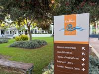
Barton Avenue, NSW.
Haberfield residents say heritage-listed street names referencing Australia’s complex federation history should not be replaced but combined with new inclusive elements.
Batman Station, Vic
Ben Boyd Road, NSW
A slave trader is still commemorated in Neutral Bay.
Black Gin Creek
In the context of Australia’s brutal colonial history, Indigenous language was co-opted by white settlers, who brought gender-based violence into the land. Read more: https://junctionjournalism.com/2024/07/16/colonial-misogyny-in-australian-place-names/
Boundary Street, Brisbane
Burrup Strategic Industrial Area, WA
Should an international treasure have a more salubrious location name?
Cockburn, WA
The pronunciation of Cockburn causes confusion in WA and across Australia. Why is the silent ‘ck’ even in the name?
Cooktown, Qld
Coutts Crossing, NSW
Coutts Crossing is just one of many places in Australia linked to the little-known massacres of Indigenous Australians by poison.
Deakin University, Vic
Dick Piercy Park, WA
It was fine. But has language moved on too far for this to still be okay?
Durack, WA
The Durack's were a pioneering family and a huge electorate is now named after them, but the East Kimberley remembers what happened after Big Johnny was killed.
Fremantle, WA
Walyalup, the place of the woylie, was given the name of a sea captain with a past he thought had been covered up. But the details have resurfaced.
Hotham, Vic
Intercourse Islands
Interwhat? Can we really believe this wasn't a giggle from the start? https://westernindependent.com.au/2024/05/21/interwhat-interwhere/
Macquarie University, NSW
Margaret Court Arena, Vic
Mount Ainslie, ACT
Should it be named after a grazier or referred to as Grandmother?
Mount Bartle Frere, Qld
Murdering Creek Road
Murdering Creek , Murdering Creek Rd and Murdering Creek Park, on the southern side of Lake Weyba near Noosa , are tranquil locations today. But their names reference a massacre orchestrated by settlers in 1862 and the deaths of at least 25 Kabi Kabi/Gubbi Gubbi men.
Niggerhead Rock, Tasmania
Everyone agrees the name is inappropriate. So why hasn't it changed yet?
Nyi Nyi Bidi (Vincent Way), WA
A long campaign to remove commemoration of Henry Vincent has finally succeeded.
Port Phillip Bay, Vic
Queen Elizabeth II Hospital, Vic
Roe, John Septimus, WA
John Septimus Roe was involved in the 1834 massacre of Bindjareb Noongar people. What are the implications of naming a school after him?
Stirling, WA
Many places in WA are named after James Stirling. Is his legacy too controversial to celebrate?
Willshire Street, NT
Yarra River, Vic
The Approach
What’s in a name, and once a name is given to a place should it ever be changed?
These are just some of the place names explored in the collection
This project approaches these questions with an open mind and invites a range of people to share their thoughts about the names written on our maps.
It also considers the reasons for keeping names as they are, and the processes involved in changing the names of geographic features.
Some of the names we explore have recently changed. Others are polarising or contentious. Many were assigned during colonisation and celebrate imperial military figures. In many cases, when these places were named, the loudest voices were those that told the victors' stories.
King Leopold of Belgium is one such example. He was once considered to be a hero, but is now widely referred to as a butcher for the way he mutilated and killed millions of Congolese people. Yet we still have places in Australia named in his honour.
Discussing changing place names, Curtin University's Professor Richard Blythe quotes the philosopher Nietzsche, who talked about history being made in the moment we write it:
"We have the power now, in the moment we are living in, to make history by changing names that no longer reflect our shared values."
He says changing place names in an appropriate way “is really the basis of a civic society and not a society that sweeps all the bad stuff under the carpet.”
The story of a place is often summarised in its name.
Other sites have come to our attention because the English language is fluid and words that were once considered plain and uncontroversial are now considered rude or unacceptable. The words 'dick' and the derogatory 'N word', are examples that are still in use on our maps.
According to Irwin Districts Historical Society chair Bruce Baskerville: "A place name is a few potent words that summarise the story of a place."
While he is not sure whether the place he lives will ever shed the name of the colonial military man it is named for, he is committed to telling both sides of the story about that man: his courage and victories, as well as the errors and atrocities.
This project shares that view and aims to air a range of views to faciltate conversations and a deeper understanding of the places we live in.
Story Mapping
Journalism in Australia plays a crucial role in keeping the public informed with accurate, timely and objective news. News publications do a great job of keeping us informed of daily events but the true scale of some stories only become clear when you can see them in the context of other similar stories.
This is why journalists worldwide are starting to integrate their storytelling with interactive maps. Embracing evolving media technology we have used ArcGIS StoryMaps to ground our storytelling, giving you the opportunity to follow our footsteps, explore these locations and consider the stories and arguments in context. So far we have 25 stories, by students from five universities. More will be added over the coming months.
This collaboration is giving student journalists the chance to use innovative tools developed for geospatial science to tell important stories in an immersive and contextualised way.
The process of bringing these stories together onto a single StoryMap was coordinated as a collaboration project by The Junction , a publication under the auspices of the Journalism Education and Research Association of Australia.
The Junction publishes journalism by students who are working under the guidance of their tutors and lecturers. It also facilitates collaborations that enhance the scale and impact of the work done by student journalists, and helps equip them for careers that involve many different kinds of digital tools.
Through this project, student journalists are using GIS to navigate the delicate task of mapping contentious location names, while respecting cultural sensitivities and historical context.
By collaborating with Indigenous communities, experts and historians, these young journalists are creating innovative, inspiring and immersive maps that provide valuable education insights.
Click on the points in this small Storymap by students from the University of the Sunshine Coast to read more about contentious place names in Queensland, or return to the top to see the whole WhereWhatWhy collection.
The Project Video
In this 8 minute video you'll meet the people who launched this project and hear why it matters.
Contact us
Is there a place name that you'd like us to investigate and tell a story about?
If so, we'd love to hear from you.
Where What Why


