The Wisconsin Coastal Atlas and ICAN
How participating in a global network strengthens coastal GIS in Wisconsin
Wisconsin Sea Grant , representing the Wisconsin Coastal Atlas , has been an active member of the International Coastal Atlas Network (ICAN). This story map shares the growth and accomplishments of ICAN and how Wisconsin has benefited from collaboration with ICAN to help build a robust and interoperable state coastal web atlas.
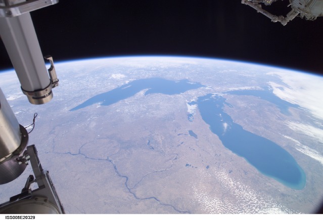
Wisconsin, Lake Michigan and Lake Superior from the International Space Station. Image credit: NASA from the Gateway to Astronaut Photography of Earth.
The Origins of ICAN
As part of a Fulbright in Ireland in 2004, Dr. Dawn Wright forged a partnership between Oregon State University, the Oregon Coastal Management Program, Ecotrust and Dr. Valerie Cummins with the Marine Irish Digital Atlas at University College Cork. The partnership was the catalyst for a series of international meetings to encourage the development of digital atlases of the global coast based on the principle of distributed, high-quality data and information.
ICAN 1 – Cork, Ireland – July 2006
The theme of ICAN 1 was "Potentials and Limitations of Coastal Web Atlases." There were 39 participants and 6 atlas case studies. A Coastal Web Atlas was defined as "a collection of digital maps and datasets with supplementary tables, illustrations and information that systematically illustrate the coast, oftentimes with cartographic and decision-support tools, and all of which are accessible via the Internet."
ICAN 2 - Corvallis, Oregon, USA – July 2007
The theme of ICAN 2 was "Coastal Atlas Interoperability." Participants chose "coastal erosion hazards" as the primary use case for linking interoperable atlases. Following ICAN 2 was the Coastal Zone 07 meeting in Portland, Oregon. Ideas from ICAN 2 were presented in a panel on U.S./European Partnerships in Coastal Atlases and Coastal/Ocean Informatics.
Building a Wisconsin Atlas
The Wisconsin Coastal GIS Applications Project began in 1994 as a partnership between Wisconsin Sea Grant and the Land Information and Computer Graphics Facility at the University of Wisconsin-Madison. From 1994 through 2009, the project evolved through four phases:
- providing GIS training for specific coastal issues
- discovering, acquiring and integrating local geospatial data to study regional coastal issues
- implementing interoperable web mapping services to build a dynamic and distributed coastal GIS
- utilizing visualization and animation to promote a more intuitive understanding of complex coastal issues.
Building the Case for a Coastal Web Atlas
David Hart, Coastal GIS Specialist with Wisconsin Sea Grant, attended the Coastal Zone 07 session on coastal web atlases and learned about ICAN, the Oregon Coastal Atlas and the coastal erosion hazards use case for atlas interoperability. Returning from the meeting, the case was made for a Wisconsin Coastal Atlas based on the success of the Oregon Coastal Atlas paired with the need for a new approach in Wisconsin to manage information about the coast and engage an expanded range of coastal decision-makers and data custodians.
The Birth of a Coastal Web Atlas
The Wisconsin Coastal Atlas was funded by Wisconsin Sea Grant as a research project about the benefits and barriers to building coastal spatial data infrastructures beginning in February 2010. The atlas enables people to explore, analyze and understand coastal issues along the Great Lakes. The atlas is intended for use by coastal resource managers, planners, researchers, educators and citizen scientists. The initial design of the atlas included four elements: maps, catalog, tools and learn. Modeled on the structure of the Oregon Coastal Atlas with support from the Oregon Coastal Management Program and Oregon State University, these elements work together to provide access to resources that can help people address specific coastal management issues.
The Maps element provides a gallery of interactive maps with customized perspectives related to specific coastal issues in Wisconsin. The Tools element allows users to conduct analyses to guide decision-making about these issues. The Catalog element provides pathways to discover, assess, and download geospatial data for the Great Lakes coasts of Wisconsin. Finally, the Learn element serves as a repository for place-based learning resources that promote a stronger understanding of Great Lakes Literacy Principles .
The initial design for the Wisconsin Coastal Atlas
Atlas Interoperability
Early ICAN meetings focused on network formation and governance, as well as atlas interoperability.
ICAN 3 – Copenhagen, Denmark – July 2008
The theme of ICAN 3 was "Federated Coastal Atlases: Building on the Interoperable Approach." This workshop featured 29 participants from 10 countries. An atlas interoperability prototype was demonstrated to show how local coastal erosion ontologies for atlases in Ireland and Oregon could be connected to a global ontology to access the content of individual atlases through one central system. Participants developed local coastal erosion vocabularies to tie to the global ICAN coastal erosion vocabulary. The workshop also informed potential stakeholders in Europe about the benefits of coastal web atlases and developed a long-term strategy and governance model for ICAN.
ICAN 4 – Trieste, Italy – November 2009
The theme of ICAN 4 was “Formalizing the Network, Engaging the Mediterranean.” The workshop engaged 32 participants from 12 countries. A governing structure for ICAN was formalized. Progress continued on ontology and semantic interoperability work, with an eye toward articulating the benefits of semantic interoperability at a broader scale to non-specialists. Mini “workshops within a workshop” were held to show atlas administrators how to become a new node in interoperability prototype and address the issues and needs of users inventory, assessment, and evaluation of atlases.
A Coastal Web Atlas Semantic Interoperability Prototype
The ICAN Technical Working Group focuses on the research and outreach needed to globally-integrate locally-maintained coastal web atlases. An example is the ICAN Interoperability Prototype, which was active from 2008 to 2016 and provided a one-stop shop for finding, visualizing, and downloading data from distributed coastal web atlases from different parts of the world. The prototype linked local vocabularies for documenting coastal data to a common multilingual ontology, which allows searches that translate between different atlas terminologies. The Marine Irish Digital Atlas and the Oregon Coastal Atlas provided the initial content for the ICAN Prototype.
With the assistance of the ICAN technical community, the Wisconsin project team followed the steps in the ICAN semantic interoperability pilot cookbooks developed as part of a NETMAR project to connect to the ICAN Prototype. The guidebook includes four cookbooks : 1) Understanding Semantics; 2) Understanding Metadata; 3) Establishing a CSW metadata catalogue with GeoNetwork; and 4) Connecting your Atlas to the ICWA prototype. A GitHub site provides updated versions of the ICAN cookbooks. These cookbooks were used by Terry Curran of the Pacific Salmon Foundation to help develop technical elements of the Strait of Georgia Data Centre .
ICAN Great Lakes – Madison, Wisconsin, USA – September 2010
ICAN Great Lakes was hosted by Wisconsin Sea Grant in Madison, Wisconsin and showcased the impact of mature atlases in six U.S. states, explored four use cases for networked atlases, described how atlases related to broader coastal data sharing initiatives and featured a workshop to build technical skills on web services and catalogs.
Agenda for the ICAN Great Lakes Meeting in 2010.
ICAN Meetings on Coastal Issues
Since 2011, ICAN meeting themes have has a focus on addressing important coastal and marine issues including coastal and marine spatial planning, ecosystem-based management and ocean literacy.
ICAN 5 – Oostende, Belgium – September 2011
The theme for ICAN 5 was “Coastal Atlases as Engines for Coastal and Marine Spatial Planning.” The workshop engaged 43 participants from 15 countries. Mini workshops were held on semantic frameworks and ontologies, as well as how to engage users before, during and after initial atlas development. A process was initiated to approve ICAN as an official project of the UNESCO, Intergovernmental Oceanographic Commission, International Oceanographic Data and Information Exchange .
ICAN 6 – Victoria, British Columbia, Canada – June 2013
The theme for ICAN 6 was “Expanding Participation in Coastal Web Atlas Development and Use.” A total of 30 people attended representing 14 counties. Opportunities were explored for ICAN as a project of the International Oceanographic Data and Information Exchange (IODE), as well as synergies with other projects of the Intergovernmental Oceanographic Commission (IOC). Mini workshops were held for atlas technical developers on how to become a new node in the third version of the ICAN interoperability prototype and the implications for Volunteered Geographical Information (VGI) in coastal atlases. The Wisconsin and Oregon atlas teams organized a workshop on "Interoperable Web Services for Adaptive Coastal Management."
ICAN 7 – CapeTown, South Africa – April 2015
The theme for ICAN 7 was "Supporting Ecosystem Based Management." The meeting was paired with the CoastGIS 2015 conference with a theme of "Rich Data, Poor Data: Geospatial Creativity and Innovation for Managing Changing Coastal Systems". Topics included: 1) opportunities for CWAs to support the objectives of managing and protecting large marine ecosystems; 2) the challenges of atlas development and usage in the African Coastal Atlas community; 3) a session on “Interoperability for Dummies” which aimed to demystify coastal atlas interoperability and highlight the benefits of interoperability; and 4) mini-workshops for atlas technical developers and atlas users.
ICAN 8 – Santa Marta, Columbia – September 2017
The theme for ICAN 8 was "Coastal Web Atlases – Enhancing Ocean Literacy." The workshop was attended by more than 25 participants from 20 countries. It started with an overview of the origins and development of ocean literacy initiatives around the world and followed up by outlining the underlying principles. Subsequent presentations covered a variety of themes ranging from how to communicate the risks of tropical storms in Central America, empowering local fishing communities in Brazil all the way to using classical literature within WebGIS content to raise appreciation of local coastal environments and to demonstrate the connectivity of inland areas to the sea. Lively discussions ensued on how Coastal Web Atlas development can support the variety of ocean literacy initiatives, which are emerging in the context of the UN Ocean Conferences call for action towards Sustainable Development Goal 14 - Conserve and sustainably use the oceans, seas and marine resources for sustainable development. The meeting was paired with an Ocean Teacher Global Academy workshop on ocean literacy and story telling maps ."
ICAN Mini-Workshop at CoastGIS 2018 - Ísafjörður, Iceland – September 2018
The theme for the mini-workshop was “Coastal Web Atlas Contributions to SDG goals.” Approximately 30 participants attended from 16 countries. The program featured presentations on recent ICAN member activities around the world, and a brainstorming session on the theme of “How can ICAN and CWA operators contribute to United Nations Sustainable Development Goal (SDG) 14 and the UN Decade of Ocean Science ?”
ICAN 9 - Virtual Workshop - September 2021
The theme for ICAN 9 was "Local to Global - Benefits of Coastal Web Atlas Sharing & Connectivity." The workshop provided an opportunity to present and discuss recent innovations in atlases, how atlases contribute to the goals of the UN´s Decade of Ocean Science and an investigation of synergies with other initiatives such as the IODE OceanInfoHub .
ICAN Coastal Atlas Resources
The International Coastal Atlas Network has developed resources intended to help those interested in implementing coastal web atlases. These include newsletters, technical guidebooks and a textbook covering the field of coastal informatics
ICAN Newsletters
Since 2012, ICAN has published a series of newsletters that contain articles about the success and technical characteristics of member atlases, as well as news about ICAN meetings, training sessions and working group activities.
ICAN Guidebook: Best Practice Guide to Engage your Coastal Web Atlas User Community
This guidebook helps new and experienced atlas developers focus on increasing the capacity to successfully interact with user communities and target audiences, while managing coastal and marine data and information in a user friendly way. It includes information on defining your target audience; how to engage potential end-users during development; how to keep your user community involved and interested; and how to win the interest of new users.
Coastal Informatics Book
This book , published in 2011, presents developments in the field of coastal web atlases and shares best practices for atlas design, data requirements, necessary software technology and institutional capacity, as well as best practices for achieving interoperability between web atlases. Selected chapters are available for download, including a selection covering the introduction and chapters on Ireland, the United Kingdom and Creating a Usable Atlas and a chapter on Coastal Web Atlas Features .
Coastal Web Atlas Research
The Wisconsin Coastal Atlas is more than just a web portal that provides access to coastal maps, tools, data and learning resources -- it is also a research project that is helping to build a coastal spatial data infrastructure for Wisconsin. The primary motivation of the research is demonstrating that a coastal web atlas can serve as an interoperable resource both internal to Wisconsin and externally to the Great Lakes region and beyond.
Design and Evaluation of Coastal Web Atlases
This 2022 article in the Coastal Management journal shares the findings of a needs assessment that bridges adaptive coastal management user needs with three tenets of interactive cartographic design relevant to Coastal Web Atlases (CWAs): map representation, interaction, and usability. The needs assessment included two stages: a competitive analysis of 10 state CWAs and a user survey with stakeholders from those states about their experiences with and opinions on CWA design. In addition to characterizing design patterns and values, the needs assessment identified important gaps informing future CWAs, such as: inclusion of a wider range of thematic maps; provision of hybrid basemaps providing context about the land and water sides of the coastline; implementation of spatial calculations and temporal sequencing for analysis and exploration; use of story maps to support CWA learnability; improved responsiveness between mobile and non-mobile devices; and customization of advanced analytical tools that support decision making about the most pressing issues facing coasts.
Enhancement of the Wisconsin Coastal Atlas
The research on Coastal Web Atlases conducted with the support of Wisconsin Sea Grant along with the lessons and examples of ICAN member atlases and the NOAA Digital Coast have guided update and enhancement of the Wisconsin Coastal Atlas. This section shares recent additions to the Wisconsin Coastal Atlas .
The current version of the Wisconsin Coastal Atlas includes featured resources for each section and a way to filter for a broader range of resources by keywords.
GeoData@Wisconsin Coastal Collection
The most robust catalog resource included in the Wisconsin Coastal Atlas is GeoData@Wisconsin , developed by the Wisconsin State Cartographer's Office and the Robinson Map Library at the University of Wisconsin-Madison. GeoData@Wisconsin combines map-based spatial searches with keyword searching and faceted browsing and its Coastal Collection provides access to over 1,500 Great Lakes-related geospatial data sets.
Topics
The Topics section of the atlas provides quick access to maps, tools, data and learning resources relevant to specific coastal management issues. This capacity is modeled after the Topics in the NOAA Digital Coast . At this point there are topics addressing flooding , bluff erosion , port/harbor/marina infrastructure , beaches , nearshore freshwater habitats , Great Lakes water levels , green infrastructure and climate adaptation in the Wisconsin Coastal Atlas.
Places
The Places section of the atlas showcases locations along the Great Lakes, providing an overview of each area along with place-based learning resources, maps, and data. These resources can help users understand the ecological, cultural, and historical significance of a place. The banner map image on the home page are tied to the featured places in the atlas - the St. Louis River Estuary , the Apostle Islands , Green Bay and the Door Peninsula .
Portals
The Portals section of the atlas highlights decision tool portals that contain numerous tools relevant for Great Lakes coastal resilience analysis and planning. These portals make it easy to search for a variety of visualization, predictive, and exploratory tools related to the Great Lakes. The two portals currently featured include the NOAA Digital Coast and the U.S. Climate Resilience Toolkit .
Coastal GIS from Local to Global
State Vision: A Coastal Spatial Data Infrastructure for Wisconsin
Wisconsin counties and municipalities have implemented publicly accessible interactive web mapping sites . The interactive map below shows the 15 coastal counties in Wisconsin with links to their general government websites, land information websites and interactive maps. Research associated with the Wisconsin Coastal Atlas seeks to identify the technical and institutional barriers to the development of interoperable spatial data catalogs and promote the development of a coastal spatial data infrastructure.
Regional Vision: A Networked Great Lakes
The interactive map below shows selected coastal GIS projects in the Great Lakes watershed with links to their websites. The blue features are coastal web atlases by ICAN members. The purple features are other coastal GIS projects in the U.S. The green features represent conservation authorities in Ontario with the darker green showing those with interactive web maps. The red points link to interoperable catalogs of coastal geospatial data. Interoperable web services and catalogs can be leveraged to analyze trans-boundary issues.
National Vision: Networking Coastal Web Atlases to Support Coastal Management
About half of the coastal states and territories in the United States have developed coastal web atlases. These atlases provide maps, data, tools and related resources to better understand coastal issues. The interactive map below shows states and territories with a coastal web atlas in red. Click on a point to link to coastal web atlases and state/territory GIS portals. Atlas developers can work together to share best practices and ideas for improving interoperability among state GIS portals.
Global Vision: Coastal Web Atlas of the Global Coast
This interactive map shows members of the International Coastal Atlas Network as of April 2019. Concentrations of coastal web atlases are established in Europe and North America and emerging on other continents. Collaboration among these atlases addresses broader regional scale issues and moves towards realizing the ICAN mission.


